TopoQuest Logo
Do you find TopoQuest useful?
Help keep TopoQuest running and adding new maps/features by donating!
Bitcoin:  19c7KJd3qBynnjoSw5npx9KScwjBe4ifkT
Litecoin:  LXs6TkuXGGXo1vDsWCkWVdjQX94eUKd6ui
Home View Maps Find Maps Find Places Resources & Links


Bull Elk Park, Wyoming Topographic Map

USGS Map Title: Bull Elk Park, WY
USGS Map MRC: 44107H6
DRG (GeoTIFF) Download: o44107h6.tif


Neighboring USGS Topographic Map Quads:


  Red Springs, MT  
45107A7
 

  Willow Creek Dam SW, MT  
45107A6
 

  Black Gulch, MT  
45107A5
 

  Boyd Ridge, WY  
44107H7
 

  Bull Elk Park, WY  
44107H6
 

  West Pass, WY  
44107H5
 

  Bald Mountain, WY  
44107G7
 

  Ice Creek, WY  
44107G6
 

  Burgess Junction, WY  
44107G5


Map MRC Location:

N45°
W108°
N45°
W107°
H8 H7 H6 H5 H4 H3 H2 H1
G8 G7 G6 G5 G4 G3 G2 G1
F8 F7 F6 F5 F4 F3 F2 F1
E8 E7 E6 E5 E4 E3 E2 E1
D8 D7 D6 D5 D4 D3 D2 D1
C8 C7 C6 C5 C4 C3 C2 C1
B8 B7 B6 B5 B4 B3 B2 B1
A8 A7 A6 A5 A4 A3 A2 A1
N44°
W108°
N44°
W107°

Bull Elk Park, WY USGS 1:24K Topographic Map Preview:
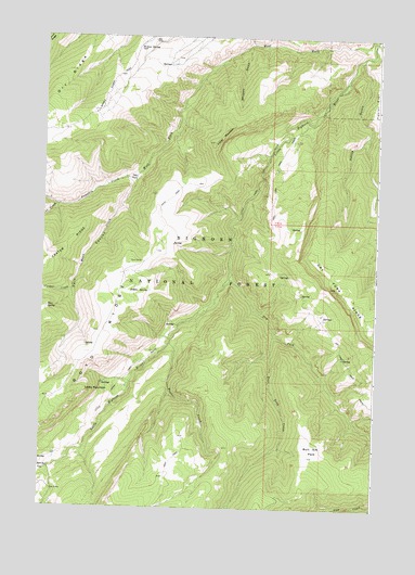
Bull Elk Park, WY USGS Topographic Map
Click on map above to begin viewing in our Map Viewer.

This topographic map contains these locations and features:
Feature Name Type Latitude Longitude GNIS ID View Map
Bear SpringSpringN44.9279°W107.7486°1585283View Map
Bear Trap CreekStreamN44.9216°W107.6634°1598027View Map
Bull Elk ParkFlatN44.8908°W107.6476°1586100View Map
Bull Elk Park Natural AreaParkN44.8877°W107.6440°1604699View Map
Crater CreekStreamN44.9325°W107.7393°1587184View Map
Cub CreekStreamN44.9552°W107.7451°1587280View Map
Dark CanyonValleyN44.9614°W107.7170°1587352View Map
Deer ParkFlatN44.9633°W107.7162°1604700View Map
Dry Fork Little Bighorn RiverStreamN44.9358°W107.6807°1604332View Map
Dry Fork TrailTrailN44.9175°W107.6381°1599358View Map
Dry RidgeRidgeN44.9807°W107.7492°2786494View Map
Elkhorn CreekStreamN44.9989°W107.6273°1599600View Map
Fisher MountainSummitN44.9739°W107.6851°1588517View Map
Hidden SpringSpringN44.9324°W107.7109°1589527View Map
Kettle GulchValleyN44.9939°W107.6318°1590337View Map
Leaky MountainSummitN44.9061°W107.7343°1590611View Map
Little Horn TrailTrailN44.9305°W107.6870°1590805View Map
Mann CreekStreamN44.9625°W107.7159°1591200View Map
Pumpkin CreekStreamN44.9625°W107.7159°1593064View Map
Short CanyonValleyN44.9983°W107.6732°776501View Map
Short CanyonValleyN44.9983°W107.6732°1594275View Map
Taylor CreekStreamN44.9186°W107.7026°1603531View Map
Wagon Box CreekStreamN44.8855°W107.7462°1595969View Map
Whiskey GulchValleyN44.9977°W107.6751°1596287View Map
Willow SpringSpringN44.9968°W107.7151°1596480View Map

Note: Coordinates in the location and feature list above are referenced to NAD83 datum.


Copyright (C) 2008-2025 Ryan Niemi / Sunset Dynamics ... All Rights Reserved