TopoQuest Logo
Do you find TopoQuest useful?
Help keep TopoQuest running and adding new maps/features by donating!
Bitcoin:  19c7KJd3qBynnjoSw5npx9KScwjBe4ifkT
Litecoin:  LXs6TkuXGGXo1vDsWCkWVdjQX94eUKd6ui
Home View Maps Find Maps Find Places Resources & Links


Bully Choop Mountain, California Topographic Map

USGS Map Title: Bully Choop Mountain, CA
USGS Map MRC: 40122E7
DRG (GeoTIFF) Download: o40122e7.tif


Neighboring USGS Topographic Map Quads:


  Weaverville, CA  
40122F8
 

  Lewiston, CA  
40122F7
 

  French Gulch, CA  
40122F6
 

  Hoosimbim Mountain, CA  
40122E8
 

  Bully Choop Mountain, CA  
40122E7
 

  Shasta Bally, CA  
40122E6


  Chancheulla Peak, CA  
40122D7
 

  Ono, CA  
40122D5


Map MRC Location:

N41°
W123°
N41°
W122°
H8 H7 H6 H5 H4 H3 H2 H1
G8 G7 G6 G5 G4 G3 G2 G1
F8 F7 F6 F5 F4 F3 F2 F1
E8 E7 E6 E5 E4 E3 E2 E1
D8 D7 D6 D5 D4 D3 D2 D1
C8 C7 C6 C5 C4 C3 C2 C1
B8 B7 B6 B5 B4 B3 B2 B1
A8 A7 A6 A5 A4 A3 A2 A1
N40°
W123°
N40°
W122°

Bully Choop Mountain, CA USGS 1:24K Topographic Map Preview:
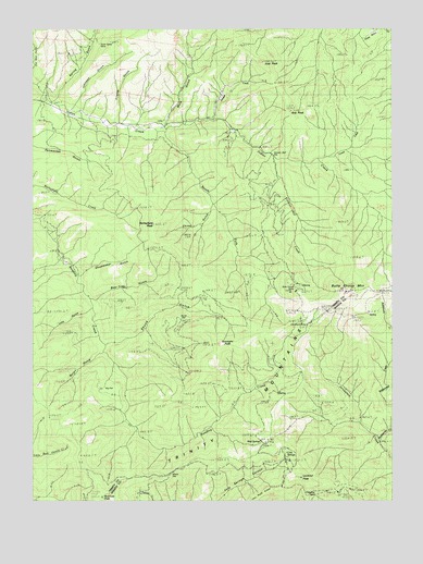
Bully Choop Mountain, CA USGS Topographic Map
Click on map above to begin viewing in our Map Viewer.

This topographic map contains these locations and features:
Feature Name Type Latitude Longitude GNIS ID View Map
Arts PeakSummitN40.6024°W122.7850°218416View Map
Barleyfield PeakSummitN40.5735°W122.8345°218674View Map
Bear Trap GulchValleyN40.5538°W122.8553°218885View Map
Big FlatFlatN40.5257°W122.8528°219186View Map
Bluenose PeakSummitN40.5004°W122.8531°219537View Map
Bryon GulchValleyN40.5396°W122.8534°219963View Map
Bully Choop MineMineN40.5549°W122.7842°220139View Map
Bully Choop MountainSummitN40.5549°W122.7670°220140View Map
Cannon Ball CreekStreamN40.5913°W122.7922°254699View Map
Cannon Ball FlatFlatN40.5910°W122.7934°220544View Map
China GulchValleyN40.5774°W122.8147°221040View Map
Cleveland MineMineN40.5465°W122.7817°221212View Map
Cold SpringsSpringN40.5121°W122.7881°221330View Map
Corral CreekStreamN40.5907°W122.7778°221584View Map
Dixie Queen MineMineN40.6213°W122.8542°222429View Map
Dripping SpringsSpringN40.5016°W122.7781°222596View Map
Frietas GulchValleyN40.6010°W122.8472°223951View Map
Gunsight PeakSummitN40.5418°W122.8022°224744View Map
Joes PeakSummitN40.6165°W122.7961°226257View Map
Johnson GulchValleyN40.6051°W122.8634°226307View Map
Joseph CreekStreamN40.6007°W122.8136°226352View Map
Lake GulchValleyN40.5510°W122.8567°226797View Map
Lookout PeakSummitN40.5060°W122.7834°227641View Map
Mud SpringsSpringN40.5154°W122.7972°229270View Map
Mule GulchValleyN40.6010°W122.8306°229308View Map
Rattlesnake CreekStreamN40.5154°W122.7553°255011View Map
Shoemaker GulchValleyN40.5599°W122.8597°233042View Map
Skunk FlatFlatN40.5482°W122.8253°233209View Map
Skunk GulchValleyN40.5418°W122.8509°233210View Map
South Fork Indian CreekStreamN40.5974°W122.8314°235017View Map
Spring GulchValleyN40.6076°W122.8686°267602View Map

Note: Coordinates in the location and feature list above are referenced to NAD83 datum.


Copyright (C) 2008-2024 Ryan Niemi / Sunset Dynamics ... All Rights Reserved