TopoQuest Logo
Do you find TopoQuest useful?
Help keep TopoQuest running and adding new maps/features by donating!
Bitcoin:  19c7KJd3qBynnjoSw5npx9KScwjBe4ifkT
Litecoin:  LXs6TkuXGGXo1vDsWCkWVdjQX94eUKd6ui
Home View Maps Find Maps Find Places Resources & Links


Hoosimbim Mountain, California Topographic Map

USGS Map Title: Hoosimbim Mountain, CA
USGS Map MRC: 40122E8
DRG (GeoTIFF) Download: o40122e8.tif


Neighboring USGS Topographic Map Quads:


  Junction City, CA  
40123F1
 

  Weaverville, CA  
40122F8
 

  Lewiston, CA  
40122F7
 

  Hayfork Summit, CA  
40123E1
 

  Hoosimbim Mountain, CA  
40122E8
 

  Bully Choop Mountain, CA  
40122E7
 

  Dubakella Mountain, CA  
40123D1


Map MRC Location:

N41°
W123°
N41°
W122°
H8 H7 H6 H5 H4 H3 H2 H1
G8 G7 G6 G5 G4 G3 G2 G1
F8 F7 F6 F5 F4 F3 F2 F1
E8 E7 E6 E5 E4 E3 E2 E1
D8 D7 D6 D5 D4 D3 D2 D1
C8 C7 C6 C5 C4 C3 C2 C1
B8 B7 B6 B5 B4 B3 B2 B1
A8 A7 A6 A5 A4 A3 A2 A1
N40°
W123°
N40°
W122°

Hoosimbim Mountain, CA USGS 1:24K Topographic Map Preview:
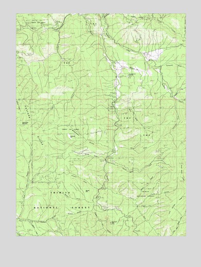
Hoosimbim Mountain, CA USGS Topographic Map
Click on map above to begin viewing in our Map Viewer.

This topographic map contains these locations and features:
Feature Name Type Latitude Longitude GNIS ID View Map
Barleyfield CreekStreamN40.5776°W122.8881°256532View Map
Barleyfield GulchValleyN40.5790°W122.8850°1683019View Map
Betty GulchValleyN40.5496°W122.9259°256856View Map
Blanchard FlatFlatN40.5935°W122.9136°1665316View Map
Blanchard Flat SchoolSchoolN40.5938°W122.9064°257197View Map
Box CanyonValleyN40.5132°W122.9417°257410View Map
Boyer GulchValleyN40.5207°W122.9134°1665317View Map
Byrons CreekStreamN40.5079°W122.9900°257793View Map
Camp GulchValleyN40.6232°W122.9370°257879View Map
Clements RanchLocaleN40.6013°W122.9067°258450View Map
Dinkles RanchLocaleN40.5488°W122.9281°1683024View Map
East Fork Browns CreekStreamN40.5282°W122.9367°270986View Map
Ferguson FlatFlatN40.5560°W122.9620°1665350View Map
Goods GulchValleyN40.6232°W122.9045°260700View Map
Hazel GulchValleyN40.5699°W122.9267°261197View Map
Hoosimbim MountainSummitN40.5635°W122.9984°261452View Map
Horse Mane CreekStreamN40.5410°W122.9347°261489View Map
Horse Mane RidgeRidgeN40.5349°W122.8822°261490View Map
Johnson GulchValleyN40.5268°W122.9425°261981View Map
Lone Springs RidgeRidgeN40.5176°W122.8834°1665382View Map
Long CanyonValleyN40.5176°W122.9117°1665383View Map
Maupin GulchValleyN40.5182°W122.9456°263272View Map
Middleton GulchValleyN40.5482°W122.9289°263554View Map
North Fork Hayfork CreekStreamN40.5096°W122.9995°1683052View Map
O'Connell GulchValleyN40.5765°W122.8853°264265View Map
Panwauket GulchValleyN40.5940°W122.8986°264494View Map
Reese Brothers Coal MineMineN40.5901°W122.9192°265360View Map
Spring GulchValleyN40.5440°W122.9370°267600View Map
Squaw FlatFlatN40.5240°W122.9534°267625View Map
Sugarloaf PeakSummitN40.5074°W122.9320°267876View Map
Sulphur GulchValleyN40.5143°W122.9470°267898View Map

Note: Coordinates in the location and feature list above are referenced to NAD83 datum.


Copyright (C) 2008-2025 Ryan Niemi / Sunset Dynamics ... All Rights Reserved