TopoQuest Logo
Do you find TopoQuest useful?
Help keep TopoQuest running and adding new maps/features by donating!
Bitcoin:  19c7KJd3qBynnjoSw5npx9KScwjBe4ifkT
Litecoin:  LXs6TkuXGGXo1vDsWCkWVdjQX94eUKd6ui
Home View Maps Find Maps Find Places Resources & Links


Bunker Peak, Nevada Topographic Map

USGS Map Title: Bunker Peak, NV
USGS Map MRC: 37114D2
DRG (GeoTIFF) Download: o37114d2.tif


Neighboring USGS Topographic Map Quads:


  Islen, NV  
37114E3
 

  Acoma, NV  
37114E2
 

  Pine Park, UT  
37114E1
 

  Fife Mountain, NV  
37114D3
 

  Bunker Peak, NV  
37114D2
 

  Docs Pass, NV  
37114D1
 

  Garden Spring, NV  
37114C3
 

  Jacks Mountain, NV  
37114C2
 

  Dodge Spring, UT  
37114C1


Map MRC Location:

N38°
W115°
N38°
W114°
H8 H7 H6 H5 H4 H3 H2 H1
G8 G7 G6 G5 G4 G3 G2 G1
F8 F7 F6 F5 F4 F3 F2 F1
E8 E7 E6 E5 E4 E3 E2 E1
D8 D7 D6 D5 D4 D3 D2 D1
C8 C7 C6 C5 C4 C3 C2 C1
B8 B7 B6 B5 B4 B3 B2 B1
A8 A7 A6 A5 A4 A3 A2 A1
N37°
W115°
N37°
W114°

Bunker Peak, NV USGS 1:24K Topographic Map Preview:
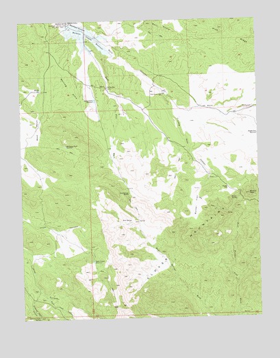
Bunker Peak, NV USGS Topographic Map
Click on map above to begin viewing in our Map Viewer.

This topographic map contains these locations and features:
Feature Name Type Latitude Longitude GNIS ID View Map
Barclay WellWellN37.4727°W114.2058°838602View Map
Bunker FlatFlatN37.4230°W114.1591°839192View Map
Bunker PassGapN37.4300°W114.1422°839194View Map
Bunker PeakSummitN37.4275°W114.1308°839195View Map
Bunker SpringSpringN37.4247°W114.1375°839196View Map
Crow CorralLocaleN37.4936°W114.1600°851367View Map
East Pass CanyonValleyN37.3844°W114.2391°840277View Map
East Pine WashStreamN37.4872°W114.2139°840281View Map
Jacks Canyon ReservoirReservoirN37.3990°W114.2135°845871View Map
Jacks PassGapN37.3802°W114.2014°841344View Map
Little Rock CanyonValleyN37.4705°W114.1772°841725View Map
Mahogany Knoll ReservoirReservoirN37.4475°W114.2275°841904View Map
Marble ReservoirReservoirN37.4712°W114.2399°841932View Map
Mathews Canyon DamDamN37.4983°W114.2241°858082View Map
Mathews Canyon ReservoirReservoirN37.4983°W114.2241°858083View Map
Mathews SpringSpringN37.4994°W114.2244°841968View Map
Middle Pass ReservoirReservoirN37.4520°W114.1256°842086View Map
Mud SpringsSpringN37.4155°W114.1969°845915View Map
Mud Springs SaddleGapN37.4277°W114.1950°845918View Map
Quaking Aspen CanyonValleyN37.3883°W114.2425°843020View Map
Quaking Aspen SpringSpringN37.3757°W114.2426°843021View Map
Rock CanyonValleyN37.4936°W114.2122°843265View Map
Rock Canyon WellWellN37.4694°W114.1766°843268View Map
Rolling HillsSummitN37.4719°W114.2253°845634View Map
Rolling Hills ReservoirReservoirN37.4666°W114.2115°843343View Map
Wood RanchLocaleN37.4550°W114.2422°845032View Map

Note: Coordinates in the location and feature list above are referenced to NAD83 datum.


Copyright (C) 2008-2024 Ryan Niemi / Sunset Dynamics ... All Rights Reserved