TopoQuest Logo
Do you find TopoQuest useful?
Help keep TopoQuest running and adding new maps/features by donating!
Bitcoin:  19c7KJd3qBynnjoSw5npx9KScwjBe4ifkT
Litecoin:  LXs6TkuXGGXo1vDsWCkWVdjQX94eUKd6ui
Home View Maps Find Maps Find Places Resources & Links


Pine Park, Utah Topographic Map

USGS Map Title: Pine Park, UT
USGS Map MRC: 37114E1
DRG (GeoTIFF) Download: o37114e1.tif


Neighboring USGS Topographic Map Quads:


  Dow Mountain, NV  
37114F2
 

  Uvada, UT  
37114F1
 

  Mount Escalante, UT  
37113F8
 

  Acoma, NV  
37114E2
 

  Pine Park, UT  
37114E1
 

  Water Canyon Peak, UT  
37113E8
 

  Bunker Peak, NV  
37114D2
 

  Docs Pass, NV  
37114D1
 

  Goldstrike, UT  
37113D8


Map MRC Location:

N38°
W115°
N38°
W114°
H8 H7 H6 H5 H4 H3 H2 H1
G8 G7 G6 G5 G4 G3 G2 G1
F8 F7 F6 F5 F4 F3 F2 F1
E8 E7 E6 E5 E4 E3 E2 E1
D8 D7 D6 D5 D4 D3 D2 D1
C8 C7 C6 C5 C4 C3 C2 C1
B8 B7 B6 B5 B4 B3 B2 B1
A8 A7 A6 A5 A4 A3 A2 A1
N37°
W115°
N37°
W114°

Pine Park, UT USGS 1:24K Topographic Map Preview:
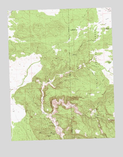
Pine Park, UT USGS Topographic Map
Click on map above to begin viewing in our Map Viewer.

This topographic map contains these locations and features:
Feature Name Type Latitude Longitude GNIS ID View Map
Barn Pole HollowValleyN37.5544°W114.0783°858817View Map
Beaver Dam State ParkParkN37.5214°W114.0722°858852View Map
California DrawValleyN37.5944°W114.0200°1439431View Map
Clay CanyonValleyN37.5694°W114.0378°1439779View Map
Cliff SpringSpringN37.5067°W114.0921°859266View Map
Crestline ReservoirReservoirN37.6228°W114.0050°1440156View Map
East Fork Beaver Dam WashStreamN37.5233°W114.0766°864986View Map
Grapevine SpringSpringN37.5056°W114.0731°859885View Map
Hamblin RanchLocaleN37.5269°W114.0864°859929View Map
Headwaters WashStreamN37.5230°W114.0766°859961View Map
Jessie Tie ExclosureLocaleN37.6233°W114.0153°1442136View Map
Mile High SpringSpringN37.5041°W114.0819°860581View Map
Oak KnollSummitN37.5069°W114.0764°860821View Map
Pine MountainSummitN37.5844°W114.0414°1444395View Map
Pine Mountain ReservoirReservoirN37.5810°W114.0492°1444396View Map
Pine ParkParkN37.5255°W114.0244°1444397View Map
Pine Park CampgroundLocaleN37.5222°W114.0236°1444399View Map
Pine Park CanyonValleyN37.5230°W114.0769°860963View Map
Pine Park SpringSpringN37.5278°W114.0233°1444401View Map
Roundup FlatFlatN37.5691°W114.0211°1445186View Map
Schroeder DamDamN37.5116°W114.0725°863487View Map
Schroeder LakeReservoirN37.5130°W114.0720°861288View Map
Sheep Corral CanyonValleyN37.5305°W114.0258°1445487View Map
Sheep SpringSpringN37.5001°W114.0259°1445510View Map
Split Pine HollowValleyN37.5325°W114.0564°1445970View Map
Split Pine HollowValleyN37.5311°W114.0572°861531View Map
Tunnel Spring WildernessReserveN37.5498°W114.0875°2575154View Map
Tunnel SpringsSpringN37.5566°W114.0769°861803View Map
Wheatgrass ReservoirReservoirN37.5733°W114.0031°1447209View Map
White HollowValleyN37.5214°W114.0244°1447252View Map
White RocksSummitN37.6139°W114.0091°1447284View Map

Note: Coordinates in the location and feature list above are referenced to NAD83 datum.


Copyright (C) 2008-2024 Ryan Niemi / Sunset Dynamics ... All Rights Reserved