TopoQuest Logo
Do you find TopoQuest useful?
Help keep TopoQuest running and adding new maps/features by donating!
Bitcoin:  19c7KJd3qBynnjoSw5npx9KScwjBe4ifkT
Litecoin:  LXs6TkuXGGXo1vDsWCkWVdjQX94eUKd6ui
Home View Maps Find Maps Find Places Resources & Links


Docs Pass, Nevada Topographic Map

USGS Map Title: Docs Pass, NV
USGS Map MRC: 37114D1
DRG (GeoTIFF) Download: o37114d1.tif


Neighboring USGS Topographic Map Quads:


  Acoma, NV  
37114E2
 

  Pine Park, UT  
37114E1
 

  Water Canyon Peak, UT  
37113E8
 

  Bunker Peak, NV  
37114D2
 

  Docs Pass, NV  
37114D1
 

  Goldstrike, UT  
37113D8
 

  Jacks Mountain, NV  
37114C2
 

  Dodge Spring, UT  
37114C1
 

  Motoqua, UT  
37113C8


Map MRC Location:

N38°
W115°
N38°
W114°
H8 H7 H6 H5 H4 H3 H2 H1
G8 G7 G6 G5 G4 G3 G2 G1
F8 F7 F6 F5 F4 F3 F2 F1
E8 E7 E6 E5 E4 E3 E2 E1
D8 D7 D6 D5 D4 D3 D2 D1
C8 C7 C6 C5 C4 C3 C2 C1
B8 B7 B6 B5 B4 B3 B2 B1
A8 A7 A6 A5 A4 A3 A2 A1
N37°
W115°
N37°
W114°

Docs Pass, NV USGS 1:24K Topographic Map Preview:
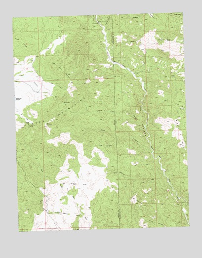
Docs Pass, NV USGS Topographic Map
Click on map above to begin viewing in our Map Viewer.

This topographic map contains these locations and features:
Feature Name Type Latitude Longitude GNIS ID View Map
Ash SpringSpringN37.3853°W114.0992°838521View Map
Ash Spring CanyonValleyN37.3847°W114.0800°838522View Map
Ash Spring ExclosureLocaleN37.4000°W114.1089°838523View Map
Black MountainSummitN37.4366°W114.1050°838846View Map
Bull MountainSummitN37.3894°W114.0380°1426126View Map
Cattle PassGapN37.4966°W114.0822°855492View Map
Cougar CanyonValleyN37.4780°W114.0550°1440053View Map
Cougar CanyonValleyN37.4764°W114.0569°839782View Map
Cougar Canyon WildernessReserveN37.4866°W114.0149°2760095View Map
Cougar SpringSpringN37.4837°W114.0133°1426974View Map
Deep CanyonValleyN37.4191°W114.0266°839962View Map
Deep CanyonValleyN37.4191°W114.0269°1427291View Map
Dobin CreekStreamN37.3872°W114.0047°840070View Map
Doc's Pass WildernessReserveN37.3943°W114.0225°2760098View Map
Docs PassGapN37.4536°W114.0972°840073View Map
Docs Pass CanyonValleyN37.4314°W114.0303°840074View Map
Docs Pass CanyonValleyN37.4308°W114.0300°1427431View Map
Docs SpringSpringN37.4494°W114.0902°845823View Map
Doe CanyonValleyN37.4261°W114.0508°840078View Map
Doe CanyonValleyN37.4278°W114.0419°1427435View Map
Holts CabinLocaleN37.4078°W114.0180°1428785View Map
Julius PeakSummitN37.4025°W114.0853°841429View Map
Middle PassGapN37.4391°W114.1155°842085View Map
Middle Pass SpringSpringN37.4369°W114.1158°842087View Map
Middle RidgeRidgeN37.4289°W114.0058°1430296View Map
Middle Ridge ExclosureLocaleN37.4444°W114.0036°1430299View Map
Oak SpringSpringN37.4995°W114.0705°842583View Map
Pine MountainSummitN37.4664°W114.0869°842828View Map
Pine RidgeRidgeN37.4775°W114.1072°842833View Map
Sheep CanyonValleyN37.4928°W114.0591°861340View Map
Slaughter CreekStreamN37.3797°W114.0028°1445668View Map
The NarrowsGapN37.4358°W114.0294°1433372View Map
Water and Ice FallsFallsN37.4972°W114.0641°855493View Map
Willow SpringSpringN37.4628°W114.0078°1434337View Map

Note: Coordinates in the location and feature list above are referenced to NAD83 datum.


Copyright (C) 2008-2024 Ryan Niemi / Sunset Dynamics ... All Rights Reserved