TopoQuest Logo
Do you find TopoQuest useful?
Help keep TopoQuest running and adding new maps/features by donating!
Bitcoin:  19c7KJd3qBynnjoSw5npx9KScwjBe4ifkT
Litecoin:  LXs6TkuXGGXo1vDsWCkWVdjQX94eUKd6ui
Home View Maps Find Maps Find Places Resources & Links


Burrton, Kansas Topographic Map

USGS Map Title: Burrton, KS
USGS Map MRC: 38097A6
DRG (GeoTIFF) Download: o38097a6.tif


Neighboring USGS Topographic Map Quads:


  Buhler, KS  
38097B7
 

  Halstead NW, KS  
38097B6
 

  Moundridge, KS  
38097B5
 

  Hutchinson SE, KS  
38097A7
 

  Burrton, KS  
38097A6
 

  Halstead, KS  
38097A5
 

  Haven, KS  
37097H7
 

  Patterson, KS  
37097H6
 

  Bentley, KS  
37097H5


Map MRC Location:

N39°
W98°
N39°
W97°
H8 H7 H6 H5 H4 H3 H2 H1
G8 G7 G6 G5 G4 G3 G2 G1
F8 F7 F6 F5 F4 F3 F2 F1
E8 E7 E6 E5 E4 E3 E2 E1
D8 D7 D6 D5 D4 D3 D2 D1
C8 C7 C6 C5 C4 C3 C2 C1
B8 B7 B6 B5 B4 B3 B2 B1
A8 A7 A6 A5 A4 A3 A2 A1
N38°
W98°
N38°
W97°

Burrton, KS USGS 1:24K Topographic Map Preview:
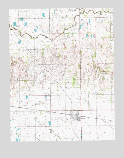
Burrton, KS USGS Topographic Map
Click on map above to begin viewing in our Map Viewer.

This topographic map contains these locations and features:
Feature Name Type Latitude Longitude GNIS ID View Map
Blaze ForkStreamN38.1211°W97.6592°477295View Map
BurrtonPopulated PlaceN38.0239°W97.6698°477984View Map
Burrton Ambulance DepartmentBuildingN38.0255°W97.6719°2696512View Map
Burrton CemeteryCemeteryN38.0150°W97.6759°2673268View Map
Burrton City BuildingBuildingN38.0254°W97.6719°2693319View Map
Burrton Elementary SchoolSchoolN38.0196°W97.6708°2497602View Map
Burrton Gas FieldOilfieldN38.0583°W97.6392°477982View Map
Burrton Mennonite ChurchChurchN38.0284°W97.6707°2689648View Map
Burrton Middle / High SchoolSchoolN38.0195°W97.6715°481234View Map
Burrton Police DepartmentBuildingN38.0248°W97.6713°2503821View Map
Burrton Post OfficePost OfficeN38.0254°W97.6713°2693648View Map
Burrton Senior CenterBuildingN38.0251°W97.6712°2692544View Map
Burrton Sewer Treatment PlantLocaleN38.0263°W97.6586°2692012View Map
Burrton United Methodist ChurchChurchN38.0225°W97.6728°2689365View Map
City of BurrtonCivilN38.0238°W97.6710°2393474View Map
Fairview Elementary School (historical)SchoolN38.0350°W97.7198°477983View Map
Faith Community Bible ChurchChurchN38.0260°W97.6735°2689649View Map
First Christian ChurchChurchN38.0221°W97.6720°2689650View Map
Flugplatz AirportAirportN38.0272°W97.7317°2770404View Map
Harvey Fire District 5BuildingN38.0278°W97.6686°2111405View Map
Lily Dale SchoolSchoolN38.0864°W97.7348°477980View Map
Township of BurrtonCivilN38.0431°W97.6470°473675View Map
Township of Little RiverCivilN38.1218°W97.7494°477732View Map
Willis School (historical)SchoolN38.1167°W97.6848°477981View Map

Note: Coordinates in the location and feature list above are referenced to NAD83 datum.


Copyright (C) 2008-2025 Ryan Niemi / Sunset Dynamics ... All Rights Reserved