TopoQuest Logo
Do you find TopoQuest useful?
Help keep TopoQuest running and adding new maps/features by donating!
Bitcoin:  19c7KJd3qBynnjoSw5npx9KScwjBe4ifkT
Litecoin:  LXs6TkuXGGXo1vDsWCkWVdjQX94eUKd6ui
Home View Maps Find Maps Find Places Resources & Links


Bushnell East, Illinois Topographic Map

USGS Map Title: Bushnell East, IL
USGS Map MRC: 40090E4
DRG (GeoTIFF) Download: o40090e4.tif


Neighboring USGS Topographic Map Quads:


  Greenbush, IL  
40090F5
 

  Avon, IL  
40090F4
 

  London Mills, IL  
40090F3
 

  Bushnell West, IL  
40090E5
 

  Bushnell East, IL  
40090E4
 

  Blyton, IL  
40090E3
 

  Bardolph, IL  
40090D5
 

  Adair, IL  
40090D4
 

  Smithfield, IL  
40090D3


Map MRC Location:

N41°
W91°
N41°
W90°
H8 H7 H6 H5 H4 H3 H2 H1
G8 G7 G6 G5 G4 G3 G2 G1
F8 F7 F6 F5 F4 F3 F2 F1
E8 E7 E6 E5 E4 E3 E2 E1
D8 D7 D6 D5 D4 D3 D2 D1
C8 C7 C6 C5 C4 C3 C2 C1
B8 B7 B6 B5 B4 B3 B2 B1
A8 A7 A6 A5 A4 A3 A2 A1
N40°
W91°
N40°
W90°

Bushnell East, IL USGS 1:24K Topographic Map Preview:
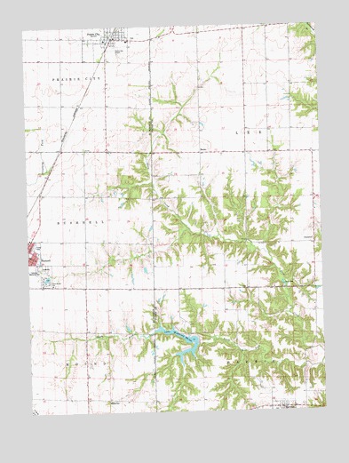
Bushnell East, IL USGS Topographic Map
Click on map above to begin viewing in our Map Viewer.

This topographic map contains these locations and features:
Feature Name Type Latitude Longitude GNIS ID View Map
Barnes CemeteryCemeteryN40.5401°W90.4075°1773311View Map
Barnes School (historical)SchoolN40.5381°W90.4173°1719431View Map
Brock School (historical)SchoolN40.5845°W90.4660°1719227View Map
Bushnell City CemeteryCemeteryN40.5473°W90.4932°1824323View Map
CheckrowPopulated PlaceN40.5542°W90.3782°422542View Map
Checkrow CemeteryCemeteryN40.5541°W90.3781°1984232View Map
Checkrow Community ChurchChurchN40.5545°W90.3779°1802209View Map
Crowl School (historical)SchoolN40.5264°W90.4668°1719228View Map
Curtis School (historical)SchoolN40.6134°W90.4462°1719229View Map
Dyers MoundSummitN40.5034°W90.4729°1824350View Map
First Baptist ChurchChurchN40.5414°W90.4899°408379View Map
Guernsey CemeteryCemeteryN40.5839°W90.3951°1773329View Map
Harris School (historical)SchoolN40.5003°W90.4265°1719454View Map
Hawn School (historical)SchoolN40.5584°W90.3785°1719456View Map
Lake Wildwood HavenReservoirN40.5187°W90.4378°421163View Map
Lake Wildwood Haven DamDamN40.5223°W90.4287°1691215View Map
Lee School (historical)SchoolN40.5914°W90.3971°1719461View Map
ManleyPopulated PlaceN40.5839°W90.4257°422932View Map
MariettaPopulated PlaceN40.5012°W90.3926°413000View Map
Marietta Fire DepartmentBuildingN40.5010°W90.3928°2640521View Map
Marietta Post OfficePost OfficeN40.5014°W90.3905°2788633View Map
Mound CemeteryCemeteryN40.5039°W90.4665°413903View Map
Mound School (historical)SchoolN40.5039°W90.4662°1719230View Map
Mound United Brethren in Christ Church (historical)ChurchN40.5039°W90.4660°1824423View Map
Oak Grove School (historical)SchoolN40.5770°W90.4287°1719476View Map
Peirsol CemeteryCemeteryN40.5836°W90.3948°1984278View Map
Piersols RunStreamN40.5520°W90.3998°1802158View Map
Pleasant Hill School (historical)SchoolN40.6125°W90.4260°1719483View Map
Prairie CityPopulated PlaceN40.6212°W90.4621°416109View Map
Prairie City Airport (historical)AirportN40.6181°W90.4599°427708View Map
Prairie City Community Church (historical)ChurchN40.6217°W90.4635°1824448View Map
Prairie City Fire Protection DistrictBuildingN40.6213°W90.4608°2640802View Map
Prairie City High School (historical)SchoolN40.6206°W90.4660°1824449View Map
Prairie City Methodist Episcopal Church (historical)ChurchN40.6217°W90.4635°1824450View Map
Prairie City ParkParkN40.6214°W90.4546°1824451View Map
Prairie City Post OfficePost OfficeN40.6208°W90.4617°2788613View Map
Prairie City Presbyterian ChurchChurchN40.6237°W90.4640°1824452View Map
Prairie Land Community Center (historical)BuildingN40.6206°W90.4660°1824453View Map
Prairieland Open Bible CenterChurchN40.6206°W90.4660°1824454View Map
Ramsey BranchStreamN40.5570°W90.4187°1802159View Map
Silver CreekStreamN40.5406°W90.3904°1802157View Map
South Fork Shaw CreekStreamN40.5145°W90.3757°418774View Map
Township of LeeCivilN40.5836°W90.3881°429240View Map
Village of Prairie CityCivilN40.6210°W90.4649°2399018View Map
Virgil (historical)Populated PlaceN40.6245°W90.3968°1802247View Map
Virgil Methodist Episcopal Church (historical)ChurchN40.6242°W90.3965°1802248View Map
Virgil School (historical)SchoolN40.6245°W90.3968°1719511View Map
WSRQ-FM (Bushnell)TowerN40.5459°W90.4876°428464View Map

Note: Coordinates in the location and feature list above are referenced to NAD83 datum.


Copyright (C) 2008-2024 Ryan Niemi / Sunset Dynamics ... All Rights Reserved