TopoQuest Logo
Do you find TopoQuest useful?
Help keep TopoQuest running and adding new maps/features by donating!
Bitcoin:  19c7KJd3qBynnjoSw5npx9KScwjBe4ifkT
Litecoin:  LXs6TkuXGGXo1vDsWCkWVdjQX94eUKd6ui
Home View Maps Find Maps Find Places Resources & Links


Bushnell Peak, Colorado Topographic Map

USGS Map Title: Bushnell Peak, CO
USGS Map MRC: 38105C8
DRG (GeoTIFF) Download: o38105c8.tif


Neighboring USGS Topographic Map Quads:


  Poncha Pass, CO  
38106D1
 

  Wellsville, CO  
38105D8
 

  Howard, CO  
38105D7
 

  Whale Hill, CO  
38106C1
 

  Bushnell Peak, CO  
38105C8
 

  Coaldale, CO  
38105C7
 

  Graveyard Gulch, CO  
38106B1
 

  Villa Grove, CO  
38105B8
 

  Valley View Hot Springs, CO  
38105B7


Map MRC Location:

N39°
W106°
N39°
W105°
H8 H7 H6 H5 H4 H3 H2 H1
G8 G7 G6 G5 G4 G3 G2 G1
F8 F7 F6 F5 F4 F3 F2 F1
E8 E7 E6 E5 E4 E3 E2 E1
D8 D7 D6 D5 D4 D3 D2 D1
C8 C7 C6 C5 C4 C3 C2 C1
B8 B7 B6 B5 B4 B3 B2 B1
A8 A7 A6 A5 A4 A3 A2 A1
N38°
W106°
N38°
W105°

Bushnell Peak, CO USGS 1:24K Topographic Map Preview:
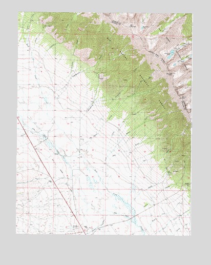
Bushnell Peak, CO USGS Topographic Map
Click on map above to begin viewing in our Map Viewer.

This topographic map contains these locations and features:
Feature Name Type Latitude Longitude GNIS ID View Map
Bolton CreekStreamN38.3553°W105.9897°191644View Map
Brook CreekStreamN38.2925°W105.9511°191693View Map
Bushnell LakesLakeN38.3483°W105.8817°191651View Map
Bushnell PeakSummitN38.3414°W105.8895°191650View Map
Butterfly CreekStreamN38.3364°W105.9700°191645View Map
Carr GulchValleyN38.2681°W105.9204°191690View Map
Cook CreekStreamN38.2783°W105.9370°191694View Map
Eaglebrook GulchValleyN38.3274°W105.9717°191646View Map
Euclid GulchValleyN38.2634°W105.9151°191688View Map
Ferguson CreekStreamN38.3258°W105.9445°191648View Map
Hayden Pass CreekStreamN38.2542°W105.9111°191684View Map
Hayden SpringSpringN38.2788°W105.8759°191685View Map
Jack GulchValleyN38.2790°W105.9388°191692View Map
Kerber CreekStreamN38.2622°W105.9303°191697View Map
Little Red CreekStreamN38.3072°W105.8828°193689View Map
Miller CreekStreamN38.2944°W105.9361°191691View Map
Mount OttoSummitN38.3272°W105.8828°196538View Map
Nieland CreekStreamN38.3411°W105.9872°191702View Map
North Rock CreekStreamN38.3711°W105.9950°191639View Map
Oak SpringsSpringN38.2856°W105.8895°191689View Map
Peterson CreekStreamN38.3064°W105.9839°191696View Map
Raspberry CreekStreamN38.2972°W105.9558°191647View Map
Red CreekStreamN38.3192°W105.9045°193688View Map
Red MountainSummitN38.3683°W105.9197°191701View Map
Rock CreekStreamN38.2564°W105.9153°191640View Map
South Rock CreekStreamN38.3711°W105.9950°191638View Map
Twin SistersSummitN38.3500°W105.8983°191649View Map
Villa Grove CemeteryCemeteryN38.2550°W105.9544°191695View Map
West Creek LakeLakeN38.3665°W105.9112°191704View Map
Yankee CreekStreamN38.3547°W105.9920°191703View Map

Note: Coordinates in the location and feature list above are referenced to NAD83 datum.


Copyright (C) 2008-2024 Ryan Niemi / Sunset Dynamics ... All Rights Reserved