TopoQuest Logo
Do you find TopoQuest useful?
Help keep TopoQuest running and adding new maps/features by donating!
Bitcoin:  19c7KJd3qBynnjoSw5npx9KScwjBe4ifkT
Litecoin:  LXs6TkuXGGXo1vDsWCkWVdjQX94eUKd6ui
Home View Maps Find Maps Find Places Resources & Links


Bussey, Arkansas Topographic Map

USGS Map Title: Bussey, AR
USGS Map MRC: 33093B4
DRG (GeoTIFF) Download: o33093b4.tif


Neighboring USGS Topographic Map Quads:


  Lewisville, AR  
33093C5
 

  Buckner, AR  
33093C4
 

  Waldo, AR  
33093C3
 

  Bradley NE, AR  
33093B5
 

  Bussey, AR  
33093B4
 

  Macedonia, AR  
33093B3
 

  Bradley SE, AR  
33093A5
 

  Taylor, AR  
33093A4
 

  Walkerville, AR  
33093A3


Map MRC Location:

N34°
W94°
N34°
W93°
H8 H7 H6 H5 H4 H3 H2 H1
G8 G7 G6 G5 G4 G3 G2 G1
F8 F7 F6 F5 F4 F3 F2 F1
E8 E7 E6 E5 E4 E3 E2 E1
D8 D7 D6 D5 D4 D3 D2 D1
C8 C7 C6 C5 C4 C3 C2 C1
B8 B7 B6 B5 B4 B3 B2 B1
A8 A7 A6 A5 A4 A3 A2 A1
N33°
W94°
N33°
W93°

Bussey, AR USGS 1:24K Topographic Map Preview:
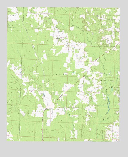
Bussey, AR USGS Topographic Map
Click on map above to begin viewing in our Map Viewer.

This topographic map contains these locations and features:
Feature Name Type Latitude Longitude GNIS ID View Map
Beacon ChurchChurchN33.1699°W93.4360°46183View Map
Big CreekStreamN33.1682°W93.3877°46525View Map
Bridge CreekStreamN33.1593°W93.3885°46939View Map
BusseyPopulated PlaceN33.1557°W93.4563°57480View Map
Bussey - Sharman Fire StationBuildingN33.1607°W93.4250°2116208View Map
Corinth ChurchChurchN33.1274°W93.3788°48043View Map
ExperimentPopulated PlaceN33.2026°W93.4660°57734View Map
FriendshipPopulated PlaceN33.2262°W93.4430°59929View Map
Friendship CemeteryCemeteryN33.2151°W93.4360°49248View Map
Friendship ChurchChurchN33.2210°W93.4413°49255View Map
Holly CreekStreamN33.2457°W93.4335°50214View Map
McKamie Patton Oil FieldOilfieldN33.2371°W93.4977°51854View Map
Mill CreekStreamN33.1437°W93.3924°52002View Map
Mill CreekStreamN33.2337°W93.4285°52003View Map
Robertson School (historical)SchoolN33.1657°W93.4555°59927View Map
Rocky Mount CemeteryCemeteryN33.2307°W93.3796°54150View Map
Rocky Mount ChurchChurchN33.2354°W93.3810°54151View Map
SharmanPopulated PlaceN33.1901°W93.4110°58604View Map
Sharman CemeteryCemeteryN33.1715°W93.4166°54731View Map
Sharman ChurchChurchN33.1779°W93.4160°54732View Map
SmithlandPopulated PlaceN33.2321°W93.3829°59930View Map
Township of Georgia (historical)CivilN33.1751°W93.4460°59967View Map
Township of TaylorCivilN33.1329°W93.4338°63752View Map
Wise School (historical)SchoolN33.2449°W93.4560°59928View Map
Woodard SchoolSchoolN33.2279°W93.4435°56517View Map

Note: Coordinates in the location and feature list above are referenced to NAD83 datum.


Copyright (C) 2008-2025 Ryan Niemi / Sunset Dynamics ... All Rights Reserved