TopoQuest Logo
Do you find TopoQuest useful?
Help keep TopoQuest running and adding new maps/features by donating!
Bitcoin:  19c7KJd3qBynnjoSw5npx9KScwjBe4ifkT
Litecoin:  LXs6TkuXGGXo1vDsWCkWVdjQX94eUKd6ui
Home View Maps Find Maps Find Places Resources & Links


Waldo, Arkansas Topographic Map

USGS Map Title: Waldo, AR
USGS Map MRC: 33093C3
DRG (GeoTIFF) Download: o33093c3.tif


Neighboring USGS Topographic Map Quads:


  Falcon, AR  
33093D4
 

  Lamartine, AR  
33093D3
 

  Magnolia NW, AR  
33093D2
 

  Buckner, AR  
33093C4
 

  Waldo, AR  
33093C3
 

  Magnolia, AR  
33093C2
 

  Bussey, AR  
33093B4
 

  Macedonia, AR  
33093B3
 

  Calhoun, AR  
33093B2


Map MRC Location:

N34°
W94°
N34°
W93°
H8 H7 H6 H5 H4 H3 H2 H1
G8 G7 G6 G5 G4 G3 G2 G1
F8 F7 F6 F5 F4 F3 F2 F1
E8 E7 E6 E5 E4 E3 E2 E1
D8 D7 D6 D5 D4 D3 D2 D1
C8 C7 C6 C5 C4 C3 C2 C1
B8 B7 B6 B5 B4 B3 B2 B1
A8 A7 A6 A5 A4 A3 A2 A1
N33°
W94°
N33°
W93°

Waldo, AR USGS 1:24K Topographic Map Preview:
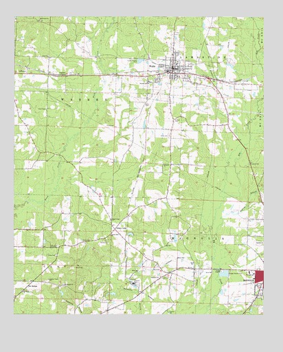
Waldo, AR USGS Topographic Map
Click on map above to begin viewing in our Map Viewer.

This topographic map contains these locations and features:
Feature Name Type Latitude Longitude GNIS ID View Map
Antioch CemeteryCemeteryN33.2696°W93.3443°45883View Map
Antioch West ChurchChurchN33.2832°W93.3268°45904View Map
Barlow BranchStreamN33.2821°W93.2760°46095View Map
Barlow CemeteryCemeteryN33.2812°W93.3368°46096View Map
Beech Creek ChurchChurchN33.3737°W93.3624°46329View Map
Big Creek Oil and Gas FieldOilfieldN33.2890°W93.2738°60271View Map
Box SpringsPopulated PlaceN33.2618°W93.3682°57418View Map
Cedar Grove Baptist ChurchChurchN33.3493°W93.2791°47605View Map
Cedar Grove School (historical)SchoolN33.3337°W93.2654°60272View Map
City of WaldoCivilN33.3528°W93.2947°2405659View Map
Cleveland School (historical)SchoolN33.2704°W93.3021°60270View Map
Columbia County Sheriff's OfficeBuildingN33.2648°W93.2660°2118893View Map
Davis ChurchChurchN33.3585°W93.3582°48389View Map
Dickson CemeteryCemeteryN33.3315°W93.2943°48511View Map
Fallin LakeReservoirN33.2839°W93.3167°80461View Map
Fallin Lake DamDamN33.2835°W93.3168°80460View Map
First Missionary Baptist ChurchChurchN33.3503°W93.2964°2127415View Map
Frazier CemeteryCemeteryN33.2748°W93.3538°49225View Map
Friendship ChurchChurchN33.2593°W93.3704°49256View Map
Frog Level PlantationLocaleN33.2787°W93.3535°49277View Map
Home Near School (historical)SchoolN33.2640°W93.3052°60269View Map
Homnear ChurchChurchN33.2654°W93.3027°50276View Map
Hurricane RidgeRidgeN33.2643°W93.2527°72131View Map
JeffersonPopulated PlaceN33.3512°W93.3688°57984View Map
Kendrick CreekStreamN33.3318°W93.2563°50807View Map
Kilgore LodgeLocaleN33.2857°W93.3246°50838View Map
Kilgore Lodge ChurchChurchN33.2898°W93.3263°77401View Map
LumberPopulated PlaceN33.3504°W93.3474°58099View Map
Memorial Baptist ChurchChurchN33.3592°W93.2961°2127416View Map
Mount Pleasant ChurchChurchN33.2624°W93.3499°52391View Map
Mount Pleasant School (historical)SchoolN33.2701°W93.3441°60268View Map
Mount Vernon Volunteer Fire DepartmentBuildingN33.3297°W93.3736°2116826View Map
Porter ChapelChurchN33.3362°W93.3591°53702View Map
Powell LakeReservoirN33.3018°W93.3252°80459View Map
Powell Lake DamDamN33.3018°W93.3252°80458View Map
Rudd CemeteryCemeteryN33.2801°W93.3282°54261View Map
Rudd Crossing Volunteer Fire DepartmentBuildingN33.2809°W93.3347°2117052View Map
Saint James ChurchChurchN33.3132°W93.3002°54337View Map
Saint John II Baptist ChurchChurchN33.3478°W93.3072°2127355View Map
Scott CemeteryCemeteryN33.2654°W93.3013°54637View Map
Strong CemeteryCemeteryN33.3293°W93.3249°55274View Map
Township of Warren (historical)CivilN33.3376°W93.3710°59959View Map
WaldoPopulated PlaceN33.3515°W93.2957°58813View Map
Waldo CemeteryCemeteryN33.3251°W93.2974°55946View Map
Waldo Church of ChristChurchN33.3542°W93.2956°2127417View Map
Waldo Elementary SchoolSchoolN33.3551°W93.2941°59903View Map
Waldo Fire DepartmentBuildingN33.3532°W93.2953°2117260View Map
Waldo High SchoolSchoolN33.3562°W93.2935°60273View Map
Waldo Police DepartmentBuildingN33.3532°W93.2932°2118898View Map
Waldo Water TowerTowerN33.3533°W93.2931°2127418View Map
Weber LakeReservoirN33.2820°W93.2945°80463View Map
Weber Lake DamDamN33.2801°W93.2952°80462View Map
West Side ParkParkN33.2640°W93.2563°60194View Map
Westside Baptist ChurchChurchN33.2657°W93.2543°60193View Map
Westside SchoolSchoolN33.3473°W93.3082°56209View Map
Westside SchoolSchoolN33.2671°W93.2552°78740View Map

Note: Coordinates in the location and feature list above are referenced to NAD83 datum.


Copyright (C) 2008-2024 Ryan Niemi / Sunset Dynamics ... All Rights Reserved