TopoQuest Logo
Do you find TopoQuest useful?
Help keep TopoQuest running and adding new maps/features by donating!
Bitcoin:  19c7KJd3qBynnjoSw5npx9KScwjBe4ifkT
Litecoin:  LXs6TkuXGGXo1vDsWCkWVdjQX94eUKd6ui
Home View Maps Find Maps Find Places Resources & Links


Byhalia, Mississippi Topographic Map

USGS Map Title: Byhalia, MS
USGS Map MRC: 34089G6
DRG (GeoTIFF) Download: o34089g6.tif


Neighboring USGS Topographic Map Quads:


  Olive Branch, MS  
34089H7
 

  Byhalia NW, MS  
34089H6
 

  Mount Pleasant, MS  
34089H5
 

  Lewisburg, MS  
34089G7
 

  Byhalia, MS  
34089G6
 

  Red Banks, MS  
34089G5
 

  Independence, MS  
34089F7
 

  Wyatte, MS  
34089F6
 

  Marianna, MS  
34089F5


Map MRC Location:

N35°
W90°
N35°
W89°
H8 H7 H6 H5 H4 H3 H2 H1
G8 G7 G6 G5 G4 G3 G2 G1
F8 F7 F6 F5 F4 F3 F2 F1
E8 E7 E6 E5 E4 E3 E2 E1
D8 D7 D6 D5 D4 D3 D2 D1
C8 C7 C6 C5 C4 C3 C2 C1
B8 B7 B6 B5 B4 B3 B2 B1
A8 A7 A6 A5 A4 A3 A2 A1
N34°
W90°
N34°
W89°

Byhalia, MS USGS 1:24K Topographic Map Preview:
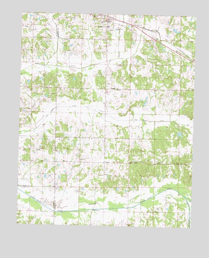
Byhalia, MS USGS Topographic Map
Click on map above to begin viewing in our Map Viewer.

This topographic map contains these locations and features:
Feature Name Type Latitude Longitude GNIS ID View Map
Barrow CreekStreamN34.8493°W89.6823°666544View Map
Buchanan Lake DamDamN34.8084°W89.6334°682802View Map
ByhaliaPopulated PlaceN34.8723°W89.6906°667879View Map
Byhalia CemeteryCemeteryN34.8737°W89.6965°706302View Map
Byhalia Police DepartmentBuildingN34.8677°W89.6875°2754155View Map
Byhalia Post OfficePost OfficeN34.8725°W89.6890°2768834View Map
Byhalia United Methodist ChurchChurchN34.8704°W89.6909°683789View Map
Byhalia Volunteer Fire Department Station 1BuildingN34.8729°W89.6882°2665959View Map
Cathey School (historical)SchoolN34.8304°W89.7298°690477View Map
Coal Oil CornerPopulated PlaceN34.8684°W89.6706°691774View Map
Cuffawa CreekStreamN34.7687°W89.6309°669007View Map
Emery CemeteryCemeteryN34.7868°W89.7176°683800View Map
Emery ChurchChurchN34.7876°W89.7176°669764View Map
First Baptist ChurchChurchN34.8704°W89.6923°683801View Map
First Presbyterian ChurchChurchN34.8709°W89.6918°683802View Map
Harmonia CemeteryCemeteryN34.8243°W89.6259°683805View Map
Harmonia Church (historical)ChurchN34.8245°W89.6259°683806View Map
Henry SchoolSchoolN34.8679°W89.6881°706308View Map
Horn CemeteryCemeteryN34.7876°W89.6340°683811View Map
Horn ChurchChurchN34.7879°W89.6348°671456View Map
Ingram CemeteryCemeteryN34.7940°W89.7470°690305View Map
Isaac CemeteryCemeteryN34.7893°W89.7056°671724View Map
Isaac Chapel ChurchChurchN34.7876°W89.6701°683816View Map
Issac Chapel School (historical)SchoolN34.7857°W89.6715°683817View Map
J P Woods DamDamN34.8668°W89.6434°682819View Map
James O Rich Pond DamDamN34.8301°W89.7368°690439View Map
L A Thompson Pond DamDamN34.7984°W89.7334°690429View Map
Liberty Hill CemeteryCemeteryN34.7876°W89.6501°683825View Map
Liberty Hill ChurchChurchN34.7876°W89.6504°672470View Map
Macedonia Baptist ChurchChurchN34.8273°W89.7259°690330View Map
Macedonia CemeteryCemeteryN34.8279°W89.7251°690541View Map
Mount Gilead ChurchChurchN34.7937°W89.7234°674006View Map
Saint Pauls CemeteryCemeteryN34.8453°W89.6812°677209View Map
Saint Pauls ChurchChurchN34.8307°W89.6818°677224View Map
Sticky CreekStreamN34.8443°W89.7320°690399View Map
Sunnyside School (historical)SchoolN34.7873°W89.7406°690596View Map
Town of ByhaliaCivilN34.8690°W89.6890°2405352View Map
Utkolb Pond DamDamN34.8384°W89.7434°690442View Map
Walter May Lake DamDamN34.7734°W89.6418°682798View Map
WarsawPopulated PlaceN34.8309°W89.6862°679356View Map
Watkins CemeteryCemeteryN34.8337°W89.6872°679375View Map
WatsonPopulated PlaceN34.7876°W89.6887°679377View Map
Watson CenterPopulated PlaceN34.7876°W89.6709°692310View Map
Watson Community ChapelChurchN34.7870°W89.6740°683872View Map
Watson Volunteer Fire DepartmentBuildingN34.7876°W89.6920°2665943View Map

Note: Coordinates in the location and feature list above are referenced to NAD83 datum.


Copyright (C) 2008-2025 Ryan Niemi / Sunset Dynamics ... All Rights Reserved