TopoQuest Logo
Do you find TopoQuest useful?
Help keep TopoQuest running and adding new maps/features by donating!
Bitcoin:  19c7KJd3qBynnjoSw5npx9KScwjBe4ifkT
Litecoin:  LXs6TkuXGGXo1vDsWCkWVdjQX94eUKd6ui
Home View Maps Find Maps Find Places Resources & Links


Wyatte, Mississippi Topographic Map

USGS Map Title: Wyatte, MS
USGS Map MRC: 34089F6
DRG (GeoTIFF) Download: o34089f6.tif


Neighboring USGS Topographic Map Quads:


  Lewisburg, MS  
34089G7
 

  Byhalia, MS  
34089G6
 

  Red Banks, MS  
34089G5
 

  Independence, MS  
34089F7
 

  Wyatte, MS  
34089F6
 

  Marianna, MS  
34089F5
 

  Looxahoma, MS  
34089E7
 

  Tyro, MS  
34089E6
 

  Laws Hill, MS  
34089E5


Map MRC Location:

N35°
W90°
N35°
W89°
H8 H7 H6 H5 H4 H3 H2 H1
G8 G7 G6 G5 G4 G3 G2 G1
F8 F7 F6 F5 F4 F3 F2 F1
E8 E7 E6 E5 E4 E3 E2 E1
D8 D7 D6 D5 D4 D3 D2 D1
C8 C7 C6 C5 C4 C3 C2 C1
B8 B7 B6 B5 B4 B3 B2 B1
A8 A7 A6 A5 A4 A3 A2 A1
N34°
W90°
N34°
W89°

Wyatte, MS USGS 1:24K Topographic Map Preview:
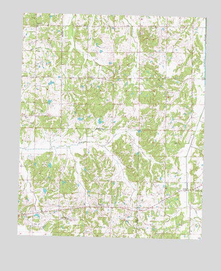
Wyatte, MS USGS Topographic Map
Click on map above to begin viewing in our Map Viewer.

This topographic map contains these locations and features:
Feature Name Type Latitude Longitude GNIS ID View Map
AikenPopulated PlaceN34.6309°W89.7398°691655View Map
Bowen Lake DamDamN34.6884°W89.6968°682777View Map
Brooks CemeteryCemeteryN34.6787°W89.6448°666118View Map
Callis Lake DamDamN34.6918°W89.7134°682778View Map
Carter Sunset Memorial GardensCemeteryN34.6351°W89.7220°666078View Map
Cathey CemeteryCemeteryN34.6315°W89.7115°668167View Map
ChulahomaPopulated PlaceN34.6537°W89.6304°666106View Map
Chulahoma CemeteryCemeteryN34.6481°W89.6290°683793View Map
Chulahoma Church (historical)ChurchN34.6537°W89.6312°683794View Map
Church of ChristChurchN34.7137°W89.7498°666409View Map
Dry Fork CreekStreamN34.7115°W89.6251°669456View Map
Ellis Chapel School (historical)SchoolN34.6345°W89.7209°683420View Map
Grubb Hill CemeteryCemeteryN34.7437°W89.6434°670758View Map
Grubb Hill Church (historical)ChurchN34.7443°W89.6440°683804View Map
Harmon CemeteryCemeteryN34.7473°W89.7412°670921View Map
Hickahala Creek Watershed Y-6-11 DamDamN34.6851°W89.6684°682776View Map
Hickahala Creek Watershed Y-6-15 DamDamN34.7018°W89.7334°682780View Map
Hickahala Creek Watershed Y-6-16 DamDamN34.7134°W89.7368°682785View Map
Hickahala Creek Watershed Y-6-3 DamDamN34.6368°W89.7368°682750View Map
Hickahala Creek Watershed Y-6-4 DamDamN34.6334°W89.7368°682748View Map
Hickahala Creek Watershed Y-6-5 DamDamN34.6634°W89.7318°682761View Map
Hickahala Creek Watershed Y-6-6 DamDamN34.6584°W89.7234°682758View Map
Jamieson ChapelChurchN34.6726°W89.6854°666104View Map
Jones CemeteryCemeteryN34.7143°W89.7026°666121View Map
Lee School (historical)SchoolN34.7426°W89.7404°683436View Map
Mount Olive ChurchChurchN34.7148°W89.7048°683833View Map
Mount Zion CemeteryCemeteryN34.7431°W89.6604°683835View Map
Mount Zion ChurchChurchN34.7440°W89.6601°674410View Map
Mullins School (historical)SchoolN34.7157°W89.6348°683836View Map
New Travel ChurchChurchN34.7395°W89.7418°674856View Map
OrionPopulated PlaceN34.7154°W89.6520°691656View Map
Phillips School (historical)SchoolN34.6565°W89.6431°683845View Map
Pigeon Roost Watershed Y-5-122 DamDamN34.6684°W89.6884°682766View Map
Roberts ChapelChurchN34.7148°W89.7312°666408View Map
Roberts Chapel CemeteryCemeteryN34.7143°W89.7331°683462View Map
RockhillPopulated PlaceN34.7143°W89.7393°691676View Map
Rockhill School (historical)SchoolN34.7137°W89.7412°683463View Map
Saint Josephs ChurchChurchN34.7437°W89.7068°677105View Map
Saint Josephs School (historical)SchoolN34.7437°W89.7070°683852View Map
Shady Grove CemeteryCemeteryN34.7079°W89.6484°683854View Map
Shady Grove ChurchChurchN34.7079°W89.6506°666119View Map
Shady Grove School (historical)SchoolN34.7070°W89.6512°683855View Map
Stickland Chapel CemeteryCemeteryN34.7156°W89.6529°683862View Map
Strickland Chapel CemeteryCemeteryN34.7151°W89.6534°683861View Map
Strickland Chapel ChurchChurchN34.7151°W89.6526°683863View Map
Thyatira ChurchChurchN34.6351°W89.7434°666099View Map
WakefieldPopulated PlaceN34.7432°W89.7409°692300View Map
WallhillPopulated PlaceN34.7145°W89.7040°691675View Map
Worrier School (historical)SchoolN34.6634°W89.7334°683489View Map
WyattePopulated PlaceN34.6418°W89.6943°666410View Map
Wyatte Baptist ChurchChurchN34.6429°W89.6937°706018View Map
Wyatte School (historical)SchoolN34.6429°W89.6929°706019View Map

Note: Coordinates in the location and feature list above are referenced to NAD83 datum.


Copyright (C) 2008-2024 Ryan Niemi / Sunset Dynamics ... All Rights Reserved