TopoQuest Logo
Do you find TopoQuest useful?
Help keep TopoQuest running and adding new maps/features by donating!
Bitcoin:  19c7KJd3qBynnjoSw5npx9KScwjBe4ifkT
Litecoin:  LXs6TkuXGGXo1vDsWCkWVdjQX94eUKd6ui
Home View Maps Find Maps Find Places Resources & Links


Byron, Nebraska Topographic Map

USGS Map Title: Byron, NE
USGS Map MRC: 40097A7
DRG (GeoTIFF) Download: o40097a7.tif


Neighboring USGS Topographic Map Quads:


  Oak, NE  
40097B8
 

  Ruskin, NE  
40097B7
 

  Deshler, NE  
40097B6
 

  Hardy, NE  
40097A8
 

  Byron, NE  
40097A7
 

  Hebron SW, NE  
40097A6
 

  Scandia NW, KS  
39097H8
 

  Republic, KS  
39097H7
 

  Belleville NW, KS  
39097H6


Map MRC Location:

N41°
W98°
N41°
W97°
H8 H7 H6 H5 H4 H3 H2 H1
G8 G7 G6 G5 G4 G3 G2 G1
F8 F7 F6 F5 F4 F3 F2 F1
E8 E7 E6 E5 E4 E3 E2 E1
D8 D7 D6 D5 D4 D3 D2 D1
C8 C7 C6 C5 C4 C3 C2 C1
B8 B7 B6 B5 B4 B3 B2 B1
A8 A7 A6 A5 A4 A3 A2 A1
N40°
W98°
N40°
W97°

Byron, NE USGS 1:24K Topographic Map Preview:
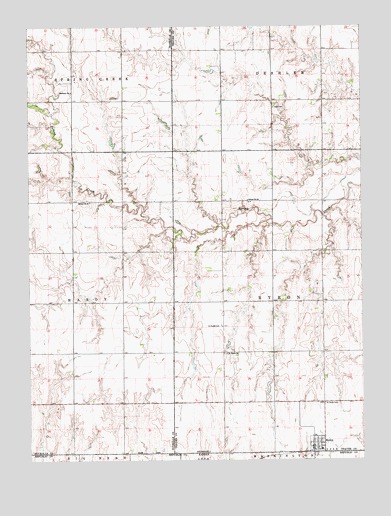
Byron, NE USGS Topographic Map
Click on map above to begin viewing in our Map Viewer.

This topographic map contains these locations and features:
Feature Name Type Latitude Longitude GNIS ID View Map
Bethany ChurchChurchN40.1064°W97.8589°827362View Map
ByronLocaleN40.0022°W97.7689°1883064View Map
ByronPopulated PlaceN40.0039°W97.7689°827830View Map
Byron Airport (historical)AirportN40.0042°W97.7734°837510View Map
Byron Elementary SchoolSchoolN40.0070°W97.7687°1882970View Map
Byron Post OfficePost OfficeN40.0035°W97.7688°1883067View Map
Byron Public LibraryBuildingN40.0039°W97.7689°1883066View Map
Byron Volunteer Fire DepartmentBuildingN40.0031°W97.7693°2553461View Map
Eggers DamDamN40.0900°W97.8430°1767406View Map
Eggers ReservoirReservoirN40.0922°W97.8439°1767407View Map
Fair View School (historical)SchoolN40.0161°W97.8020°1882929View Map
Fintel DamDamN40.0833°W97.7687°1767626View Map
Fintel ReservoirReservoirN40.0818°W97.7693°1767627View Map
Hillcrest School (historical)SchoolN40.1031°W97.7928°1882918View Map
Hofts DamDamN40.0955°W97.8219°1767434View Map
Hofts ReservoirLakeN40.0973°W97.8242°1767435View Map
Lone Star School (historical)SchoolN40.0458°W97.7942°1882928View Map
Saint Pauls CemeteryCemeteryN40.0161°W97.7648°833061View Map
Saint Pauls CemeteryCemeteryN40.0383°W97.8036°833062View Map
Saint Pauls ChurchChurchN40.0306°W97.8012°833067View Map
Saint Peters Lutheran ChurchChurchN40.0039°W97.7689°1883065View Map
School Number 91SchoolN40.0745°W97.8523°837190View Map
Spring Creek Valley School (historical)SchoolN40.0747°W97.7934°836974View Map
Township of ByronCivilN40.0472°W97.7642°1882944View Map
Township of HardyCivilN40.0417°W97.8748°1882659View Map
Village of ByronCivilN40.0049°W97.7686°2397518View Map
Zion CemeteryCemeteryN40.1017°W97.7831°834928View Map

Note: Coordinates in the location and feature list above are referenced to NAD83 datum.


Copyright (C) 2008-2024 Ryan Niemi / Sunset Dynamics ... All Rights Reserved