TopoQuest Logo
Do you find TopoQuest useful?
Help keep TopoQuest running and adding new maps/features by donating!
Bitcoin:  19c7KJd3qBynnjoSw5npx9KScwjBe4ifkT
Litecoin:  LXs6TkuXGGXo1vDsWCkWVdjQX94eUKd6ui
Home View Maps Find Maps Find Places Resources & Links


Cactus Flat, Arizona Topographic Map

USGS Map Title: Cactus Flat, AZ
USGS Map MRC: 34110D2
DRG (GeoTIFF) Download: o34110d2.tif


Neighboring USGS Topographic Map Quads:


  Sheepskin Wash, AZ  
34110E3
 

  Second Knolls, AZ  
34110E2
 

  Snowflake, AZ  
34110E1
 

  Big Pug Tank, AZ  
34110D3
 

  Cactus Flat, AZ  
34110D2
 

  Taylor, AZ  
34110D1
 

  Clay Springs, AZ  
34110C3
 

  Pinedale, AZ  
34110C2
 

  Show Low North, AZ  
34110C1


Map MRC Location:

N35°
W111°
N35°
W110°
H8 H7 H6 H5 H4 H3 H2 H1
G8 G7 G6 G5 G4 G3 G2 G1
F8 F7 F6 F5 F4 F3 F2 F1
E8 E7 E6 E5 E4 E3 E2 E1
D8 D7 D6 D5 D4 D3 D2 D1
C8 C7 C6 C5 C4 C3 C2 C1
B8 B7 B6 B5 B4 B3 B2 B1
A8 A7 A6 A5 A4 A3 A2 A1
N34°
W111°
N34°
W110°

Cactus Flat, AZ USGS 1:24K Topographic Map Preview:
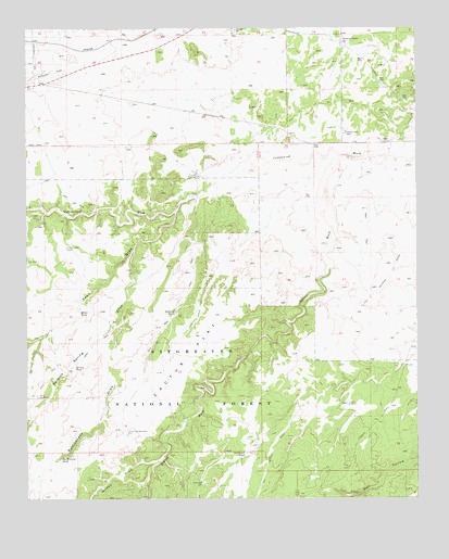
Cactus Flat, AZ USGS Topographic Map
Click on map above to begin viewing in our Map Viewer.

This topographic map contains these locations and features:
Feature Name Type Latitude Longitude GNIS ID View Map
Antelope TankReservoirN34.4127°W110.1673°42000View Map
Back Stop TankReservoirN34.3947°W110.1482°42002View Map
Ballard TankReservoirN34.4246°W110.2031°25938View Map
Bull Ranch DrawValleyN34.3770°W110.1418°41527View Map
Cactus FlatFlatN34.4128°W110.1985°27162View Map
Cactus Flat WindmillLocaleN34.3920°W110.2190°27163View Map
Carlisle TankReservoirN34.4222°W110.1828°41998View Map
Deborah TankReservoirN34.4030°W110.1554°1853649View Map
Dodson WashStreamN34.4661°W110.1501°28511View Map
Drinker TankReservoirN34.4058°W110.2048°41999View Map
East WellWellN34.3789°W110.1946°28798View Map
Linden WindmillLocaleN34.4000°W110.1482°31006View Map
Miller TankReservoirN34.4251°W110.2338°8068View Map
Mortensen WashArroyoN34.4642°W110.1723°40223View Map
Northeast TankReservoirN34.3868°W110.1807°32402View Map
Number Two TankReservoirN34.3965°W110.1825°42001View Map
Perkins Spring DrawValleyN34.4417°W110.2160°32797View Map
Rattlesnake DrawValleyN34.4278°W110.2176°33397View Map
Rattlesnake TankReservoirN34.3854°W110.2400°33407View Map
Snowflake DivisionCivilN34.4488°W110.2392°1934981View Map
Spring TankReservoirN34.4102°W110.2354°34735View Map
Thomas TankReservoirN34.4616°W110.1847°40276View Map
Thomas WindmillLocaleN34.4606°W110.1957°35275View Map
Town DrawValleyN34.4509°W110.2032°35424View Map
West WindmillLocaleN34.4025°W110.2476°36029View Map
Wilson DrawValleyN34.3848°W110.2098°36289View Map

Note: Coordinates in the location and feature list above are referenced to NAD83 datum.


Copyright (C) 2008-2024 Ryan Niemi / Sunset Dynamics ... All Rights Reserved