TopoQuest Logo
Do you find TopoQuest useful?
Help keep TopoQuest running and adding new maps/features by donating!
Bitcoin:  19c7KJd3qBynnjoSw5npx9KScwjBe4ifkT
Litecoin:  LXs6TkuXGGXo1vDsWCkWVdjQX94eUKd6ui
Home View Maps Find Maps Find Places Resources & Links


Clay Springs, Arizona Topographic Map

USGS Map Title: Clay Springs, AZ
USGS Map MRC: 34110C3
DRG (GeoTIFF) Download: o34110c3.tif


Neighboring USGS Topographic Map Quads:


  Aripine, AZ  
34110D4
 

  Big Pug Tank, AZ  
34110D3
 

  Cactus Flat, AZ  
34110D2
 

  Day Spring, AZ  
34110C4
 

  Clay Springs, AZ  
34110C3
 

  Pinedale, AZ  
34110C2
 

  Bear Ridge, AZ  
34110B4
 

  Limestone Canyon North, AZ  
34110B3
 

  Red Top Mountain, AZ  
34110B2


Map MRC Location:

N35°
W111°
N35°
W110°
H8 H7 H6 H5 H4 H3 H2 H1
G8 G7 G6 G5 G4 G3 G2 G1
F8 F7 F6 F5 F4 F3 F2 F1
E8 E7 E6 E5 E4 E3 E2 E1
D8 D7 D6 D5 D4 D3 D2 D1
C8 C7 C6 C5 C4 C3 C2 C1
B8 B7 B6 B5 B4 B3 B2 B1
A8 A7 A6 A5 A4 A3 A2 A1
N34°
W111°
N34°
W110°

Clay Springs, AZ USGS 1:24K Topographic Map Preview:
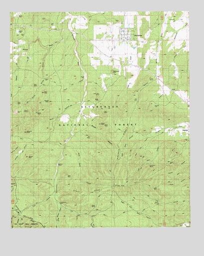
Clay Springs, AZ USGS Topographic Map
Click on map above to begin viewing in our Map Viewer.

This topographic map contains these locations and features:
Feature Name Type Latitude Longitude GNIS ID View Map
Ashhurst PointSummitN34.2914°W110.3632°25811View Map
Aunt Lottie Mormon Pioneer Historical MarkerParkN34.3370°W110.2729°40144View Map
Bald PointSummitN34.3170°W110.3104°25919View Map
Blain PointSummitN34.3284°W110.3523°26474View Map
Borrow TankReservoirN34.3638°W110.3697°40653View Map
Bryant CanyonValleyN34.3162°W110.3271°40658View Map
Bryant PointSummitN34.3100°W110.3123°26852View Map
Buck TankReservoirN34.3517°W110.3626°40162View Map
Butler PointSummitN34.3239°W110.3140°27081View Map
Cabin TankReservoirN34.3458°W110.2514°2745531View Map
Christmas TankReservoirN34.3649°W110.2752°2745534View Map
Clay SpringsPopulated PlaceN34.3617°W110.2954°27691View Map
Clay Springs Census Designated PlaceCensusN34.3593°W110.3043°2582759View Map
Clay Springs Pinedale Fire Department Station 620BuildingN34.3644°W110.2983°2672372View Map
Clay Springs Post OfficePost OfficeN34.3635°W110.2968°44959View Map
Clay Springs SchoolSchoolN34.3594°W110.2981°40166View Map
Cline PointSummitN34.3223°W110.3710°27720View Map
Coal CanyonValleyN34.3378°W110.3718°27751View Map
Cottonwood SeepSpringN34.2603°W110.3412°40172View Map
Cottonwood TrailTrailN34.3092°W110.3058°2745532View Map
Deer Lick CanyonValleyN34.3037°W110.2779°28382View Map
Doe TankReservoirN34.3681°W110.3448°40178View Map
E J Smith TankReservoirN34.3750°W110.3124°40181View Map
East Fork Cottonwood WashStreamN34.2637°W110.3412°28755View Map
Ellsworth PointSummitN34.3059°W110.3646°28887View Map
Fir PointSummitN34.3028°W110.3196°43547View Map
General Crook Connector TrailTrailN34.3628°W110.3404°1853671View Map
Gourd FlatFlatN34.3367°W110.3232°29434View Map
Gourd Flat CanyonValleyN34.3353°W110.3246°29435View Map
Grover PointSummitN34.3181°W110.3593°29619View Map
Grover SpringSpringN34.3175°W110.3664°29620View Map
Grover Spring CanyonValleyN34.3542°W110.3479°29621View Map
Hub PointSummitN34.2745°W110.3029°30265View Map
Indian SpringSpringN34.3273°W110.3137°30364View Map
Jims TankReservoirN34.3216°W110.2547°2745533View Map
Left Hand CanyonValleyN34.3073°W110.2604°30934View Map
Left Hand SpringSpringN34.2859°W110.2791°30935View Map
Loggers TankReservoirN34.3363°W110.3518°31195View Map
Lons PointSummitN34.2725°W110.2762°31271View Map
Lons SpringSpringN34.2643°W110.2730°31272View Map
Nicks Camp CanyonValleyN34.3000°W110.3340°32320View Map
Nicks TankReservoirN34.3006°W110.3343°40717View Map
Pearce WellWellN34.2628°W110.3171°32760View Map
Perkins SpringSpringN34.3357°W110.2759°40231View Map
PinedalePopulated PlaceN34.3075°W110.2515°32986View Map
Pinedale Census Designated PlaceCensusN34.3207°W110.2599°2582843View Map
Pinedale RidgeRidgeN34.2989°W110.3004°32987View Map
Pinedale TankReservoirN34.3217°W110.2748°40236View Map
Rattlesnake PointSummitN34.3403°W110.3040°33402View Map
Red Rock SpringSpringN34.2870°W110.3427°33505View Map
Right Hand CanyonValleyN34.3037°W110.2779°33618View Map
Road TankReservoirN34.3670°W110.3668°40243View Map
Russell PointSummitN34.3231°W110.3482°33882View Map
Sacket TankReservoirN34.3726°W110.3696°40244View Map
Saul PointSummitN34.3328°W110.3593°34094View Map
Scott PointSummitN34.2756°W110.3362°34162View Map
Scott RidgeRidgeN34.2720°W110.3221°34164View Map
Scrub PointSummitN34.3092°W110.3076°34176View Map
Shingle CanyonValleyN34.3000°W110.3626°34378View Map
Stinson WashStreamN34.3620°W110.3323°34857View Map
Talls TankReservoirN34.3240°W110.2872°35118View Map
Trail CanyonValleyN34.2714°W110.3448°35428View Map
Turkey HillSummitN34.2878°W110.2654°35557View Map
Umbrella FlatFlatN34.3700°W110.2576°35658View Map
West Fork Cottonwood WashStreamN34.2978°W110.3382°35985View Map
Wood CanyonValleyN34.3237°W110.3237°40755View Map
Woodys TankReservoirN34.3156°W110.3018°40298View Map

Note: Coordinates in the location and feature list above are referenced to NAD83 datum.


Copyright (C) 2008-2025 Ryan Niemi / Sunset Dynamics ... All Rights Reserved