TopoQuest Logo
Do you find TopoQuest useful?
Help keep TopoQuest running and adding new maps/features by donating!
Bitcoin:  19c7KJd3qBynnjoSw5npx9KScwjBe4ifkT
Litecoin:  LXs6TkuXGGXo1vDsWCkWVdjQX94eUKd6ui
Home View Maps Find Maps Find Places Resources & Links


Cairo, Oregon Topographic Map

USGS Map Title: Cairo, OR
USGS Map MRC: 43117H1
DRG (GeoTIFF) Download: o43117h1.tif


Neighboring USGS Topographic Map Quads:


  Henry Gulch, OR  
44117A2
 

  Malheur Butte, OR  
44117A1
 

  Payette, ID  
44116A8
 

  Vale East, OR  
43117H2
 

  Cairo, OR  
43117H1
 

  Nyssa, OR  
43116H8
 

  Mitchell Butte, OR  
43117G2
 

  Owyhee, OR  
43117G1
 

  Parma, ID  
43116G8


Map MRC Location:

N44°
W118°
N44°
W117°
H8 H7 H6 H5 H4 H3 H2 H1
G8 G7 G6 G5 G4 G3 G2 G1
F8 F7 F6 F5 F4 F3 F2 F1
E8 E7 E6 E5 E4 E3 E2 E1
D8 D7 D6 D5 D4 D3 D2 D1
C8 C7 C6 C5 C4 C3 C2 C1
B8 B7 B6 B5 B4 B3 B2 B1
A8 A7 A6 A5 A4 A3 A2 A1
N43°
W118°
N43°
W117°

Cairo, OR USGS 1:24K Topographic Map Preview:
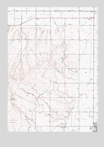
Cairo, OR USGS Topographic Map
Click on map above to begin viewing in our Map Viewer.

This topographic map contains these locations and features:
Feature Name Type Latitude Longitude GNIS ID View Map
Albertsons DamDamN43.9083°W117.0944°1133446View Map
Albertsons Reservoir 'A'ReservoirN43.9066°W117.0960°1133447View Map
Arcadia School (historical)SchoolN43.9269°W117.0100°1158107View Map
Big Sage FlatsFlatN43.9263°W117.0832°1117665View Map
CairoPopulated PlaceN43.9960°W117.0091°1118451View Map
Cairo Elementary SchoolSchoolN43.9879°W117.0125°1118452View Map
Cairo JunctionLocaleN43.9888°W117.0054°1136113View Map
Jordan DrainCanalN43.9963°W117.0988°1122530View Map
Lincoln BenchBenchN43.8832°W117.1174°1123093View Map
Lincoln Bench ReservoirReservoirN43.9070°W117.1213°1123094View Map
Locket Gulch SiphonCanalN43.8868°W117.0968°1123334View Map
Luse (historical)LocaleN43.9960°W117.0746°1136505View Map
Malheur Butte ChurchChurchN43.9879°W117.0854°1123705View Map
Malheur Junction DivisionCivilN43.9582°W117.0354°1938052View Map
Malheur Memorial HospitalHospitalN43.8796°W117.0079°1638989View Map
Malheur SiphonCanalN43.9810°W117.0574°1123713View Map
MallettLocaleN43.9963°W117.1238°1123716View Map
Mallett DrainCanalN43.9943°W117.1160°1123717View Map
Mayberg (historical)LocaleN43.9960°W117.0866°1167792View Map
Nevada CanalCanalN43.9877°W117.1032°1124657View Map
North Canal LateralCanalN43.9527°W117.0902°1124728View Map
Nyssa CemeteryCemeteryN43.8833°W117.0479°1124871View Map
Nyssa DivisionCivilN43.8870°W117.0408°1938085View Map
Nyssa DrainCanalN43.8960°W117.0088°1124872View Map
Nyssa Elementary SchoolSchoolN43.8768°W117.0029°1638988View Map
Nyssa HeightsPopulated PlaceN43.8943°W117.0260°1130326View Map
Nyssa High SchoolSchoolN43.8752°W117.0047°1638990View Map
Nyssa Middle SchoolSchoolN43.8755°W117.0068°1638987View Map
Nyssa-Arcadia DrainCanalN43.8916°W117.0043°1166863View Map
Ontario Nyssa CanalCanalN43.8966°W117.0374°1125004View Map
Sheep CreekStreamN43.8882°W117.0496°1126815View Map
Sheep Creek SiphonCanalN43.9079°W117.0835°1126821View Map
South Sheep CreekStreamN43.8888°W117.0535°1127345View Map
White SettlementLocaleN43.9832°W117.1066°1130327View Map

Note: Coordinates in the location and feature list above are referenced to NAD83 datum.


Copyright (C) 2008-2025 Ryan Niemi / Sunset Dynamics ... All Rights Reserved