TopoQuest Logo
Do you find TopoQuest useful?
Help keep TopoQuest running and adding new maps/features by donating!
Bitcoin:  19c7KJd3qBynnjoSw5npx9KScwjBe4ifkT
Litecoin:  LXs6TkuXGGXo1vDsWCkWVdjQX94eUKd6ui
Home View Maps Find Maps Find Places Resources & Links


Owyhee, Oregon Topographic Map

USGS Map Title: Owyhee, OR
USGS Map MRC: 43117G1
DRG (GeoTIFF) Download: o43117g1.tif


Neighboring USGS Topographic Map Quads:


  Vale East, OR  
43117H2
 

  Cairo, OR  
43117H1
 

  Nyssa, OR  
43116H8
 

  Mitchell Butte, OR  
43117G2
 

  Owyhee, OR  
43117G1
 

  Parma, ID  
43116G8
 

  Owyhee Dam, OR  
43117F2
 

  Adrian, OR  
43117F1
 

  Wilder, ID  
43116F8


Map MRC Location:

N44°
W118°
N44°
W117°
H8 H7 H6 H5 H4 H3 H2 H1
G8 G7 G6 G5 G4 G3 G2 G1
F8 F7 F6 F5 F4 F3 F2 F1
E8 E7 E6 E5 E4 E3 E2 E1
D8 D7 D6 D5 D4 D3 D2 D1
C8 C7 C6 C5 C4 C3 C2 C1
B8 B7 B6 B5 B4 B3 B2 B1
A8 A7 A6 A5 A4 A3 A2 A1
N43°
W118°
N43°
W117°

Owyhee, OR USGS 1:24K Topographic Map Preview:
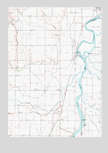
Owyhee, OR USGS Topographic Map
Click on map above to begin viewing in our Map Viewer.

This topographic map contains these locations and features:
Feature Name Type Latitude Longitude GNIS ID View Map
Big Cottonwood IslandIslandN43.8277°W117.0277°399405View Map
Billy Goat IslandIslandN43.7613°W117.0254°371549View Map
Boise RiverStreamN43.8207°W117.0260°378007View Map
Bridge IslandIslandN43.8563°W117.0079°371692View Map
Cow HollowValleyN43.8163°W117.1185°1119428View Map
DunawayLocaleN43.8249°W117.0385°1130266View Map
Dunaway Pumping StationLocaleN43.8310°W117.0329°1163701View Map
East Cow HollowValleyN43.8165°W117.1141°1120287View Map
Fort Boise (historical)LocaleN43.8246°W117.0199°399403View Map
Fort Boise (historical)Populated PlaceN43.8291°W117.0132°399484View Map
Fort Boise Wildlife Management AreaReserveN43.8179°W117.0099°399401View Map
Gold IslandIslandN43.8360°W117.0188°399404View Map
Goose Egg IslandIslandN43.7641°W117.0259°372881View Map
Heron IslandIslandN43.8293°W117.0204°399402View Map
Keck SloughStreamN43.8071°W117.0290°1122643View Map
KingmanLocaleN43.7665°W117.0510°1130817View Map
Kingman DrainCanalN43.7660°W117.0590°1122759View Map
Kingman KolonyLocaleN43.7999°W117.0177°1130268View Map
Locket GulchValleyN43.8391°W117.0288°1123333View Map
Mitchell Butte LateralCanalN43.8215°W117.0904°1124263View Map
Musser (historical)LocaleN43.8532°W117.0271°1167798View Map
North Alkali DrainCanalN43.7743°W117.0129°374168View Map
North CanalCanalN43.8665°W117.1110°1124724View Map
Nyssa BenchBenchN43.8638°W117.0927°1157403View Map
Nyssa Rodeo GroundsLocaleN43.8714°W117.0055°2699656View Map
OverstreetLocaleN43.7749°W117.0538°1136606View Map
OwyheePopulated PlaceN43.7949°W117.0552°1136607View Map
Owyhee CemeteryCemeteryN43.7956°W117.0861°1125093View Map
Owyhee DitchCanalN43.7899°W117.0829°1125095View Map
Owyhee DivisionCivilN43.8095°W117.1148°1938090View Map
Owyhee Ferry Post Office (historical)Post OfficeN43.8229°W117.0196°1164573View Map
Owyhee Post Office (historical)Post OfficeN43.7949°W117.0552°1165753View Map
Owyhee RiverStreamN43.8127°W117.0254°1147319View Map
Prati IslandIslandN43.8654°W117.0021°1125648View Map
Ralphs PondLakeN43.8160°W117.0121°399399View Map
RichlandLocaleN43.8388°W117.0552°1130267View Map
Ross DrainCanalN43.7877°W117.0015°374783View Map
Sand Hollow CreekStreamN43.8274°W117.0177°400070View Map
Sand Run GulchValleyN43.8274°W117.0177°399228View Map
Scott DrainCanalN43.7640°W117.0113°374933View Map
Settlers IslandIslandN43.8296°W117.0310°399397View Map
South Boise DrainCanalN43.7791°W117.0115°375131View Map
Swan PondLakeN43.8207°W117.0052°399398View Map
Ward DrainCanalN43.8679°W117.0052°1166866View Map

Note: Coordinates in the location and feature list above are referenced to NAD83 datum.


Copyright (C) 2008-2024 Ryan Niemi / Sunset Dynamics ... All Rights Reserved