TopoQuest Logo
Do you find TopoQuest useful?
Help keep TopoQuest running and adding new maps/features by donating!
Bitcoin:  19c7KJd3qBynnjoSw5npx9KScwjBe4ifkT
Litecoin:  LXs6TkuXGGXo1vDsWCkWVdjQX94eUKd6ui
Home View Maps Find Maps Find Places Resources & Links


Deanville, Texas Topographic Map

USGS Map Title: Deanville, TX
USGS Map MRC: 30096D7
DRG (GeoTIFF) Download: o30096d7.tif


Neighboring USGS Topographic Map Quads:


  Hicks, TX  
30096E8
 

  Chriesman, TX  
30096E7
 

  Caldwell, TX  
30096E6
 

  Tanglewood, TX  
30096D8
 

  Deanville, TX  
30096D7
 

  Frenstat, TX  
30096D6
 

  Lincoln, TX  
30096C8
 

  Dime Box, TX  
30096C7
 

  Flag Pond, TX  
30096C6


Map MRC Location:

N31°
W97°
N31°
W96°
H8 H7 H6 H5 H4 H3 H2 H1
G8 G7 G6 G5 G4 G3 G2 G1
F8 F7 F6 F5 F4 F3 F2 F1
E8 E7 E6 E5 E4 E3 E2 E1
D8 D7 D6 D5 D4 D3 D2 D1
C8 C7 C6 C5 C4 C3 C2 C1
B8 B7 B6 B5 B4 B3 B2 B1
A8 A7 A6 A5 A4 A3 A2 A1
N30°
W97°
N30°
W96°

Deanville, TX USGS 1:24K Topographic Map Preview:
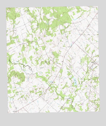
Deanville, TX USGS Topographic Map
Click on map above to begin viewing in our Map Viewer.

This topographic map contains these locations and features:
Feature Name Type Latitude Longitude GNIS ID View Map
Balcar LakeReservoirN30.4110°W96.7832°1351444View Map
Balcar Lake DamDamN30.4069°W96.7836°1865348View Map
Belltown CemeteryCemeteryN30.4344°W96.8230°1351853View Map
Buffalo CreekStreamN30.4130°W96.8211°1353189View Map
Chriesman CemeteryCemeteryN30.4144°W96.7744°1354468View Map
Cottonwood CreekStreamN30.4013°W96.7808°1355072View Map
DeanvillePopulated PlaceN30.4322°W96.7561°1355793View Map
Deanville Post OfficePost OfficeN30.4309°W96.7570°2731245View Map
Deanville Volunteer Fire DepartmentBuildingN30.4332°W96.7531°2552435View Map
Dry CreekStreamN30.3877°W96.7872°1356298View Map
GusPopulated PlaceN30.4555°W96.8578°1379872View Map
HoggPopulated PlaceN30.4355°W96.7986°1379942View Map
Hooker CreekStreamN30.4322°W96.8514°1359526View Map
Hranice CemeteryCemeteryN30.3888°W96.8230°1359754View Map
Krunk LakeLakeN30.3912°W96.7934°1360774View Map
Mueller LakeReservoirN30.4144°W96.8469°1865440View Map
Mueller Lake DamDamN30.4152°W96.8469°1865439View Map
Old Dime BoxPopulated PlaceN30.3772°W96.8630°1375270View Map
Porter BranchStreamN30.4994°W96.8283°1365600View Map
Porters ChapelChurchN30.4960°W96.8461°1365612View Map
Providence ChurchChurchN30.4283°W96.8266°1365817View Map
San Antonio PrairiePopulated PlaceN30.4580°W96.7833°2034765View Map
San Antonio Prairie CemeteryCemeteryN30.4527°W96.7880°1367486View Map
Sulphur Spring SchoolSchoolN30.4344°W96.8244°1369368View Map
Wolphen HollowValleyN30.4129°W96.7681°1371877View Map

Note: Coordinates in the location and feature list above are referenced to NAD83 datum.


Copyright (C) 2008-2025 Ryan Niemi / Sunset Dynamics ... All Rights Reserved