TopoQuest Logo
Do you find TopoQuest useful?
Help keep TopoQuest running and adding new maps/features by donating!
Bitcoin:  19c7KJd3qBynnjoSw5npx9KScwjBe4ifkT
Litecoin:  LXs6TkuXGGXo1vDsWCkWVdjQX94eUKd6ui
Home View Maps Find Maps Find Places Resources & Links


Caledonia, New York Topographic Map

USGS Map Title: Caledonia, NY
USGS Map MRC: 42077H7
DRG (GeoTIFF) Download: o42077h7.tif


Neighboring USGS Topographic Map Quads:


  Churchville, NY  
43077A8
 

  Clifton, NY  
43077A7
 

  West Henrietta, NY  
43077A6
 

  Le Roy, NY  
42077H8
 

  Caledonia, NY  
42077H7
 

  Rush, NY  
42077H6
 

  Leicester, NY  
42077G8
 

  Geneseo, NY  
42077G7
 

  Livonia, NY  
42077G6


Map MRC Location:

N43°
W78°
N43°
W77°
H8 H7 H6 H5 H4 H3 H2 H1
G8 G7 G6 G5 G4 G3 G2 G1
F8 F7 F6 F5 F4 F3 F2 F1
E8 E7 E6 E5 E4 E3 E2 E1
D8 D7 D6 D5 D4 D3 D2 D1
C8 C7 C6 C5 C4 C3 C2 C1
B8 B7 B6 B5 B4 B3 B2 B1
A8 A7 A6 A5 A4 A3 A2 A1
N42°
W78°
N42°
W77°

Caledonia, NY USGS 1:24K Topographic Map Preview:
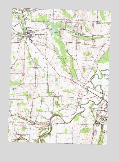
Caledonia, NY USGS Topographic Map
Click on map above to begin viewing in our Map Viewer.

This topographic map contains these locations and features:
Feature Name Type Latitude Longitude GNIS ID View Map
AshanteePopulated PlaceN42.8970°W77.7647°942620View Map
Avon Springs DownsLocaleN42.9070°W77.7678°942738View Map
Avon Village Sewage Treatment PlantLocaleN42.9200°W77.7555°2598879View Map
BakerPopulated PlaceN42.9773°W77.7919°972191View Map
Big Springs Historical MuseumBuildingN42.9739°W77.8548°2463859View Map
CaledoniaPopulated PlaceN42.9731°W77.8528°945451View Map
Caledonia - Mumford Elementary SchoolSchoolN42.9843°W77.8534°2597785View Map
Caledonia - Mumford Middle SchoolSchoolN42.9822°W77.8551°2463855View Map
Caledonia Assembly of GodChurchN42.9729°W77.8564°2597791View Map
Caledonia Country ClubLocaleN42.9730°W77.8405°2598861View Map
Caledonia Fire DepartmentBuildingN42.9736°W77.8550°2701123View Map
Caledonia Fish HatcheryLocaleN42.9859°W77.8596°2463479View Map
Caledonia House Hotel (historical)BuildingN42.9731°W77.8525°2708559View Map
Caledonia Mobile Home ParkPopulated PlaceN42.9751°W77.8268°2598827View Map
Caledonia Post OfficePost OfficeN42.9757°W77.8536°2598810View Map
Caledonia Public LibraryBuildingN42.9729°W77.8541°2463857View Map
Caledonia QuarryMineN42.9803°W77.7517°2567157View Map
Caledonia Rural CemeteryCemeteryN42.9761°W77.8517°2463481View Map
Caledonia Town HallBuildingN42.9733°W77.8542°2463860View Map
Caledonia Water Works Pumping StationBuildingN42.9742°W77.8451°2463864View Map
CanawaugusPopulated PlaceN42.9270°W77.7794°945759View Map
Cement Plant PondLakeN42.9783°W77.8223°946170View Map
Christie CreekStreamN42.9109°W77.7850°946640View Map
Church of GodChurchN42.9734°W77.8574°2597793View Map
Collings HillSummitN42.9837°W77.7872°947149View Map
Conesus CreekStreamN42.9128°W77.7672°947263View Map
Davis HillSummitN42.9715°W77.7714°948062View Map
East Avon Fire Department Station 2BuildingN42.8975°W77.7623°2700805View Map
FarView Golf CourseLocaleN42.8840°W77.7641°2598863View Map
Fellowship Baptist ChurchChurchN42.9617°W77.8387°2597799View Map
Finnegan HillSummitN42.9467°W77.7828°950078View Map
First Baptist ChurchChurchN42.9905°W77.8600°2463473View Map
First Presbyterian Church of CaledoniaChurchN42.9726°W77.8558°2463863View Map
FowlervillePopulated PlaceN42.8934°W77.8456°950550View Map
Fowlerville Census Designated PlaceCensusN42.8940°W77.8481°2584257View Map
FraserPopulated PlaceN42.9145°W77.8711°972509View Map
Grant PondLakeN42.9564°W77.7730°951521View Map
InvernessPopulated PlaceN42.8928°W77.8695°972652View Map
Inverness CemeteryCemeteryN42.9183°W77.8096°953739View Map
Little Conesus CreekStreamN42.9015°W77.7672°955498View Map
LittlevillePopulated PlaceN42.8951°W77.7600°972732View Map
Littleville CemeteryCemeteryN42.8951°W77.7615°2547847View Map
Living Hope Community ChurchChurchN42.9019°W77.7513°2597810View Map
MaxwellPopulated PlaceN42.9767°W77.7725°972771View Map
Menzie CrossingPopulated PlaceN42.9815°W77.8072°972789View Map
Monte Carlo Mobile Home ParkPopulated PlaceN42.9270°W77.7829°2598839View Map
Mount Pleasant CemeteryCemeteryN42.8813°W77.8568°957883View Map
MumfordPopulated PlaceN42.9928°W77.8603°958157View Map
Mumford Fire DepartmentBuildingN42.9926°W77.8611°2701036View Map
Mumford United Presbyterian ChurchChurchN42.9923°W77.8617°2463475View Map
Saint Agnes CemeteryCemeteryN42.9001°W77.7543°963244View Map
Saint Andrew's Episcopal ChurchChurchN42.9782°W77.8549°2463861View Map
Saint Columba CemeteryCemeteryN42.9668°W77.8448°963450View Map
Saint Columba's Roman Catholic ChurchChurchN42.9765°W77.8550°2463862View Map
Saint Patrick's Roman Catholic ChurchChurchN42.9962°W77.8563°2463478View Map
School Number 3 (historical)SchoolN42.9286°W77.7839°2105965View Map
School Number 4 (historical)SchoolN42.9903°W77.7772°2100119View Map
School Number 9 (historical)SchoolN42.9690°W77.7919°975647View Map
Scottish CemeteryCemeteryN42.9101°W77.8136°964685View Map
Second Baptist ChurchChurchN42.9923°W77.8648°2463476View Map
Sinclair HillSummitN42.9426°W77.8711°965301View Map
Stone Presbyterian ChurchChurchN42.9757°W77.8514°2463858View Map
ToggletownPopulated PlaceN42.9187°W77.8128°973160View Map
Town of CaledoniaCivilN42.9534°W77.8287°978773View Map
Treasure Island Mobile Home ParkPopulated PlaceN42.8935°W77.8440°2598845View Map
Tri-County Fair Association Fair Grounds And Race TrackLocaleN42.9721°W77.8655°2463856View Map
Village of CaledoniaCivilN42.9755°W77.8571°2391571View Map
White CreekStreamN42.9340°W77.7731°971089View Map

Note: Coordinates in the location and feature list above are referenced to NAD83 datum.


Copyright (C) 2008-2025 Ryan Niemi / Sunset Dynamics ... All Rights Reserved