TopoQuest Logo
Do you find TopoQuest useful?
Help keep TopoQuest running and adding new maps/features by donating!
Bitcoin:  19c7KJd3qBynnjoSw5npx9KScwjBe4ifkT
Litecoin:  LXs6TkuXGGXo1vDsWCkWVdjQX94eUKd6ui
Home View Maps Find Maps Find Places Resources & Links


Globe, California Topographic Map

USGS Map Title: Globe, CA
USGS Map MRC: 36118A7
DRG (GeoTIFF) Download: o36118a7.tif


Neighboring USGS Topographic Map Quads:


  Frazier Valley, CA  
36118B8
 

  Springville, CA  
36118B7
 

  Camp Wishon, CA  
36118B6
 

  Success Dam, CA  
36118A8
 

  Globe, CA  
36118A7
 

  Solo Peak, CA  
36118A6
 

  Fountain Springs, CA  
35118H8
 

  Gibbon Peak, CA  
35118H7
 

  California Hot Springs, CA  
35118H6


Map MRC Location:

N37°
W119°
N37°
W118°
H8 H7 H6 H5 H4 H3 H2 H1
G8 G7 G6 G5 G4 G3 G2 G1
F8 F7 F6 F5 F4 F3 F2 F1
E8 E7 E6 E5 E4 E3 E2 E1
D8 D7 D6 D5 D4 D3 D2 D1
C8 C7 C6 C5 C4 C3 C2 C1
B8 B7 B6 B5 B4 B3 B2 B1
A8 A7 A6 A5 A4 A3 A2 A1
N36°
W119°
N36°
W118°

Globe, CA USGS 1:24K Topographic Map Preview:
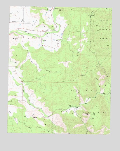
Globe, CA USGS Topographic Map
Click on map above to begin viewing in our Map Viewer.

This topographic map contains these locations and features:
Feature Name Type Latitude Longitude GNIS ID View Map
Bagby HillSummitN36.0150°W118.8415°1660290View Map
Big CampbellSummitN36.0924°W118.8693°269813View Map
Blue CanyonValleyN36.0572°W118.7565°269921View Map
Blue CreekStreamN36.0394°W118.7612°269925View Map
Bond CreekStreamN36.0372°W118.7573°269953View Map
Bonsall HillSummitN36.0269°W118.8695°1660359View Map
Campbell CreekStreamN36.1011°W118.8673°270235View Map
Cow MountainSummitN36.0577°W118.7854°270648View Map
Cow Mountain CreekStreamN36.0283°W118.7868°270649View Map
Crew CreekStreamN36.0480°W118.8598°270687View Map
Duncan CanyonValleyN36.0408°W118.7643°270939View Map
Gibbon CanyonValleyN36.0249°W118.7940°1670252View Map
Gibbon CreekStreamN36.0263°W118.7940°269409View Map
GlobePopulated PlaceN36.1011°W118.8281°1660683View Map
Graham CreekStreamN36.0961°W118.8326°271387View Map
Graham-Osborn DitchCanalN36.0927°W118.8101°271388View Map
Joaquin FlatFlatN36.0536°W118.7931°271791View Map
KKAK-TV (Porterville)TowerN36.0580°W118.7854°1663190View Map
Larson 712 DamDamN36.0333°W118.8493°1664020View Map
Long BranchStreamN36.0283°W118.8490°272174View Map
Moore-Witt DitchCanalN36.0988°W118.8243°272547View Map
Oak FlatFlatN36.0202°W118.7687°272737View Map
Oak Flat PeakSummitN36.0194°W118.7773°272739View Map
Oat MountainSummitN36.0002°W118.7995°272765View Map
Pleasant ValleyBasinN36.1124°W118.8593°273052View Map
Pleasant Valley DitchCanalN36.1055°W118.8354°273053View Map
Rocky CreekStreamN36.0374°W118.7565°273322View Map
Snail HeadSummitN36.1216°W118.8123°273772View Map
Soda SpringsPopulated PlaceN36.0391°W118.7581°1661462View Map
South Tule DitchCanalN36.0658°W118.8657°273853View Map
Springville Census Designated PlaceCensusN36.1168°W118.8345°2408798View Map
Springville District Ranger OfficeLocaleN36.1022°W118.8498°276354View Map
Street CanyonValleyN36.0033°W118.7773°273930View Map
Tule River Community Fire DepartmentBuildingN36.0256°W118.7953°2624250View Map
Ward SpringSpringN36.1171°W118.7763°274376View Map

Note: Coordinates in the location and feature list above are referenced to NAD83 datum.


Copyright (C) 2008-2025 Ryan Niemi / Sunset Dynamics ... All Rights Reserved