TopoQuest Logo
Do you find TopoQuest useful?
Help keep TopoQuest running and adding new maps/features by donating!
Bitcoin:  19c7KJd3qBynnjoSw5npx9KScwjBe4ifkT
Litecoin:  LXs6TkuXGGXo1vDsWCkWVdjQX94eUKd6ui
Home View Maps Find Maps Find Places Resources & Links


Castalia, Iowa Topographic Map

USGS Map Title: Castalia, IA
USGS Map MRC: 43091A6
DRG (GeoTIFF) Download: o43091a6.tif


Neighboring USGS Topographic Map Quads:


  Calmar, IA  
43091B7
 

  Postville NW, IA  
43091B6
 

  Frankville, IA  
43091B5
 

  Festina, IA  
43091A7
 

  Castalia, IA  
43091A6
 

  Postville, IA  
43091A5
 

  West Union, IA  
42091H7
 

  Elgin, IA  
42091H6
 

  Gunder, IA  
42091H5


Map MRC Location:

N44°
W92°
N44°
W91°
H8 H7 H6 H5 H4 H3 H2 H1
G8 G7 G6 G5 G4 G3 G2 G1
F8 F7 F6 F5 F4 F3 F2 F1
E8 E7 E6 E5 E4 E3 E2 E1
D8 D7 D6 D5 D4 D3 D2 D1
C8 C7 C6 C5 C4 C3 C2 C1
B8 B7 B6 B5 B4 B3 B2 B1
A8 A7 A6 A5 A4 A3 A2 A1
N43°
W92°
N43°
W91°

Castalia, IA USGS 1:24K Topographic Map Preview:
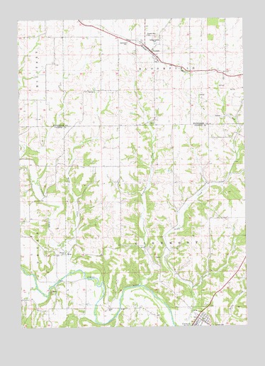
Castalia, IA USGS Topographic Map
Click on map above to begin viewing in our Map Viewer.

This topographic map contains these locations and features:
Feature Name Type Latitude Longitude GNIS ID View Map
Area Ambulance Service Clermont UnitBuildingN43.0030°W91.6505°2599685View Map
Bloomfield CemeteryCemeteryN43.1152°W91.6894°454703View Map
CastaliaPopulated PlaceN43.1119°W91.6763°455206View Map
CastaliaLocaleN43.1119°W91.6763°1941469View Map
Castalia City ParkParkN43.1119°W91.6763°1941467View Map
Castalia Fire DepartmentBuildingN43.1122°W91.6774°1941472View Map
Castalia Post OfficePost OfficeN43.1119°W91.6763°1941471View Map
Church of the Saviour EpiscopalChurchN43.0028°W91.6538°1945123View Map
City of CastaliaCivilN43.1126°W91.6769°2393770View Map
City of ClermontCivilN43.0002°W91.6523°2393559View Map
ClermontPopulated PlaceN43.0036°W91.6524°455473View Map
Clermont City HallBuildingN43.0003°W91.6613°1945129View Map
Clermont Fire DepartmentBuildingN43.0030°W91.6505°2577332View Map
Clermont LibraryBuildingN43.0003°W91.6613°1945128View Map
Clermont MuseumBuildingN43.0003°W91.6563°1945122View Map
Clermont ParkParkN43.0033°W91.6529°1944965View Map
Clermont Police DeptBuildingN43.0011°W91.6535°1945127View Map
Clermont Post OfficePost OfficeN43.0005°W91.6557°1945120View Map
Clermont Presbyterian ChurchChurchN43.0005°W91.6546°1945124View Map
Dover MillsPopulated PlaceN43.0194°W91.7293°464083View Map
Dover Mills Post Office (historical)Post OfficeN43.0194°W91.7293°1944986View Map
Fitzgerald CreekStreamN43.0153°W91.6796°456623View Map
Junction (historical)Populated PlaceN43.0853°W91.6293°464059View Map
Lutheran Church WestChurchN43.0019°W91.6529°1945125View Map
Molineland MuseumBuildingN43.1119°W91.6763°1941468View Map
Montauk State Historical SiteParkN43.0089°W91.6482°459188View Map
Nutting CemeteryCemeteryN43.0302°W91.7255°459682View Map
Nutting CreekStreamN43.0222°W91.7221°459683View Map
Pleasant Valley Sports ClubLocaleN43.0005°W91.6557°1945119View Map
Pleasant View CemeteryCemeteryN43.1182°W91.6789°460316View Map
Quinn CreekStreamN43.0347°W91.7263°460488View Map
Saint Peters CemeteryCemeteryN43.0000°W91.6438°461316View Map
Township of ClermontCivilN43.0376°W91.6645°467622View Map
William Larrabee HouseBuildingN43.0111°W91.6479°1945130View Map
Zion Lutheran ChurchChurchN43.1119°W91.6763°1941470View Map

Note: Coordinates in the location and feature list above are referenced to NAD83 datum.


Copyright (C) 2008-2024 Ryan Niemi / Sunset Dynamics ... All Rights Reserved