TopoQuest Logo
Do you find TopoQuest useful?
Help keep TopoQuest running and adding new maps/features by donating!
Bitcoin:  19c7KJd3qBynnjoSw5npx9KScwjBe4ifkT
Litecoin:  LXs6TkuXGGXo1vDsWCkWVdjQX94eUKd6ui
Home View Maps Find Maps Find Places Resources & Links


Camden, Washington Topographic Map

USGS Map Title: Camden, WA
USGS Map MRC: 48117A2
DRG (GeoTIFF) Download: o48117a2.tif


Neighboring USGS Topographic Map Quads:


  Sacheen Lake, WA  
48117B3
 

  Diamond Lake, WA  
48117B2
 

  Newport, WA  
48117B1
 

  Elk, WA  
48117A3
 

  Camden, WA  
48117A2
 

  Tweedie, WA  
48117A1
 

  Chattaroy, WA  
47117H3
 

  Mount Kit Carson, WA  
47117H2
 

  Mount Spokane, WA  
47117H1


Map MRC Location:

N49°
W118°
N49°
W117°
H8 H7 H6 H5 H4 H3 H2 H1
G8 G7 G6 G5 G4 G3 G2 G1
F8 F7 F6 F5 F4 F3 F2 F1
E8 E7 E6 E5 E4 E3 E2 E1
D8 D7 D6 D5 D4 D3 D2 D1
C8 C7 C6 C5 C4 C3 C2 C1
B8 B7 B6 B5 B4 B3 B2 B1
A8 A7 A6 A5 A4 A3 A2 A1
N48°
W118°
N48°
W117°

Camden, WA USGS 1:24K Topographic Map Preview:
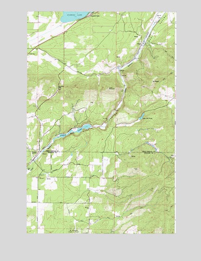
Camden, WA USGS Topographic Map
Click on map above to begin viewing in our Map Viewer.

This topographic map contains these locations and features:
Feature Name Type Latitude Longitude GNIS ID View Map
CamdenPopulated PlaceN48.0474°W117.2399°1510856View Map
Camden DamDamN48.0466°W117.1627°1533004View Map
Camden GapGapN48.0824°W117.2233°1503764View Map
Chain LakeReservoirN48.0578°W117.2119°1503902View Map
Decie LakeReservoirN48.0508°W117.1485°1532542View Map
Decie Lake DamDamN48.0516°W117.1494°1532541View Map
Diamond LakePopulated PlaceN48.1218°W117.1991°1518755View Map
Diamond Lake Seventh Day Adventist ChurchChurchN48.1237°W117.1917°2608468View Map
Frideger Road BridgeBridgeN48.0407°W117.2439°2729596View Map
GrahamsPopulated PlaceN48.0921°W117.1724°1511007View Map
Isabelle LakeReservoirN48.0493°W117.1442°1532540View Map
Isabelle Lake DamDamN48.0499°W117.1444°1532539View Map
Lake of the WoodsSwampN48.0656°W117.1537°1532888View Map
Lone MountainSummitN48.0818°W117.1808°1506261View Map
Lynda LakeReservoirN48.0475°W117.1419°1532538View Map
Lynda Lake DamDamN48.0482°W117.1427°1532537View Map
Mount PisgahSummitN48.0857°W117.1449°1512565View Map
ScotiaPopulated PlaceN48.1063°W117.1541°1511297View Map
Scotia CanyonValleyN48.0452°W117.2372°1508171View Map
Scotia ValleyValleyN48.1088°W117.1483°1525516View Map
South Pend Oreille Fire and Rescue Station 31 - Diamond LakeBuildingN48.1193°W117.2063°2643685View Map
The Woods Lake DamDamN48.0649°W117.1560°1532887View Map

Note: Coordinates in the location and feature list above are referenced to NAD83 datum.


Copyright (C) 2008-2025 Ryan Niemi / Sunset Dynamics ... All Rights Reserved