TopoQuest Logo
Do you find TopoQuest useful?
Help keep TopoQuest running and adding new maps/features by donating!
Bitcoin:  19c7KJd3qBynnjoSw5npx9KScwjBe4ifkT
Litecoin:  LXs6TkuXGGXo1vDsWCkWVdjQX94eUKd6ui
Home View Maps Find Maps Find Places Resources & Links


Camdenton, Missouri Topographic Map

USGS Map Title: Camdenton, MO
USGS Map MRC: 38092A6
DRG (GeoTIFF) Download: o38092a6.tif


Neighboring USGS Topographic Map Quads:


  Sunrise Beach, MO  
38092B7
 

  Lake Ozark, MO  
38092B6
 

  Bagnell, MO  
38092B5
 

  Green Bay Terrace, MO  
38092A7
 

  Camdenton, MO  
38092A6
 

  Toronto, MO  
38092A5
 

  Hahatonka, MO  
37092H7
 

  Decaturville, MO  
37092H6
 

  Montreal, MO  
37092H5


Map MRC Location:

N39°
W93°
N39°
W92°
H8 H7 H6 H5 H4 H3 H2 H1
G8 G7 G6 G5 G4 G3 G2 G1
F8 F7 F6 F5 F4 F3 F2 F1
E8 E7 E6 E5 E4 E3 E2 E1
D8 D7 D6 D5 D4 D3 D2 D1
C8 C7 C6 C5 C4 C3 C2 C1
B8 B7 B6 B5 B4 B3 B2 B1
A8 A7 A6 A5 A4 A3 A2 A1
N38°
W93°
N38°
W92°

Camdenton, MO USGS 1:24K Topographic Map Preview:
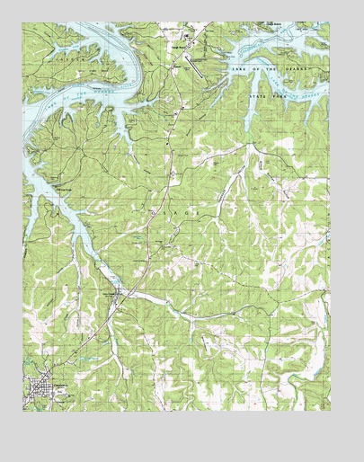
Camdenton, MO USGS Topographic Map
Click on map above to begin viewing in our Map Viewer.

This topographic map contains these locations and features:
Feature Name Type Latitude Longitude GNIS ID View Map
Anderson HollowValleyN38.0886°W92.6577°713289View Map
Anderson Hollow School (historical)SchoolN38.0834°W92.6535°745263View Map
Blue Springs BranchStreamN38.0975°W92.6971°738332View Map
Boone BluffCliffN38.1056°W92.7135°714531View Map
Brushy HollowValleyN38.1067°W92.6657°715109View Map
Camden County Sheriff's OfficeBuildingN38.0078°W92.7461°2752127View Map
CamdentonPopulated PlaceN38.0081°W92.7446°715231View Map
Camdenton Fire DepartmentBuildingN38.0067°W92.7442°2620991View Map
Camdenton High SchoolSchoolN38.0061°W92.7374°742771View Map
Camp Clover PointLocaleN38.1056°W92.6399°742780View Map
Camp HawthornLocaleN38.1153°W92.6424°742782View Map
Camp Pa He TsiLocaleN38.1214°W92.6641°742783View Map
Camp Pin OakLocaleN38.1170°W92.6291°742781View Map
Church of ChristChurchN38.0481°W92.7005°742775View Map
City of Linn CreekCivilN38.0344°W92.7039°2395721View Map
Clopp HollowValleyN38.0575°W92.7280°716007View Map
Conway CemeteryCemeteryN38.1239°W92.6549°716213View Map
Conway School (historical)SchoolN38.1192°W92.6816°745262View Map
Crabtree CoveBayN38.1170°W92.7307°716448View Map
DamselPopulated PlaceN38.1098°W92.6902°740793View Map
Davis CemeteryCemeteryN38.0281°W92.6310°742772View Map
Grand Glaize - Osage Beach AirportAirportN38.1136°W92.6825°758841View Map
Hall CemeteryCemeteryN38.0367°W92.7077°742773View Map
Heritage Landing Strip (historical)AirportN38.0220°W92.6760°742791View Map
Hill HollowValleyN38.1170°W92.7357°719603View Map
Hopkins CemeteryCemeteryN38.0939°W92.7068°742778View Map
Hospital Property HeliportAirportN38.1200°W92.6821°758840View Map
Hunter MineMineN38.1103°W92.6838°720018View Map
KADI-AM (Camdenton)TowerN38.0273°W92.7010°754305View Map
KRMS-AM (Osage Beach)TowerN38.1248°W92.6777°759204View Map
KYLC-FM (Osage Beach)TowerN38.1248°W92.6777°759059View Map
Lake Regional Health SystemHospitalN38.1205°W92.6831°2655064View Map
Linn CreekPopulated PlaceN38.0381°W92.7116°721126View Map
Linn CreekStreamN38.0489°W92.7194°721127View Map
Linn Creek BendBendN38.1095°W92.7182°721130View Map
Linn Creek ChurchChurchN38.0536°W92.6938°721131View Map
Linn Creek Police DepartmentBuildingN38.0376°W92.7119°2752231View Map
Linn Creek Post OfficePost OfficeN38.0383°W92.7057°2783221View Map
Lyons BluffCliffN38.1125°W92.7019°727564View Map
Memorial CemeteryCemeteryN38.0739°W92.7388°742776View Map
Mid County Fire Protection District Station 1 HeadquartersBuildingN38.0104°W92.7466°2621066View Map
North Fork Linn CreekStreamN38.0398°W92.7099°723462View Map
Old Erie CemeteryCemeteryN38.0875°W92.7377°742777View Map
Old Linn CreekPopulated PlaceN38.0725°W92.7366°723761View Map
Osage Beach Fire Protection District Station 2BuildingN38.1138°W92.6921°2620897View Map
Osage Beach Fire Protection District Station 3BuildingN38.0689°W92.6903°2621615View Map
Outlets, LimitedLocaleN38.0331°W92.7149°742011View Map
Parrish HollowValleyN38.0545°W92.7294°738331View Map
Percival Memorial CemeteryCemeteryN38.0531°W92.6941°742774View Map
Possum HollowValleyN38.0695°W92.7446°724778View Map
Racetrack HollowValleyN38.0970°W92.7110°725046View Map
Rodeo ArenaBuildingN38.0014°W92.7399°742769View Map
Sawyer HollowValleyN38.0328°W92.7282°726080View Map
Shepherd CoveBayN38.1034°W92.7419°726327View Map
Shoop HollowValleyN38.1148°W92.7007°726403View Map
South Fork Linn CreekStreamN38.0398°W92.7099°726744View Map
Steinberg Lake DamDamN38.0117°W92.6919°765391View Map
Township of KihekaCivilN38.0262°W92.6864°1729741View Map
Township of OsageCivilN38.1010°W92.7074°766392View Map
Township of PawhuskaCivilN38.1215°W92.6281°2397852View Map
Voc-Tech SchoolSchoolN38.0056°W92.7330°742770View Map
Wildcat HollowValleyN38.1189°W92.7063°728840View Map
Williams CemeteryCemeteryN38.0793°W92.6733°742779View Map
Williams HollowValleyN38.0495°W92.7294°728897View Map
Willow Springs HollowValleyN38.0836°W92.6549°728948View Map
Zion CemeteryCemeteryN38.0797°W92.6491°729233View Map
Zion Church (historical)ChurchN38.0792°W92.6496°745264View Map

Note: Coordinates in the location and feature list above are referenced to NAD83 datum.


Copyright (C) 2008-2024 Ryan Niemi / Sunset Dynamics ... All Rights Reserved