TopoQuest Logo
Do you find TopoQuest useful?
Help keep TopoQuest running and adding new maps/features by donating!
Bitcoin:  19c7KJd3qBynnjoSw5npx9KScwjBe4ifkT
Litecoin:  LXs6TkuXGGXo1vDsWCkWVdjQX94eUKd6ui
Home View Maps Find Maps Find Places Resources & Links


Lake Ozark, Missouri Topographic Map

USGS Map Title: Lake Ozark, MO
USGS Map MRC: 38092B6
DRG (GeoTIFF) Download: o38092b6.tif


Neighboring USGS Topographic Map Quads:


  Gravois Mills, MO  
38092C7
 

  Rocky Mount, MO  
38092C6
 

  Eldon, MO  
38092C5
 

  Sunrise Beach, MO  
38092B7
 

  Lake Ozark, MO  
38092B6
 

  Bagnell, MO  
38092B5
 

  Green Bay Terrace, MO  
38092A7
 

  Camdenton, MO  
38092A6
 

  Toronto, MO  
38092A5


Map MRC Location:

N39°
W93°
N39°
W92°
H8 H7 H6 H5 H4 H3 H2 H1
G8 G7 G6 G5 G4 G3 G2 G1
F8 F7 F6 F5 F4 F3 F2 F1
E8 E7 E6 E5 E4 E3 E2 E1
D8 D7 D6 D5 D4 D3 D2 D1
C8 C7 C6 C5 C4 C3 C2 C1
B8 B7 B6 B5 B4 B3 B2 B1
A8 A7 A6 A5 A4 A3 A2 A1
N38°
W93°
N38°
W92°

Lake Ozark, MO USGS 1:24K Topographic Map Preview:
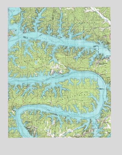
Lake Ozark, MO USGS Topographic Map
Click on map above to begin viewing in our Map Viewer.

This topographic map contains these locations and features:
Feature Name Type Latitude Longitude GNIS ID View Map
Anderson CemeteryCemeteryN38.1775°W92.6838°713282View Map
Anderson HollowValleyN38.1678°W92.6516°713290View Map
ArrowheadPopulated PlaceN38.1811°W92.6282°738413View Map
Arrowhead BeachPopulated PlaceN38.1800°W92.6296°713405View Map
Autumn LakeReservoirN38.2071°W92.7133°764707View Map
Autumn Lake DamDamN38.2067°W92.7152°764706View Map
Bagnell DamDamN38.2023°W92.6269°729422View Map
Bald RidgeRidgeN38.2103°W92.6824°713594View Map
Banner CemeteryCemeteryN38.1600°W92.6466°742900View Map
Baydy PeakSummitN38.1473°W92.6921°713759View Map
Ben Anderson HollowValleyN38.1456°W92.6988°713941View Map
Birdsong CemeteryCemeteryN38.2303°W92.6460°714267View Map
Birdsong Hollow CoveBayN38.2242°W92.6680°714268View Map
Burton Duenke Lake Number 1 DamDamN38.1334°W92.7002°765386View Map
Burton Duenke Lake Number 2 DamDamN38.1334°W92.7019°765388View Map
Burton Duenke Lake Number 3 DamDamN38.1300°W92.6969°765384View Map
Burton Duenke Lake Number 5 DamDamN38.1300°W92.6952°765383View Map
Burton Duenke Lake Number 6 DamDamN38.1400°W92.7052°765390View Map
Burton Duenke Number 1 ReservoirReservoirN38.1324°W92.7001°765387View Map
Burton Duenke Number 2 ReservoirReservoirN38.1321°W92.7030°765389View Map
Burton Duenke Number 3 ReservoirReservoirN38.1287°W92.6973°765385View Map
Burton Duenke Number 4 DamDamN38.1384°W92.6985°765465View Map
Carrot BluffCliffN38.1575°W92.7157°715435View Map
City of Lake OzarkCivilN38.1893°W92.6298°2395596View Map
City of Osage BeachCivilN38.1353°W92.6479°2396089View Map
Cooper CemeteryCemeteryN38.2361°W92.7180°742903View Map
Cornett Branch CoveBayN38.2123°W92.7260°716326View Map
Cotton HollowValleyN38.2456°W92.6880°716347View Map
Darby HollowValleyN38.1314°W92.6599°738407View Map
Davey Hollow CoveBayN38.1720°W92.7257°716688View Map
Dogwood Hills DamDamN38.1267°W92.6902°765382View Map
Downing Branch CoveBayN38.2084°W92.6946°717031View Map
Downing CemeteryCemeteryN38.1994°W92.6903°717032View Map
Dry Branch CoveBayN38.2267°W92.7010°717080View Map
Duck Head PointCapeN38.2086°W92.6446°717145View Map
Eagles Roost HeliportAirportN38.1850°W92.6960°758579View Map
Fish Hatchery CoveBayN38.1325°W92.6385°738409View Map
Forked Hollow CoveBayN38.1742°W92.6860°738411View Map
Four SeasonsPopulated PlaceN38.1981°W92.7110°1669605View Map
Good Oak LakeReservoirN38.1973°W92.7159°765379View Map
Good Oak Lake DamDamN38.1984°W92.7185°765378View Map
Grand Glaize Shopping CenterLocaleN38.1309°W92.6521°742515View Map
Great Blue Heron HillSummitN38.1898°W92.6507°748490View Map
Harpers ChapelChurchN38.1261°W92.6710°719134View Map
Harpers HollowValleyN38.1323°W92.6699°719135View Map
Hawaiian IslandIslandN38.2214°W92.6877°738415View Map
High Point Shopping CenterLocaleN38.1442°W92.6319°742013View Map
Horseshoe BendBendN38.1998°W92.7144°719859View Map
Houston CemeteryCemeteryN38.1997°W92.6905°742902View Map
Jackson BranchStreamN38.2456°W92.6877°720203View Map
Jackson Branch CoveBayN38.2350°W92.6880°720204View Map
Jennings Branch CoveBayN38.2014°W92.6471°720300View Map
Jobson Hollow CoveBayN38.2289°W92.6763°720330View Map
Kays PointCapeN38.2173°W92.7182°720484View Map
Kinchlow Hollow CoveBayN38.1339°W92.7449°738402View Map
Laguna BeachPopulated PlaceN38.1303°W92.6516°720739View Map
Lake of the OzarksReservoirN38.2025°W92.6263°729600View Map
Lake OzarkPopulated PlaceN38.1986°W92.6388°729529View Map
Lake Ozark Fire Protection District Fire BoatBuildingN38.1767°W92.6264°2620624View Map
Lake Ozark Fire Protection District Station 1 HeadquartersBuildingN38.1940°W92.6426°2621233View Map
Lake Ozark Fire Protection District Station 2BuildingN38.1892°W92.7201°2621234View Map
Lake Ozark Fire Protection District Station 3BuildingN38.2283°W92.6498°2620622View Map
Lake Ozark Post OfficePost OfficeN38.1889°W92.6426°2783099View Map
LakelandPopulated PlaceN38.2220°W92.6310°738414View Map
Lick Branch CoveBayN38.2370°W92.7152°721019View Map
Links Landing Seaplane BaseAirportN38.1336°W92.6405°758837View Map
Little Kinchlow Hollow CoveBayN38.1456°W92.7466°738403View Map
Lone Oak PointCapeN38.1759°W92.7324°721454View Map
Lotell Hollow CoveBayN38.2220°W92.6546°721604View Map
Mansfield Forest State Wildlife Management AreaParkN38.1398°W92.7157°742899View Map
McCoy Branch CoveBayN38.2064°W92.6630°722060View Map
Middle Hollow CoveBayN38.1703°W92.6935°738410View Map
Miller HollowValleyN38.1384°W92.6960°738406View Map
Miller Hollow CoveBayN38.1442°W92.6966°738405View Map
Millstone ChurchChurchN38.2231°W92.7491°742904View Map
Mud Harbor Seaplane BaseAirportN38.1800°W92.6899°758962View Map
Osage Beach Police DepartmentBuildingN38.1260°W92.6722°2752553View Map
Osage Beach Post OfficePost OfficeN38.1265°W92.6699°2783159View Map
Our Lady of the Lake ChapelChurchN38.1839°W92.6355°723887View Map
Perkins PointCapeN38.1873°W92.6796°724230View Map
Pogue Hollow CoveBayN38.1723°W92.6266°738313View Map
Possum Hollow CoveBayN38.2317°W92.7307°724781View Map
Raccoon HollowValleyN38.2473°W92.7291°725043View Map
Raccoon Hollow CoveBayN38.2379°W92.7333°725044View Map
Riverview CemeteryCemeteryN38.1931°W92.6802°725352View Map
Rocky Mount Fire Protection District Station 3BuildingN38.2329°W92.7231°2620978View Map
Salt HollowValleyN38.1342°W92.6877°725974View Map
School of the OsageSchoolN38.1953°W92.6394°726112View Map
Shawnee BendBendN38.1659°W92.6624°726290View Map
Shawnee Bend CemeteryCemeteryN38.1581°W92.6977°742901View Map
Stevens Banner CemeteryCemeteryN38.1600°W92.6468°727083View Map
Sunrise Beach Fire Department Station 3BuildingN38.1588°W92.6977°2621593View Map
Tan Tar A Resort Seaplane BaseAirportN38.1334°W92.7335°758838View Map
Tonys PointCapeN38.2275°W92.7435°738416View Map
Treeline LakeReservoirN38.1925°W92.7321°765381View Map
Treeline Lake DamDamN38.1934°W92.7352°765380View Map
Turkey BendBendN38.1323°W92.7052°727837View Map
Village of the Village of Four SeasonsCivilN38.1977°W92.7188°2399966View Map
Watson Hollow CoveBayN38.1270°W92.6269°738314View Map
Wideford Hollow CoveBayN38.1703°W92.7049°728814View Map
Wilson HillSummitN38.2200°W92.6485°728970View Map
Woods Hollow CoveBayN38.1475°W92.7088°738404View Map
Workmen Hollow CoveBayN38.2014°W92.7435°729145View Map

Note: Coordinates in the location and feature list above are referenced to NAD83 datum.


Copyright (C) 2008-2024 Ryan Niemi / Sunset Dynamics ... All Rights Reserved