TopoQuest Logo
Do you find TopoQuest useful?
Help keep TopoQuest running and adding new maps/features by donating!
Bitcoin:  19c7KJd3qBynnjoSw5npx9KScwjBe4ifkT
Litecoin:  LXs6TkuXGGXo1vDsWCkWVdjQX94eUKd6ui
Home View Maps Find Maps Find Places Resources & Links


Agnos, Arkansas Topographic Map

USGS Map Title: Agnos, AR
USGS Map MRC: 36091C6
DRG (GeoTIFF) Download: o36091c6.tif


Neighboring USGS Topographic Map Quads:


  Salem Knob, AR  
36091D7
 

  Camp, AR  
36091D6
 

  Mammoth Spring, AR  
36091D5
 

  Salem, AR  
36091C7
 

  Agnos, AR  
36091C6
 

  Stuart, AR  
36091C5
 

  Franklin, AR  
36091B7
 

  Myron, AR  
36091B6
 

  Ash Flat, AR  
36091B5


Map MRC Location:

N37°
W92°
N37°
W91°
H8 H7 H6 H5 H4 H3 H2 H1
G8 G7 G6 G5 G4 G3 G2 G1
F8 F7 F6 F5 F4 F3 F2 F1
E8 E7 E6 E5 E4 E3 E2 E1
D8 D7 D6 D5 D4 D3 D2 D1
C8 C7 C6 C5 C4 C3 C2 C1
B8 B7 B6 B5 B4 B3 B2 B1
A8 A7 A6 A5 A4 A3 A2 A1
N36°
W92°
N36°
W91°

Agnos, AR USGS 1:24K Topographic Map Preview:
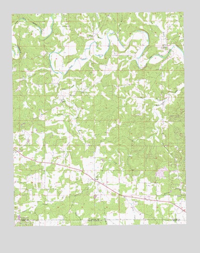
Agnos, AR USGS Topographic Map
Click on map above to begin viewing in our Map Viewer.

This topographic map contains these locations and features:
Feature Name Type Latitude Longitude GNIS ID View Map
AgnosPopulated PlaceN36.2773°W91.6915°76154View Map
Agnos - Heart - Glencoe Volunteer Fire DepartmentBuildingN36.2859°W91.7277°2116059View Map
Burks ChapelChurchN36.3676°W91.7093°47197View Map
Cherokee Sanitary LandfillLocaleN36.2825°W91.6408°2726680View Map
Cherry Hollow BranchStreamN36.3631°W91.6760°47729View Map
County Line BranchStreamN36.3634°W91.6760°48085View Map
Flat BranchStreamN36.3240°W91.6371°49090View Map
FrenchPopulated PlaceN36.3606°W91.6935°57773View Map
GlencoePopulated PlaceN36.2942°W91.7474°57032View Map
Glencoe Post OfficePost OfficeN36.2938°W91.7482°2781849View Map
HeartPopulated PlaceN36.3237°W91.7149°57053View Map
Heart ChurchChurchN36.3270°W91.7085°49982View Map
Humphries CemeteryCemeteryN36.2578°W91.7374°50411View Map
KHAM-AM (Horseshoe Bend)TowerN36.2540°W91.6949°85090View Map
KittlePopulated PlaceN36.2667°W91.6282°58023View Map
Lake BrownReservoirN36.2917°W91.6785°79637View Map
Lake Brown DamDamN36.2917°W91.6785°79636View Map
Lick CreekStreamN36.3392°W91.7124°51140View Map
Mill Pond BranchStreamN36.3531°W91.6343°52046View Map
Nazarene ChurchChurchN36.3415°W91.6418°52583View Map
North LakeReservoirN36.2552°W91.7466°79727View Map
North Lake DamDamN36.2551°W91.7468°79726View Map
Pond CreekStreamN36.3406°W91.7199°53678View Map
Rhoads CemeteryCemeteryN36.2834°W91.7279°54001View Map
SaddlePopulated PlaceN36.3551°W91.6388°58564View Map
Saddle Baptist ChurchChurchN36.3545°W91.6393°65911View Map
Timber LakeReservoirN36.2692°W91.6362°80972View Map
Timber Lake DamDamN36.2684°W91.6351°80971View Map
Township of Pleasant RidgeCivilN36.2964°W91.6464°66580View Map

Note: Coordinates in the location and feature list above are referenced to NAD83 datum.


Copyright (C) 2008-2024 Ryan Niemi / Sunset Dynamics ... All Rights Reserved