TopoQuest Logo
Do you find TopoQuest useful?
Help keep TopoQuest running and adding new maps/features by donating!
Bitcoin:  19c7KJd3qBynnjoSw5npx9KScwjBe4ifkT
Litecoin:  LXs6TkuXGGXo1vDsWCkWVdjQX94eUKd6ui
Home View Maps Find Maps Find Places Resources & Links


Salem Knob, Arkansas Topographic Map

USGS Map Title: Salem Knob, AR
USGS Map MRC: 36091D7
DRG (GeoTIFF) Download: o36091d7.tif


Neighboring USGS Topographic Map Quads:


  Moody, MO  
36091E8
 

  Lanton, MO  
36091E7
 

  Koshkonong, MO  
36091E6
 

  Viola, AR  
36091D8
 

  Salem Knob, AR  
36091D7
 

  Camp, AR  
36091D6
 

  Byron, AR  
36091C8
 

  Salem, AR  
36091C7
 

  Agnos, AR  
36091C6


Map MRC Location:

N37°
W92°
N37°
W91°
H8 H7 H6 H5 H4 H3 H2 H1
G8 G7 G6 G5 G4 G3 G2 G1
F8 F7 F6 F5 F4 F3 F2 F1
E8 E7 E6 E5 E4 E3 E2 E1
D8 D7 D6 D5 D4 D3 D2 D1
C8 C7 C6 C5 C4 C3 C2 C1
B8 B7 B6 B5 B4 B3 B2 B1
A8 A7 A6 A5 A4 A3 A2 A1
N36°
W92°
N36°
W91°

Salem Knob, AR USGS 1:24K Topographic Map Preview:
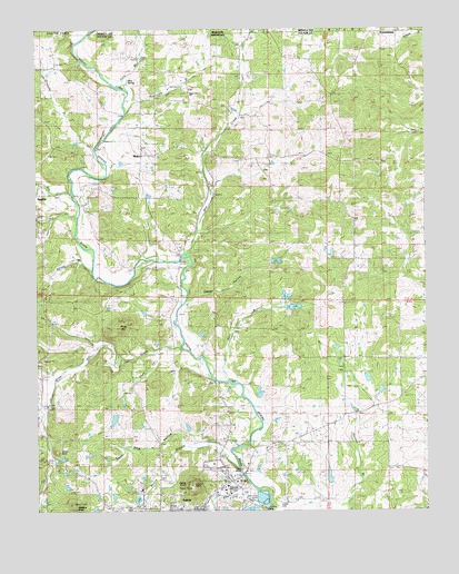
Salem Knob, AR USGS Topographic Map
Click on map above to begin viewing in our Map Viewer.

This topographic map contains these locations and features:
Feature Name Type Latitude Longitude GNIS ID View Map
Bay CreekStreamN36.4575°W91.8638°46167View Map
Cole BranchStreamN36.4846°W91.8471°76649View Map
CornertownPopulated PlaceN36.4992°W91.7585°740767View Map
Courtwright LakeReservoirN36.4002°W91.7644°80112View Map
Courtwright Lake DamDamN36.4001°W91.7635°80111View Map
Craft HollowValleyN36.4159°W91.8360°48133View Map
Crossroads School (historical)SchoolN36.4356°W91.7593°48225View Map
Fulton CountyCivilN36.3817°W91.8182°66854View Map
Fulton County HospitalHospitalN36.3829°W91.8103°63053View Map
Fulton County Hospital HeliportAirportN36.3831°W91.8101°83826View Map
Gravelly BranchStreamN36.4681°W91.8551°49592View Map
Hunter CemeteryCemeteryN36.3773°W91.7979°50415View Map
Katy BranchStreamN36.4081°W91.8138°50771View Map
KSAR-FM (Salem)TowerN36.3809°W91.8246°85243View Map
Lake Lewis Dam OneDamN36.3884°W91.7501°79738View Map
Lake Lewis OneReservoirN36.3884°W91.7501°79739View Map
Langston LakeReservoirN36.3780°W91.8430°80104View Map
Langston Lake DamDamN36.3767°W91.8418°80103View Map
Mill CreekStreamN36.4412°W91.8268°51998View Map
Mint SpringSpringN36.4869°W91.8455°63057View Map
MokoPopulated PlaceN36.4676°W91.8399°57126View Map
Moore BranchStreamN36.3851°W91.8099°52156View Map
Newcomb BranchStreamN36.4773°W91.8451°52752View Map
Pine HillSummitN36.4228°W91.8488°58378View Map
Pine Hill CreekStreamN36.4167°W91.8279°53440View Map
Rockwood ChurchChurchN36.4484°W91.8221°54119View Map
Salem KnobSummitN36.3812°W91.8251°54504View Map
Spring BranchStreamN36.4365°W91.8565°55083View Map
State LineLocaleN36.4845°W91.8257°55175View Map
State Line ChurchChurchN36.4840°W91.8260°63062View Map
Staten School (historical)SchoolN36.4520°W91.8388°55180View Map
SturkiePopulated PlaceN36.4573°W91.8732°58702View Map
Sweat HollowValleyN36.4292°W91.8271°63063View Map
Sweet Gum HollowValleyN36.3915°W91.8265°55378View Map
Town CreekStreamN36.3759°W91.8004°55619View Map
Township of BentonCivilN36.3752°W91.8499°66573View Map
Township of WashingtonCivilN36.4650°W91.8589°66585View Map
Trace CreekStreamN36.4509°W91.8607°55630View Map
Turkey KnobSummitN36.3903°W91.8685°58769View Map
Wallace KnobSummitN36.3767°W91.8632°55983View Map
Winlake DamDamN36.4217°W91.7968°79736View Map
Winlake ReservoirReservoirN36.4217°W91.7968°79737View Map

Note: Coordinates in the location and feature list above are referenced to NAD83 datum.


Copyright (C) 2008-2024 Ryan Niemi / Sunset Dynamics ... All Rights Reserved