TopoQuest Logo
Do you find TopoQuest useful?
Help keep TopoQuest running and adding new maps/features by donating!
Bitcoin:  19c7KJd3qBynnjoSw5npx9KScwjBe4ifkT
Litecoin:  LXs6TkuXGGXo1vDsWCkWVdjQX94eUKd6ui
Home View Maps Find Maps Find Places Resources & Links


Altha West, Florida Topographic Map

USGS Map Title: Altha West, FL
USGS Map MRC: 30085E2
DRG (GeoTIFF) Download: o30085e2.tif


Neighboring USGS Topographic Map Quads:


  Kynesville, FL  
30085F3
 

  Oakdale, FL  
30085F2
 

  Cypress, FL  
30085F1
 

  Alford SE, FL  
30085E3
 

  Altha West, FL  
30085E2
 

  Altha East, FL  
30085E1


  Clarksville, FL  
30085D2
 

  Blountstown, FL  
30085D1


Map MRC Location:

N31°
W86°
N31°
W85°
H8 H7 H6 H5 H4 H3 H2 H1
G8 G7 G6 G5 G4 G3 G2 G1
F8 F7 F6 F5 F4 F3 F2 F1
E8 E7 E6 E5 E4 E3 E2 E1
D8 D7 D6 D5 D4 D3 D2 D1
C8 C7 C6 C5 C4 C3 C2 C1
B8 B7 B6 B5 B4 B3 B2 B1
A8 A7 A6 A5 A4 A3 A2 A1
N30°
W86°
N30°
W85°

Altha West, FL USGS 1:24K Topographic Map Preview:
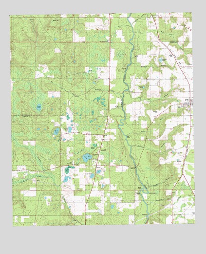
Altha West, FL USGS Topographic Map
Click on map above to begin viewing in our Map Viewer.

This topographic map contains these locations and features:
Feature Name Type Latitude Longitude GNIS ID View Map
Alliance SchoolSchoolN30.6210°W85.1363°277766View Map
Alliance StationLocaleN30.5885°W85.1288°304090View Map
AlthaPopulated PlaceN30.5705°W85.1271°277823View Map
Altha Police DepartmentBuildingN30.5704°W85.1276°2754480View Map
Altha Post OfficePost OfficeN30.5755°W85.1277°2783364View Map
Altha Volunteer Fire DepartmentBuildingN30.5708°W85.1282°2644203View Map
Bauldree BranchStreamN30.5210°W85.1574°278183View Map
Bell PondLakeN30.6007°W85.1746°278426View Map
Boardhead BranchStreamN30.5119°W85.1577°279094View Map
Boggs PondLakeN30.5704°W85.2307°279137View Map
Bullet BendBendN30.5221°W85.1602°279649View Map
Burke PondLakeN30.5475°W85.1928°2437377View Map
Cattle Creek Ranch AirportAirportN30.5140°W85.2075°309228View Map
ChasonPopulated PlaceN30.5352°W85.1919°294710View Map
Chason PondLakeN30.5811°W85.1587°280335View Map
Cook BaySwampN30.5441°W85.2036°280732View Map
CoxPopulated PlaceN30.6016°W85.1391°294728View Map
Double PondLakeN30.5571°W85.2097°281706View Map
Edenfield CemeteryCemeteryN30.5419°W85.1366°282083View Map
Farm Air Service AirportAirportN30.6004°W85.1390°309225View Map
Gem BayBayN30.5457°W85.1946°283004View Map
Gortemoller CemeteryCemeteryN30.5427°W85.1935°283232View Map
Hanna Lookout TowerTowerN30.5505°W85.1541°283692View Map
Hansford BranchStreamN30.5955°W85.1669°283696View Map
Hasty PondSwampN30.5915°W85.1930°283797View Map
Hasty Pond ChurchChurchN30.5860°W85.1905°283798View Map
Hasty Pond SchoolSchoolN30.5880°W85.1941°283799View Map
Holliman BranchStreamN30.5463°W85.1680°284160View Map
Hollis BranchStreamN30.5527°W85.1708°284164View Map
Horseshoe BendBendN30.5180°W85.1566°284299View Map
Jim BaySwampN30.5335°W85.2110°279689View Map
Johnson PondLakeN30.5968°W85.1468°284887View Map
Maddox CemeteryCemeteryN30.6216°W85.2160°286264View Map
May Mill CreekStreamN30.6135°W85.1649°286538View Map
Mayo Mill BranchStreamN30.5027°W85.2058°286550View Map
Mill CreekStreamN30.5699°W85.1758°286871View Map
Mount Olive CemeteryCemeteryN30.5930°W85.1269°287250View Map
New Shiloh CemeteryCemeteryN30.5371°W85.2083°287690View Map
Old Shiloh CemeteryCemeteryN30.5444°W85.1846°288117View Map
Page PondLakeN30.5403°W85.1985°288378View Map
Pumpkin CreekStreamN30.5749°W85.1738°289366View Map
Ring Jaw BranchStreamN30.5796°W85.1694°289708View Map
Ring Jaw IslandIslandN30.5796°W85.1694°289709View Map
Ritchards CemeteryCemeteryN30.5663°W85.1491°289722View Map
Sink CreekPopulated PlaceN30.6227°W85.1516°291171View Map
Sink CreekStreamN30.6185°W85.1660°291172View Map
Todd PondLakeN30.5293°W85.1951°292326View Map
Town of AlthaCivilN30.5721°W85.1270°2405144View Map
White PondLakeN30.5559°W85.2189°293223View Map
Whitewater CreekStreamN30.5269°W85.2213°293248View Map
WillisPopulated PlaceN30.5532°W85.1866°294974View Map

Note: Coordinates in the location and feature list above are referenced to NAD83 datum.


Copyright (C) 2008-2025 Ryan Niemi / Sunset Dynamics ... All Rights Reserved