TopoQuest Logo
Do you find TopoQuest useful?
Help keep TopoQuest running and adding new maps/features by donating!
Bitcoin:  19c7KJd3qBynnjoSw5npx9KScwjBe4ifkT
Litecoin:  LXs6TkuXGGXo1vDsWCkWVdjQX94eUKd6ui
Home View Maps Find Maps Find Places Resources & Links


Bancroft, Idaho Topographic Map

USGS Map Title: Bancroft, ID
USGS Map MRC: 42111F8
DRG (GeoTIFF) Download: o42111f8.tif


Neighboring USGS Topographic Map Quads:


  Bear Camp Gulch, ID  
42112G1
 

  Chesterfield, ID  
42111G8
 

  Hatch, ID  
42111G7
 

  Haystack Mountain, ID  
42112F1
 

  Bancroft, ID  
42111F8
 

  Talmage, ID  
42111F7
 

  Lava Hot Springs, ID  
42112E1
 

  Sedgwick Peak, ID  
42111E8
 

  Grace Power Plant, ID  
42111E7


Map MRC Location:

N43°
W112°
N43°
W111°
H8 H7 H6 H5 H4 H3 H2 H1
G8 G7 G6 G5 G4 G3 G2 G1
F8 F7 F6 F5 F4 F3 F2 F1
E8 E7 E6 E5 E4 E3 E2 E1
D8 D7 D6 D5 D4 D3 D2 D1
C8 C7 C6 C5 C4 C3 C2 C1
B8 B7 B6 B5 B4 B3 B2 B1
A8 A7 A6 A5 A4 A3 A2 A1
N42°
W112°
N42°
W111°

Bancroft, ID USGS 1:24K Topographic Map Preview:
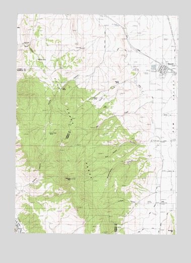
Bancroft, ID USGS Topographic Map
Click on map above to begin viewing in our Map Viewer.

This topographic map contains these locations and features:
Feature Name Type Latitude Longitude GNIS ID View Map
BancroftPopulated PlaceN42.7202°W111.8858°397402View Map
Bancroft Fire DepartmentBuildingN42.7196°W111.8837°2619167View Map
Bancroft Post OfficePost OfficeN42.7203°W111.8847°2767311View Map
Caribou County Emergency Medical Services BancroftBuildingN42.7181°W111.8856°2642831View Map
City of BancroftCivilN42.7202°W111.8830°2409780View Map
Clark SpringSpringN42.7080°W111.9649°395220View Map
Conklin WellWellN42.7310°W111.9500°395250View Map
Hadley CanyonValleyN42.6521°W111.9930°372956View Map
Josie SpringSpringN42.6971°W111.9297°373350View Map
LundPopulated PlaceN42.6427°W111.8886°376169View Map
Lundgren CanyonValleyN42.6433°W111.8975°373778View Map
Milkshake SpringSpringN42.7240°W111.9841°394769View Map
Mill CreekStreamN42.7135°W111.9111°373943View Map
North CanyonValleyN42.7280°W111.9330°374176View Map
North Gem Elementary SchoolSchoolN42.7174°W111.8883°401019View Map
North Gem Junior-Senior High SchoolSchoolN42.7177°W111.8883°401018View Map
Pebble WellWellN42.7324°W111.9947°394898View Map
Petticoat PeakSummitN42.6560°W111.9577°374381View Map
Railroad SpringSpringN42.7108°W111.9204°374567View Map
Red House CanyonValleyN42.6769°W111.9013°374619View Map
Rindlishbaker CanyonValleyN42.6683°W111.8950°374687View Map
School House SpringSpringN42.6818°W111.9739°395922View Map
Smith CanyonValleyN42.7324°W111.9980°375077View Map
Squaw CreekStreamN42.7138°W111.9113°375230View Map
Toolson SpringSpringN42.7051°W111.9363°375552View Map

Note: Coordinates in the location and feature list above are referenced to NAD83 datum.


Copyright (C) 2008-2025 Ryan Niemi / Sunset Dynamics ... All Rights Reserved