TopoQuest Logo
Do you find TopoQuest useful?
Help keep TopoQuest running and adding new maps/features by donating!
Bitcoin:  19c7KJd3qBynnjoSw5npx9KScwjBe4ifkT
Litecoin:  LXs6TkuXGGXo1vDsWCkWVdjQX94eUKd6ui
Home View Maps Find Maps Find Places Resources & Links


Chesterfield, Idaho Topographic Map

USGS Map Title: Chesterfield, ID
USGS Map MRC: 42111G8
DRG (GeoTIFF) Download: o42111g8.tif


Neighboring USGS Topographic Map Quads:


  Jeff Cabin Creek, ID  
42112H1
 

  Chesterfield Reservoir, ID  
42111H8
 

  Grizzly Creek, ID  
42111H7
 

  Bear Camp Gulch, ID  
42112G1
 

  Chesterfield, ID  
42111G8
 

  Hatch, ID  
42111G7
 

  Haystack Mountain, ID  
42112F1
 

  Bancroft, ID  
42111F8
 

  Talmage, ID  
42111F7


Map MRC Location:

N43°
W112°
N43°
W111°
H8 H7 H6 H5 H4 H3 H2 H1
G8 G7 G6 G5 G4 G3 G2 G1
F8 F7 F6 F5 F4 F3 F2 F1
E8 E7 E6 E5 E4 E3 E2 E1
D8 D7 D6 D5 D4 D3 D2 D1
C8 C7 C6 C5 C4 C3 C2 C1
B8 B7 B6 B5 B4 B3 B2 B1
A8 A7 A6 A5 A4 A3 A2 A1
N42°
W112°
N42°
W111°

Chesterfield, ID USGS 1:24K Topographic Map Preview:
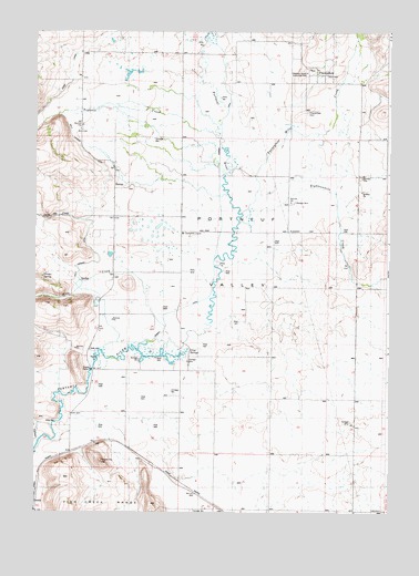
Chesterfield, ID USGS Topographic Map
Click on map above to begin viewing in our Map Viewer.

This topographic map contains these locations and features:
Feature Name Type Latitude Longitude GNIS ID View Map
Bancroft DivisionCivilN42.7858°W111.9223°1936676View Map
ChesterfieldPopulated PlaceN42.8669°W111.9019°396274View Map
Chesterfield CemeteryCemeteryN42.8541°W111.9047°395202View Map
Chesterfield ChurchChurchN42.8227°W111.9480°395203View Map
Chesterfield Meeting House (historical)ChurchN42.8644°W111.9047°395205View Map
Downey CanalCanalN42.8241°W111.9344°395578View Map
Eighteenmile CreekStreamN42.8308°W111.8952°397680View Map
Gooch SchoolSchoolN42.8263°W111.9722°372872View Map
Grim SpringsSpringN42.7921°W111.9461°395435View Map
Higginson CanyonValleyN42.8630°W111.8830°395467View Map
Kelly SchoolSchoolN42.7874°W111.9688°373389View Map
Kelly Toponce DitchCanalN42.8216°W111.9822°395547View Map
King CreekStreamN42.8055°W111.9752°384229View Map
KinportPopulated PlaceN42.7544°W111.9416°396748View Map
Moses CreekStreamN42.8249°W111.8802°374033View Map
North Canyon SchoolSchoolN42.7730°W111.9494°374178View Map
Orman SpringSpringN42.8112°W111.9973°394874View Map
Portneuf Marsh Valley Irrigation Company Feeder CanalCanalN42.8727°W111.9808°374511View Map
Rigby SchoolSchoolN42.8002°W111.9175°374669View Map
Smith CreekStreamN42.8258°W111.9836°390675View Map
Toponce and Chesterfield Land Co DitchCanalN42.8710°W111.9758°397265View Map
Toponce CreekStreamN42.8510°W111.9372°400139View Map
Twentyfour Mile CreekStreamN42.8358°W111.9177°397280View Map

Note: Coordinates in the location and feature list above are referenced to NAD83 datum.


Copyright (C) 2008-2025 Ryan Niemi / Sunset Dynamics ... All Rights Reserved