TopoQuest Logo
Do you find TopoQuest useful?
Help keep TopoQuest running and adding new maps/features by donating!
Bitcoin:  19c7KJd3qBynnjoSw5npx9KScwjBe4ifkT
Litecoin:  LXs6TkuXGGXo1vDsWCkWVdjQX94eUKd6ui
Home View Maps Find Maps Find Places Resources & Links


Bear Camp Gulch, Idaho Topographic Map

USGS Map Title: Bear Camp Gulch, ID
USGS Map MRC: 42112G1
DRG (GeoTIFF) Download: o42112g1.tif


Neighboring USGS Topographic Map Quads:


  South Putnam Mountain, ID  
42112H2
 

  Jeff Cabin Creek, ID  
42112H1
 

  Chesterfield Reservoir, ID  
42111H8
 

  Bonneville Peak, ID  
42112G2
 

  Bear Camp Gulch, ID  
42112G1
 

  Chesterfield, ID  
42111G8
 

  McCammon, ID  
42112F2
 

  Haystack Mountain, ID  
42112F1
 

  Bancroft, ID  
42111F8


Map MRC Location:

N43°
W113°
N43°
W112°
H8 H7 H6 H5 H4 H3 H2 H1
G8 G7 G6 G5 G4 G3 G2 G1
F8 F7 F6 F5 F4 F3 F2 F1
E8 E7 E6 E5 E4 E3 E2 E1
D8 D7 D6 D5 D4 D3 D2 D1
C8 C7 C6 C5 C4 C3 C2 C1
B8 B7 B6 B5 B4 B3 B2 B1
A8 A7 A6 A5 A4 A3 A2 A1
N42°
W113°
N42°
W112°

Bear Camp Gulch, ID USGS 1:24K Topographic Map Preview:
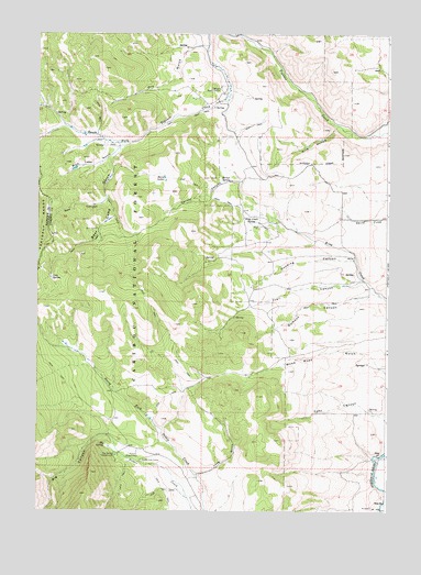
Bear Camp Gulch, ID USGS Topographic Map
Click on map above to begin viewing in our Map Viewer.

This topographic map contains these locations and features:
Feature Name Type Latitude Longitude GNIS ID View Map
Bear CampLocaleN42.8241°W112.1036°377070View Map
Bear Camp GulchValleyN42.8414°W112.0993°2761138View Map
Big CanyonValleyN42.7699°W112.1000°377453View Map
Big SpringSpringN42.7674°W112.1005°377593View Map
Big Spring CampgroundLocaleN42.7646°W112.0966°377597View Map
Blue Lake GulchValleyN42.8441°W112.0975°377931View Map
Cold SpringSpringN42.8110°W112.1207°379524View Map
Deer CanyonValleyN42.7755°W112.0047°380407View Map
Dry GulchValleyN42.8721°W112.0655°380859View Map
Dumont CanyonValleyN42.8074°W112.0058°399858View Map
Gooding CanyonValleyN42.8160°W112.0125°382430View Map
Hornet CanyonValleyN42.8363°W112.0539°383340View Map
Hornet SpringSpringN42.8365°W112.0567°383347View Map
Horse LakesLakeN42.8375°W112.0801°383392View Map
King Creek SpringSpringN42.8256°W112.0498°384234View Map
Long GulchValleyN42.7599°W112.0672°386044View Map
New CanyonValleyN42.8316°W112.1008°387530View Map
Pebble Cow CampLocaleN42.7632°W112.0880°388313View Map
Pebble Guard StationLocaleN42.7641°W112.0889°388315View Map
Pine HollowValleyN42.8505°W112.0194°388520View Map
Trail CanyonValleyN42.8102°W112.0105°392262View Map
Wood Road GulchValleyN42.7880°W112.0030°393663View Map

Note: Coordinates in the location and feature list above are referenced to NAD83 datum.


Copyright (C) 2008-2025 Ryan Niemi / Sunset Dynamics ... All Rights Reserved