TopoQuest Logo
Do you find TopoQuest useful?
Help keep TopoQuest running and adding new maps/features by donating!
Bitcoin:  19c7KJd3qBynnjoSw5npx9KScwjBe4ifkT
Litecoin:  LXs6TkuXGGXo1vDsWCkWVdjQX94eUKd6ui
Home View Maps Find Maps Find Places Resources & Links


Branchville, Georgia Topographic Map

USGS Map Title: Branchville, GA
USGS Map MRC: 31084B3
DRG (GeoTIFF) Download: o31084b3.tif


Neighboring USGS Topographic Map Quads:


  Elmodel, GA  
31084C4
 

  Newton, GA  
31084C3
 

  Baconton South, GA  
31084C2
 

  Hopeful, GA  
31084B4
 

  Branchville, GA  
31084B3
 

  Camilla, GA  
31084B2
 

  Vada, GA  
31084A4
 

  Gee Pond, GA  
31084A3
 

  Pelham, GA  
31084A2


Map MRC Location:

N32°
W85°
N32°
W84°
H8 H7 H6 H5 H4 H3 H2 H1
G8 G7 G6 G5 G4 G3 G2 G1
F8 F7 F6 F5 F4 F3 F2 F1
E8 E7 E6 E5 E4 E3 E2 E1
D8 D7 D6 D5 D4 D3 D2 D1
C8 C7 C6 C5 C4 C3 C2 C1
B8 B7 B6 B5 B4 B3 B2 B1
A8 A7 A6 A5 A4 A3 A2 A1
N31°
W85°
N31°
W84°

Branchville, GA USGS 1:24K Topographic Map Preview:
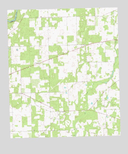
Branchville, GA USGS Topographic Map
Click on map above to begin viewing in our Map Viewer.

This topographic map contains these locations and features:
Feature Name Type Latitude Longitude GNIS ID View Map
Antioch ChurchChurchN31.1871°W84.3741°310563View Map
Big SloughStreamN31.1285°W84.3010°311413View Map
BranchvillePopulated PlaceN31.1505°W84.3155°354834View Map
Branchville ChurchChurchN31.1427°W84.3199°343618View Map
Evergreen ChurchChurchN31.1977°W84.2849°355739View Map
GreenwoodPopulated PlaceN31.1980°W84.3399°326310View Map
Greenwood Freewill Baptist ChurchChurchN31.1968°W84.3396°343637View Map
Medicine SinkBasinN31.1269°W84.3010°317993View Map
Mount Zion ChurchChurchN31.2427°W84.3402°318941View Map
Oak Grove ChurchChurchN31.2146°W84.2885°319764View Map
Pine Cliff ChurchChurchN31.2418°W84.3244°320545View Map
Turkey Pen CemeteryCemeteryN31.1302°W84.3080°324394View Map

Note: Coordinates in the location and feature list above are referenced to NAD83 datum.


Copyright (C) 2008-2024 Ryan Niemi / Sunset Dynamics ... All Rights Reserved