TopoQuest Logo
Do you find TopoQuest useful?
Help keep TopoQuest running and adding new maps/features by donating!
Bitcoin:  19c7KJd3qBynnjoSw5npx9KScwjBe4ifkT
Litecoin:  LXs6TkuXGGXo1vDsWCkWVdjQX94eUKd6ui
Home View Maps Find Maps Find Places Resources & Links


Hopeful, Georgia Topographic Map

USGS Map Title: Hopeful, GA
USGS Map MRC: 31084B4
DRG (GeoTIFF) Download: o31084b4.tif


Neighboring USGS Topographic Map Quads:


  Bethany, GA  
31084C5
 

  Elmodel, GA  
31084C4
 

  Newton, GA  
31084C3
 

  Cooktown, GA  
31084B5
 

  Hopeful, GA  
31084B4
 

  Branchville, GA  
31084B3
 

  Steadhams Store, GA  
31084A5
 

  Vada, GA  
31084A4
 

  Gee Pond, GA  
31084A3


Map MRC Location:

N32°
W85°
N32°
W84°
H8 H7 H6 H5 H4 H3 H2 H1
G8 G7 G6 G5 G4 G3 G2 G1
F8 F7 F6 F5 F4 F3 F2 F1
E8 E7 E6 E5 E4 E3 E2 E1
D8 D7 D6 D5 D4 D3 D2 D1
C8 C7 C6 C5 C4 C3 C2 C1
B8 B7 B6 B5 B4 B3 B2 B1
A8 A7 A6 A5 A4 A3 A2 A1
N31°
W85°
N31°
W84°

Hopeful, GA USGS 1:24K Topographic Map Preview:
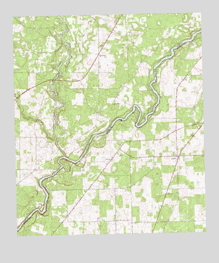
Hopeful, GA USGS Topographic Map
Click on map above to begin viewing in our Map Viewer.

This topographic map contains these locations and features:
Feature Name Type Latitude Longitude GNIS ID View Map
Big Cypress CreekStreamN31.1796°W84.4730°311375View Map
Branchville DivisionCivilN31.1443°W84.3820°1936127View Map
Green Grove ChurchChurchN31.1668°W84.4366°314833View Map
Hell Gate ShoalsBarN31.1568°W84.4832°1704968View Map
Hoggard MillPopulated PlaceN31.2171°W84.4707°342837View Map
HopefulPopulated PlaceN31.1688°W84.3930°332021View Map
Hopeful ChurchChurchN31.1682°W84.3924°343640View Map
Hopeful Community Fire DepartmentBuildingN31.1673°W84.3931°2604204View Map
Hopeful Lookout TowerTowerN31.1477°W84.4010°344258View Map
Horseshoe BendBendN31.1885°W84.4160°315716View Map
Ichauway Volunteer Fire DepartmentBuildingN31.2318°W84.4708°2604148View Map
Ichawaynochaway CreekStreamN31.1699°W84.4680°315875View Map
John the Baptist ChurchChurchN31.1993°W84.4346°316138View Map
LamarPopulated PlaceN31.1405°W84.4930°342839View Map
Pilgrim Home ChurchChurchN31.2271°W84.4432°320522View Map
Red Hill Still (historical)LocaleN31.1510°W84.4285°343658View Map
Riverview Airport (historical)AirportN31.1693°W84.4324°343659View Map
Thankful ChurchChurchN31.2318°W84.4416°324022View Map

Note: Coordinates in the location and feature list above are referenced to NAD83 datum.


Copyright (C) 2008-2024 Ryan Niemi / Sunset Dynamics ... All Rights Reserved