TopoQuest Logo
Do you find TopoQuest useful?
Help keep TopoQuest running and adding new maps/features by donating!
Bitcoin:  19c7KJd3qBynnjoSw5npx9KScwjBe4ifkT
Litecoin:  LXs6TkuXGGXo1vDsWCkWVdjQX94eUKd6ui
Home View Maps Find Maps Find Places Resources & Links


Bull Basin, New Mexico Topographic Map

USGS Map Title: Bull Basin, NM
USGS Map MRC: 33108F8
DRG (GeoTIFF) Download: o33108f8.tif


Neighboring USGS Topographic Map Quads:


  Luna Lake, AZ  
33109G1
 

  Luna, NM  
33108G8
 

  Dillon Mountain, NM  
33108G7
 

  Maness Peak, AZ  
33109F1
 

  Bull Basin, NM  
33108F8
 

  Reserve, NM  
33108F7
 

  Blue, AZ  
33109E1
 

  Saliz Pass, NM  
33108E8
 

  O Block Canyon, NM  
33108E7


Map MRC Location:

N34°
W109°
N34°
W108°
H8 H7 H6 H5 H4 H3 H2 H1
G8 G7 G6 G5 G4 G3 G2 G1
F8 F7 F6 F5 F4 F3 F2 F1
E8 E7 E6 E5 E4 E3 E2 E1
D8 D7 D6 D5 D4 D3 D2 D1
C8 C7 C6 C5 C4 C3 C2 C1
B8 B7 B6 B5 B4 B3 B2 B1
A8 A7 A6 A5 A4 A3 A2 A1
N33°
W109°
N33°
W108°

Bull Basin, NM USGS 1:24K Topographic Map Preview:
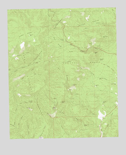
Bull Basin, NM USGS Topographic Map
Click on map above to begin viewing in our Map Viewer.

This topographic map contains these locations and features:
Feature Name Type Latitude Longitude GNIS ID View Map
Aspen MountainPopulated PlaceN33.6981°W108.9656°903449View Map
Bell Park TankReservoirN33.6749°W108.9012°903734View Map
Black Bull PeakSummitN33.6545°W108.9756°903849View Map
Black Bull SaddleGapN33.6606°W108.9734°903850View Map
Bluff TankReservoirN33.6588°W108.8930°909670View Map
Bull BasinBasinN33.7181°W108.9445°904168View Map
Bull Basin SpringSpringN33.7197°W108.9363°904170View Map
Bull CanyonValleyN33.6314°W108.9920°904174View Map
Camp CanyonValleyN33.6370°W108.9940°904313View Map
Dangerous ParkParkN33.6256°W108.9637°905588View Map
Dave Lee LakeLakeN33.7249°W108.9757°905611View Map
Flying T SpringSpringN33.6544°W108.9510°906316View Map
Heifer BasinBasinN33.7353°W108.9078°906899View Map
Highway TankReservoirN33.6264°W108.8945°912892View Map
Horse MesaSummitN33.7298°W108.9767°907099View Map
Joe Green PeakSummitN33.6762°W108.9267°907382View Map
Joe Green SpringSpringN33.6853°W108.9349°912901View Map
Jones CorralLocaleN33.6314°W108.9117°912893View Map
Leggett Cabin SpringSpringN33.6825°W108.8966°907930View Map
Leggett CanyonValleyN33.6278°W108.8945°907931View Map
Leggett Pasture TankReservoirN33.6760°W108.8770°907932View Map
Leggett PeakSummitN33.7064°W108.9012°907933View Map
Leggett TankReservoirN33.6574°W108.9103°912890View Map
Lost SpringSpringN33.6668°W108.9251°908253View Map
Maverick PeakSummitN33.6595°W108.9401°908477View Map
Maverick SpringSpringN33.6634°W108.9460°908479View Map
Nutt SpringSpringN33.7085°W108.9310°909228View Map
Oak SpringSpringN33.6991°W108.9326°909241View Map
Owl CanyonValleyN33.6589°W108.9917°909405View Map
Pine Lawn CampLocaleN33.6556°W108.8767°923650View Map
Pine Lawn ValleyValleyN33.6556°W108.8767°2650433View Map
Prairie Point PeakSummitN33.7220°W108.8915°909841View Map
Quarry TankReservoirN33.6978°W108.8773°2038635View Map
Quarter Corner SpringsSpringN33.6380°W108.9155°909919View Map
Rim TankReservoirN33.6413°W108.8768°912891View Map
San Francisco MountainsRangeN33.6987°W108.9606°40491View Map
Tuff SpringSpringN33.7459°W108.8840°912900View Map
Ward CanyonValleyN33.6873°W108.9762°912157View Map
Wet Leggett SpringSpringN33.7001°W108.8954°912278View Map

Note: Coordinates in the location and feature list above are referenced to NAD83 datum.


Copyright (C) 2008-2025 Ryan Niemi / Sunset Dynamics ... All Rights Reserved