TopoQuest Logo
Do you find TopoQuest useful?
Help keep TopoQuest running and adding new maps/features by donating!
Bitcoin:  19c7KJd3qBynnjoSw5npx9KScwjBe4ifkT
Litecoin:  LXs6TkuXGGXo1vDsWCkWVdjQX94eUKd6ui
Home View Maps Find Maps Find Places Resources & Links


Burden, Kansas Topographic Map

USGS Map Title: Burden, KS
USGS Map MRC: 37096C7
DRG (GeoTIFF) Download: o37096c7.tif


Neighboring USGS Topographic Map Quads:


  Wilmot, KS  
37096D8
 

  Atlanta, KS  
37096D7
 

  Cambridge NW, KS  
37096D6
 

  New Salem, KS  
37096C8
 

  Burden, KS  
37096C7
 

  Cambridge, KS  
37096C6
 

  Winfield, KS  
37096B8
 

  Eaton, KS  
37096B7
 

  Dexter, KS  
37096B6


Map MRC Location:

N38°
W97°
N38°
W96°
H8 H7 H6 H5 H4 H3 H2 H1
G8 G7 G6 G5 G4 G3 G2 G1
F8 F7 F6 F5 F4 F3 F2 F1
E8 E7 E6 E5 E4 E3 E2 E1
D8 D7 D6 D5 D4 D3 D2 D1
C8 C7 C6 C5 C4 C3 C2 C1
B8 B7 B6 B5 B4 B3 B2 B1
A8 A7 A6 A5 A4 A3 A2 A1
N37°
W97°
N37°
W96°

Burden, KS USGS 1:24K Topographic Map Preview:
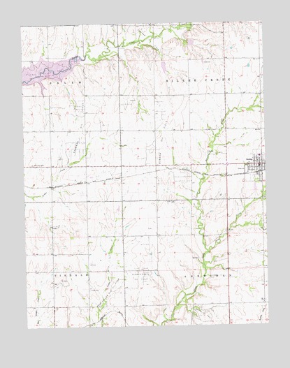
Burden, KS USGS Topographic Map
Click on map above to begin viewing in our Map Viewer.

This topographic map contains these locations and features:
Feature Name Type Latitude Longitude GNIS ID View Map
Bolack Oil FieldOilfieldN37.2550°W96.7836°469907View Map
BurdenPopulated PlaceN37.3128°W96.7542°469910View Map
Burden City HallBuildingN37.3152°W96.7538°2693041View Map
Burden Oil FieldOilfieldN37.3270°W96.8036°469904View Map
Burden Police DepartmentBuildingN37.3152°W96.7537°2504117View Map
Burden United Methodist ChurchChurchN37.3179°W96.7526°2689362View Map
Burden Wastewater PlantLocaleN37.3134°W96.7626°2692000View Map
Central Elementary SchoolSchoolN37.3235°W96.7533°481067View Map
Central Elementary SchoolSchoolN37.3235°W96.7533°2497524View Map
Central Junior - Senior High SchoolSchoolN37.3199°W96.7533°481092View Map
City of BurdenCivilN37.3150°W96.7554°2393466View Map
Cowley County Fire District 3 BurdenBuildingN37.3167°W96.7544°2111234View Map
First Baptist ChurchChurchN37.3160°W96.7562°2690727View Map
Fleming Feed and Grain Company Grain Elevator Number 2LocaleN37.3151°W96.8019°2695218View Map
Frog Hollow Oil FieldOilfieldN37.2647°W96.8320°469923View Map
Hard Scrable School (historical)SchoolN37.3745°W96.7700°483429View Map
Moscow School (historical)SchoolN37.3342°W96.8067°483440View Map
Old Salem School (historical)SchoolN37.3306°W96.8517°483451View Map
Plum CreekStreamN37.2803°W96.7806°469911View Map
Prairie Home School (historical)SchoolN37.3014°W96.8431°483463View Map
Salem CemeteryCemeteryN37.3172°W96.8708°469905View Map
Shannon Oil FieldOilfieldN37.3331°W96.8450°469906View Map
Silver Creek CemeteryCemeteryN37.3014°W96.7974°469903View Map
Silver Creek School (historical)SchoolN37.3014°W96.8064°483476View Map
Timber Creek LakeReservoirN37.3542°W96.8740°481091View Map
Tisdale CemeteryCemeteryN37.2653°W96.8424°469908View Map
Township of SheridanCivilN37.2586°W96.7702°469580View Map
Township of Silver CreekCivilN37.3453°W96.7705°469912View Map
Township of TisdaleCivilN37.2588°W96.8703°469566View Map
Turner North Oil FieldOilfieldN37.2706°W96.8164°469909View Map
Victor Point School (historical)SchoolN37.2731°W96.8248°483488View Map

Note: Coordinates in the location and feature list above are referenced to NAD83 datum.


Copyright (C) 2008-2025 Ryan Niemi / Sunset Dynamics ... All Rights Reserved