TopoQuest Logo
Do you find TopoQuest useful?
Help keep TopoQuest running and adding new maps/features by donating!
Bitcoin:  19c7KJd3qBynnjoSw5npx9KScwjBe4ifkT
Litecoin:  LXs6TkuXGGXo1vDsWCkWVdjQX94eUKd6ui
Home View Maps Find Maps Find Places Resources & Links


Caldwell Mesa, California Topographic Map

USGS Map Title: Caldwell Mesa, CA
USGS Map MRC: 35120B3
DRG (GeoTIFF) Download: o35120b3.tif


Neighboring USGS Topographic Map Quads:


  Santa Margarita Lake, CA  
35120C4
 

  Pozo Summit, CA  
35120C3
 

  La Panza, CA  
35120C2
 

  Tar Spring Ridge, CA  
35120B4
 

  Caldwell Mesa, CA  
35120B3
 

  Los Machos Hills, CA  
35120B2
 

  Nipomo, CA  
35120A4
 

  Huasna Peak, CA  
35120A3
 

  Chimney Canyon, CA  
35120A2


Map MRC Location:

N36°
W121°
N36°
W120°
H8 H7 H6 H5 H4 H3 H2 H1
G8 G7 G6 G5 G4 G3 G2 G1
F8 F7 F6 F5 F4 F3 F2 F1
E8 E7 E6 E5 E4 E3 E2 E1
D8 D7 D6 D5 D4 D3 D2 D1
C8 C7 C6 C5 C4 C3 C2 C1
B8 B7 B6 B5 B4 B3 B2 B1
A8 A7 A6 A5 A4 A3 A2 A1
N35°
W121°
N35°
W120°

Caldwell Mesa, CA USGS 1:24K Topographic Map Preview:
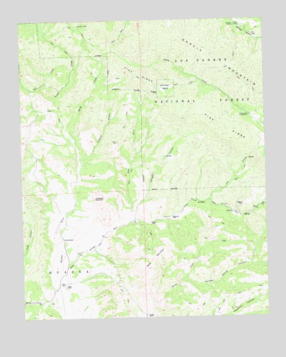
Caldwell Mesa, CA USGS Topographic Map
Click on map above to begin viewing in our Map Viewer.

This topographic map contains these locations and features:
Feature Name Type Latitude Longitude GNIS ID View Map
Arroyo SecoStreamN35.1411°W120.3596°269592View Map
Avenales StationLocaleN35.2478°W120.2663°269614View Map
Bald MountainRidgeN35.1491°W120.3090°269642View Map
Bonnet RockPillarN35.2197°W120.3052°269966View Map
Buckeye CampLocaleN35.2480°W120.3457°270061View Map
Caldwell MesaSummitN35.2233°W120.3054°240002View Map
Caldwell MountainSummitN35.1736°W120.3335°270160View Map
Colwell Ranch (historical)LocaleN35.2200°W120.3015°1670662View Map
Drain OneValleyN35.1411°W120.2918°270905View Map
Garcia MountainRidgeN35.2489°W120.3096°271265View Map
Garcia WildernessReserveN35.2453°W120.3141°2035128View Map
Hathaway PlacePopulated PlaceN35.1669°W120.2993°1660730View Map
Hubert PlacePopulated PlaceN35.1689°W120.2674°1660775View Map
Joaquin CanyonValleyN35.1916°W120.3460°271790View Map
Oso CreekStreamN35.1744°W120.2804°272818View Map
Pine CreekStreamN35.1655°W120.3210°272980View Map
Pine RidgeRidgeN35.2097°W120.2846°273003View Map
Porter RanchLocaleN35.1383°W120.3538°273085View Map
Ranger CanyonValleyN35.1675°W120.3182°273201View Map
Records RanchLocaleN35.1258°W120.3124°273236View Map
Reeves PlacePopulated PlaceN35.1650°W120.3099°1661299View Map
Renshaw PlacePopulated PlaceN35.1722°W120.2627°1661301View Map
Salt CreekStreamN35.2303°W120.3479°273422View Map
Stony CreekStreamN35.2011°W120.3502°273918View Map
Stony Creek CampgroundLocaleN35.2094°W120.2593°273920View Map
Trout CreekStreamN35.2011°W120.3502°274194View Map
Venados RanchLocaleN35.1583°W120.3549°274323View Map

Note: Coordinates in the location and feature list above are referenced to NAD83 datum.


Copyright (C) 2008-2025 Ryan Niemi / Sunset Dynamics ... All Rights Reserved