TopoQuest Logo
Do you find TopoQuest useful?
Help keep TopoQuest running and adding new maps/features by donating!
Bitcoin:  19c7KJd3qBynnjoSw5npx9KScwjBe4ifkT
Litecoin:  LXs6TkuXGGXo1vDsWCkWVdjQX94eUKd6ui
Home View Maps Find Maps Find Places Resources & Links


Calexico, California Topographic Map

USGS Map Title: Calexico, CA
USGS Map MRC: 32115F4
DRG (GeoTIFF) Download: o32115f4.tif


Neighboring USGS Topographic Map Quads:


  El Centro, CA  
32115G5
 

  Holtville West, CA  
32115G4
 

  Holtville East, CA  
32115G3
 

  Heber, CA  
32115F5
 

  Calexico, CA  
32115F4
 

  Bonds Corner, CA  
32115F3


Map MRC Location:

N33°
W116°
N33°
W115°
H8 H7 H6 H5 H4 H3 H2 H1
G8 G7 G6 G5 G4 G3 G2 G1
F8 F7 F6 F5 F4 F3 F2 F1
E8 E7 E6 E5 E4 E3 E2 E1
D8 D7 D6 D5 D4 D3 D2 D1
C8 C7 C6 C5 C4 C3 C2 C1
B8 B7 B6 B5 B4 B3 B2 B1
A8 A7 A6 A5 A4 A3 A2 A1
N32°
W116°
N32°
W115°

Calexico, CA USGS 1:24K Topographic Map Preview:
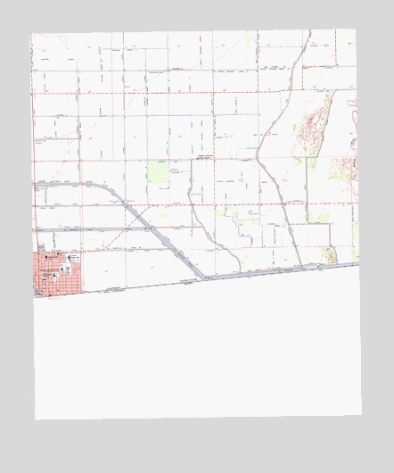
Calexico, CA USGS Topographic Map
Click on map above to begin viewing in our Map Viewer.

This topographic map contains these locations and features:
Feature Name Type Latitude Longitude GNIS ID View Map
Alamitos CanalCanalN32.7303°W115.4575°238470View Map
Alamitos Canal Lateral EightCanalN32.7228°W115.4405°253997View Map
Alamitos Three DrainCanalN32.6901°W115.4400°253996View Map
Alder Canal Lateral TwoCanalN32.7139°W115.4828°255249View Map
Alder DrainCanalN32.7342°W115.4961°238495View Map
Alder Two DrainCanalN32.7184°W115.4825°255248View Map
All American Drain Eight ACanalN32.6801°W115.4655°255260View Map
American Methodist ChurchChurchN32.6689°W115.4917°1868202View Map
Amistad CristanaChurchN32.6664°W115.4836°1868203View Map
Apostolic ChurchChurchN32.6678°W115.4880°1868204View Map
Ash Four DrainCanalN32.7023°W115.4205°255317View Map
Ash Lateral NineCanalN32.7253°W115.4319°255336View Map
Ash Lateral SixCanalN32.7251°W115.4233°255335View Map
Ash Nine A DrainCanalN32.7162°W115.4111°255318View Map
Ash Three DrainCanalN32.7006°W115.4139°255312View Map
Ash Two DrainCanalN32.6756°W115.4086°255311View Map
Assembly of God ChurchChurchN32.6764°W115.4983°1868205View Map
Aurora Continuation High SchoolSchoolN32.6715°W115.4969°243505View Map
Border ParkParkN32.6664°W115.4989°1868206View Map
Brair CanalCanalN32.6798°W115.4486°239644View Map
Brair Siphon WeirCanalN32.6953°W115.4667°239645View Map
CalexicoPopulated PlaceN32.6789°W115.4989°1652680View Map
Calexico City HallBuildingN32.6698°W115.4930°1868208View Map
Calexico DivisionCivilN32.6957°W115.4953°1935036View Map
Calexico Fire Department Station 1 HeadquartersBuildingN32.6696°W115.4924°2664587View Map
Calexico Health CenterHospitalN32.6785°W115.4912°1868209View Map
Calexico Mission SchoolSchoolN32.6661°W115.4901°1868207View Map
Calexico Police DepartmentBuildingN32.6696°W115.4926°2770098View Map
Camarena Memorial LibraryBuildingN32.6745°W115.4878°1868212View Map
Carnegie Public LibraryBuildingN32.6695°W115.4930°1868213View Map
Central Drain ThreeCanalN32.7298°W115.4569°255445View Map
Central Drain ThreeCanalN32.7414°W115.4897°255446View Map
Central Drain Three CCanalN32.7298°W115.4569°240418View Map
Central Drain Three ECanalN32.6798°W115.4483°240419View Map
Central Drain Three ECanalN32.7014°W115.4572°255450View Map
Central Drain Three FCanalN32.7373°W115.4739°255451View Map
City of CalexicoCivilN32.6849°W115.4944°2409958View Map
Cortez ParkParkN32.6664°W115.4828°1868214View Map
Crummett ParkParkN32.6751°W115.4869°1868215View Map
De Anza 9th Grade AcademySchoolN32.6740°W115.4899°1868216View Map
Dool Elementary SchoolSchoolN32.6736°W115.4875°241566View Map
Drain OneCanalN32.7378°W115.3967°241604View Map
Eight A LateralCanalN32.6812°W115.4825°241860View Map
Emerson ParkParkN32.6767°W115.4939°1868217View Map
First American Baptist ChurchChurchN32.6695°W115.4936°1868218View Map
First Chinese Baptist ChurchChurchN32.6717°W115.4880°1868219View Map
First Church of Christ ScientistChurchN32.6709°W115.4936°1868220View Map
First Methodist ChurchChurchN32.6692°W115.4944°1868221View Map
Heber Dunes State Vehicular Recreation AreaParkN32.7302°W115.3876°2570605View Map
Jasper-Alamitos Union SchoolSchoolN32.7087°W115.4380°244009View Map
Jefferson Elementary SchoolSchoolN32.6714°W115.4808°1868227View Map
Kennedy Garden SchoolSchoolN32.6912°W115.4975°1868228View Map
Kennedy Gardens ParkParkN32.6889°W115.4975°1868229View Map
KQVO-FM (Calexico)TowerN32.6801°W115.4275°1665013View Map
Lateral EightCanalN32.7156°W115.4278°255598View Map
Lateral FiveCanalN32.6942°W115.4442°255584View Map
Lateral FiveCanalN32.7084°W115.4183°255585View Map
Lateral Five ACanalN32.7301°W115.3880°255588View Map
Lateral FourCanalN32.6867°W115.4444°255579View Map
Lateral FourCanalN32.7378°W115.4975°255580View Map
Lateral Four ACanalN32.6848°W115.4403°255582View Map
Lateral NineCanalN32.7376°W115.4453°255601View Map
Lateral OneCanalN32.6820°W115.4739°255551View Map
Lateral OneCanalN32.7126°W115.4742°255553View Map
Lateral SixCanalN32.7048°W115.4447°255591View Map
Lateral SixCanalN32.7378°W115.3842°255592View Map
Lateral Six ACanalN32.7128°W115.4492°255595View Map
Lateral ThreeCanalN32.6851°W115.4314°255572View Map
Lateral ThreeCanalN32.6945°W115.4014°255573View Map
Lateral ThreeCanalN32.7303°W115.4830°255575View Map
Lateral TwoCanalN32.6789°W115.4314°255563View Map
Lateral TwoCanalN32.6873°W115.4114°255564View Map
Lateral TwoCanalN32.7231°W115.4880°255567View Map
New Brair CanalCanalN32.6726°W115.4114°246481View Map
Our Lady of Guadalupe AcademySchoolN32.6705°W115.4970°1868235View Map
Our Lady of Guadalupe ChurchChurchN32.6689°W115.4964°1868234View Map
Rockwood Elementary SchoolSchoolN32.6778°W115.4955°248301View Map
Rockwood PlazaParkN32.6703°W115.4930°1868236View Map
Saint Lukes Episcopal ChurchChurchN32.6706°W115.4958°1868238View Map
San Diego State University - Imperial Valley CampusSchoolN32.6723°W115.4928°1868239View Map
Schenk Seven DrainCanalN32.7448°W115.3903°254226View Map
Schenk Six DrainCanalN32.7456°W115.3950°254225View Map
Seventh Day Adventist ChurchChurchN32.6667°W115.4917°1868240View Map
South Alamo DrainCanalN32.6931°W115.3783°249676View Map
South Central DrainCanalN32.7370°W115.4361°249688View Map
South Central Drain FiveCanalN32.6859°W115.4089°249689View Map
South Central Drain SixCanalN32.6867°W115.3994°254279View Map
South Central Drain TwoCanalN32.7370°W115.4230°254276View Map
South Central Drain Two-ACanalN32.7378°W115.4064°254277View Map
Stout Drain TwoCanalN32.7006°W115.4864°254312View Map
Union High SchoolSchoolN32.6776°W115.4872°250787View Map

Note: Coordinates in the location and feature list above are referenced to NAD83 datum.


Copyright (C) 2008-2024 Ryan Niemi / Sunset Dynamics ... All Rights Reserved