TopoQuest Logo
Do you find TopoQuest useful?
Help keep TopoQuest running and adding new maps/features by donating!
Bitcoin:  19c7KJd3qBynnjoSw5npx9KScwjBe4ifkT
Litecoin:  LXs6TkuXGGXo1vDsWCkWVdjQX94eUKd6ui
Home View Maps Find Maps Find Places Resources & Links


Carlton Lake, Montana Topographic Map

USGS Map Title: Carlton Lake, MT
USGS Map MRC: 46114F2
DRG (GeoTIFF) Download: o46114f2.tif


Neighboring USGS Topographic Map Quads:


  Camp Creek, MT  
46114G3
 

  Blue Mountain, MT  
46114G2
 

  Southwest Missoula, MT  
46114G1
 

  Dick Creek, MT  
46114F3
 

  Carlton Lake, MT  
46114F2
 

  Florence, MT  
46114F1
 

  Saint Joseph Peak, MT  
46114E3
 

  Saint Mary Peak, MT  
46114E2
 

  Stevensville, MT  
46114E1


Map MRC Location:

N47°
W115°
N47°
W114°
H8 H7 H6 H5 H4 H3 H2 H1
G8 G7 G6 G5 G4 G3 G2 G1
F8 F7 F6 F5 F4 F3 F2 F1
E8 E7 E6 E5 E4 E3 E2 E1
D8 D7 D6 D5 D4 D3 D2 D1
C8 C7 C6 C5 C4 C3 C2 C1
B8 B7 B6 B5 B4 B3 B2 B1
A8 A7 A6 A5 A4 A3 A2 A1
N46°
W115°
N46°
W114°

Carlton Lake, MT USGS 1:24K Topographic Map Preview:
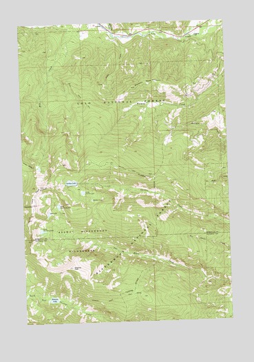
Carlton Lake, MT USGS Topographic Map
Click on map above to begin viewing in our Map Viewer.

This topographic map contains these locations and features:
Feature Name Type Latitude Longitude GNIS ID View Map
Carlton LakeLakeN46.6835°W114.2214°780948View Map
Carlton Lake Number 1 DamDamN46.6833°W114.2209°796272View Map
Carlton Lake TrailTrailN46.6883°W114.1859°780949View Map
Chickaman GulchValleyN46.7460°W114.1934°781207View Map
Fort Fizzle (historical)MilitaryN46.7450°W114.1906°1781292View Map
Fort Fizzle CampgroundLocaleN46.7460°W114.1912°794492View Map
Fort Fizzle Historic SiteLocaleN46.7449°W114.1915°794501View Map
Hollensteiner GulchValleyN46.7474°W114.1646°784945View Map
John CreekStreamN46.7441°W114.1932°785507View Map
Little Carlton LakeLakeN46.6793°W114.2143°786267View Map
Lolo PeakSummitN46.6746°W114.2446°786467View Map
McClain LakeLakeN46.6761°W114.2087°787004View Map
Mill Creek MineMineN46.7319°W114.2384°804848View Map
Mill Creek TrailTrailN46.7210°W114.2171°787378View Map
Mormon PeakSummitN46.7227°W114.1812°787689View Map
North One Horse LakeLakeN46.6738°W114.2295°788298View Map
Peterson LakeLakeN46.6349°W114.2339°788793View Map
Reed LakeLakeN46.6708°W114.2355°789504View Map
South One Horse LakeLakeN46.6636°W114.2399°791107View Map
Sweeney PeakSummitN46.6480°W114.2215°791812View Map
Sweeney Ridge TrailTrailN46.6333°W114.2048°791813View Map

Note: Coordinates in the location and feature list above are referenced to NAD83 datum.


Copyright (C) 2008-2025 Ryan Niemi / Sunset Dynamics ... All Rights Reserved