TopoQuest Logo
Do you find TopoQuest useful?
Help keep TopoQuest running and adding new maps/features by donating!
Bitcoin:  19c7KJd3qBynnjoSw5npx9KScwjBe4ifkT
Litecoin:  LXs6TkuXGGXo1vDsWCkWVdjQX94eUKd6ui
Home View Maps Find Maps Find Places Resources & Links


Blue Mountain, Montana Topographic Map

USGS Map Title: Blue Mountain, MT
USGS Map MRC: 46114G2
DRG (GeoTIFF) Download: o46114g2.tif


Neighboring USGS Topographic Map Quads:


  Diamond Point, MT  
46114H3
 

  Primrose, MT  
46114H2
 

  Northwest Missoula, MT  
46114H1
 

  Camp Creek, MT  
46114G3
 

  Blue Mountain, MT  
46114G2
 

  Southwest Missoula, MT  
46114G1
 

  Dick Creek, MT  
46114F3
 

  Carlton Lake, MT  
46114F2
 

  Florence, MT  
46114F1


Map MRC Location:

N47°
W115°
N47°
W114°
H8 H7 H6 H5 H4 H3 H2 H1
G8 G7 G6 G5 G4 G3 G2 G1
F8 F7 F6 F5 F4 F3 F2 F1
E8 E7 E6 E5 E4 E3 E2 E1
D8 D7 D6 D5 D4 D3 D2 D1
C8 C7 C6 C5 C4 C3 C2 C1
B8 B7 B6 B5 B4 B3 B2 B1
A8 A7 A6 A5 A4 A3 A2 A1
N46°
W115°
N46°
W114°

Blue Mountain, MT USGS 1:24K Topographic Map Preview:
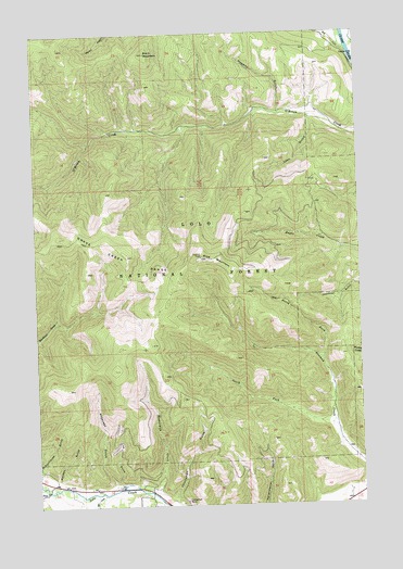
Blue Mountain, MT USGS Topographic Map
Click on map above to begin viewing in our Map Viewer.

This topographic map contains these locations and features:
Feature Name Type Latitude Longitude GNIS ID View Map
13N20W21DA__01 WellWellN46.8688°W114.1257°818963View Map
Anderson GulchValleyN46.7563°W114.2207°768246View Map
Black MountainSummitN46.8699°W114.2059°768974View Map
Blue MountainSummitN46.8158°W114.1862°769040View Map
Blue Mountain LookoutLocaleN46.8171°W114.1865°794296View Map
Blue Mountain SaddleLocaleN46.8077°W114.2182°794295View Map
Chickaman MineMineN46.7508°W114.1946°804851View Map
Chickaman MineMineN46.7513°W114.1937°769808View Map
Hagerty GulchValleyN46.8544°W114.1554°772056View Map
Lick GulchValleyN46.7566°W114.2190°773328View Map
Lyon GulchValleyN46.8524°W114.1432°773775View Map
Mailbox GulchValleyN46.7580°W114.2426°773828View Map
Mill CreekStreamN46.7533°W114.2248°787364View Map
North Fork Sleeman CreekStreamN46.7883°W114.1404°774811View Map
South Fork Sleeman CreekStreamN46.7702°W114.1354°776873View Map
Square and Round Dance CenterLocaleN46.7513°W114.1315°1781533View Map
Tevis CreekStreamN46.7546°W114.2473°792011View Map
Westerman CreekStreamN46.7527°W114.2046°778320View Map

Note: Coordinates in the location and feature list above are referenced to NAD83 datum.


Copyright (C) 2008-2025 Ryan Niemi / Sunset Dynamics ... All Rights Reserved