TopoQuest Logo
Do you find TopoQuest useful?
Help keep TopoQuest running and adding new maps/features by donating!
Bitcoin:  19c7KJd3qBynnjoSw5npx9KScwjBe4ifkT
Litecoin:  LXs6TkuXGGXo1vDsWCkWVdjQX94eUKd6ui
Home View Maps Find Maps Find Places Resources & Links


Carroll, Texas Topographic Map

USGS Map Title: Carroll, TX
USGS Map MRC: 32095D5
DRG (GeoTIFF) Download: o32095d5.tif


Neighboring USGS Topographic Map Quads:


  Van, TX  
32095E6
 

  Van Lake, TX  
32095E5
 

  Lindale, TX  
32095E4
 

  Ben Wheeler, TX  
32095D6
 

  Carroll, TX  
32095D5
 

  Mount Sylvan, TX  
32095D4
 

  Murchinson East, TX  
32095C6
 

  Brownsboro, TX  
32095C5
 

  Chandler, TX  
32095C4


Map MRC Location:

N33°
W96°
N33°
W95°
H8 H7 H6 H5 H4 H3 H2 H1
G8 G7 G6 G5 G4 G3 G2 G1
F8 F7 F6 F5 F4 F3 F2 F1
E8 E7 E6 E5 E4 E3 E2 E1
D8 D7 D6 D5 D4 D3 D2 D1
C8 C7 C6 C5 C4 C3 C2 C1
B8 B7 B6 B5 B4 B3 B2 B1
A8 A7 A6 A5 A4 A3 A2 A1
N32°
W96°
N32°
W95°

Carroll, TX USGS 1:24K Topographic Map Preview:
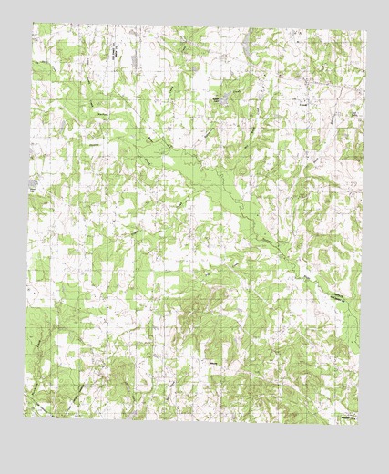
Carroll, TX USGS Topographic Map
Click on map above to begin viewing in our Map Viewer.

This topographic map contains these locations and features:
Feature Name Type Latitude Longitude GNIS ID View Map
Allen BranchStreamN32.4293°W95.5286°1372269View Map
Basslake Airport (historical)AirportN32.4868°W95.5619°1387672View Map
Big Sandy CreekStreamN32.4871°W95.6239°1372563View Map
Butler DamDamN32.4768°W95.5536°1854723View Map
Butler LakeReservoirN32.4774°W95.5527°1353423View Map
Caney CreekStreamN32.4621°W95.5713°1372920View Map
CarrollPopulated PlaceN32.4774°W95.5202°1353873View Map
Clark SpringSpringN32.4729°W95.5049°1889941View Map
Clear Spring ChurchChurchN32.4765°W95.5711°1354644View Map
Cypress Creek Branch LibraryBuildingN32.4946°W95.5125°2015010View Map
Dover CemeteryCemeteryN32.4865°W95.5247°1356223View Map
Galena CemeteryCemeteryN32.4924°W95.5833°1357823View Map
Galena ChurchChurchN32.4940°W95.5961°1369960View Map
Horsley CreekStreamN32.4460°W95.5475°1359683View Map
Hunter Brush DamDamN32.4901°W95.5419°1854719View Map
Hunter Brush LakeReservoirN32.4901°W95.5419°1854720View Map
Jacob CemeteryCemeteryN32.4424°W95.5765°1360123View Map
MidwayPopulated PlaceN32.3946°W95.5597°2034663View Map
Midway Volunteer Fire DepartmentBuildingN32.3915°W95.5504°2655614View Map
Mill Break CreekStreamN32.4488°W95.5488°1362855View Map
New Harmony CemeteryCemeteryN32.4529°W95.5986°1363714View Map
Pleasant Hill ChurchChurchN32.3846°W95.5675°1365434View Map
Prairie CreekStreamN32.4488°W95.5516°1365719View Map
Prairie Creek SchoolSchoolN32.4246°W95.5738°1365723View Map
PrimrosePopulated PlaceN32.4335°W95.6041°2034649View Map
Primrose SchoolSchoolN32.4335°W95.6100°1365793View Map
Rattlesnake CreekStreamN32.4599°W95.5625°1375640View Map
Sexton ChapelChurchN32.4335°W95.6016°1368005View Map
Shiloh LakeReservoirN32.4504°W95.6236°1368177View Map
Starr LakeReservoirN32.4891°W95.5867°1854722View Map
Starr Lake DamDamN32.4868°W95.5852°1854721View Map
Young LakeReservoirN32.4670°W95.6135°1859784View Map
Young Lake DamDamN32.4685°W95.6136°1859783View Map

Note: Coordinates in the location and feature list above are referenced to NAD83 datum.


Copyright (C) 2008-2025 Ryan Niemi / Sunset Dynamics ... All Rights Reserved