TopoQuest Logo
Do you find TopoQuest useful?
Help keep TopoQuest running and adding new maps/features by donating!
Bitcoin:  19c7KJd3qBynnjoSw5npx9KScwjBe4ifkT
Litecoin:  LXs6TkuXGGXo1vDsWCkWVdjQX94eUKd6ui
Home View Maps Find Maps Find Places Resources & Links


Lindale, Texas Topographic Map

USGS Map Title: Lindale, TX
USGS Map MRC: 32095E4
DRG (GeoTIFF) Download: o32095e4.tif


Neighboring USGS Topographic Map Quads:


  Golden, TX  
32095F5
 

  Mineola, TX  
32095F4
 

  Hainesville, TX  
32095F3
 

  Van Lake, TX  
32095E5
 

  Lindale, TX  
32095E4
 

  Crow, TX  
32095E3
 

  Carroll, TX  
32095D5
 

  Mount Sylvan, TX  
32095D4
 

  Tyler North, TX  
32095D3


Map MRC Location:

N33°
W96°
N33°
W95°
H8 H7 H6 H5 H4 H3 H2 H1
G8 G7 G6 G5 G4 G3 G2 G1
F8 F7 F6 F5 F4 F3 F2 F1
E8 E7 E6 E5 E4 E3 E2 E1
D8 D7 D6 D5 D4 D3 D2 D1
C8 C7 C6 C5 C4 C3 C2 C1
B8 B7 B6 B5 B4 B3 B2 B1
A8 A7 A6 A5 A4 A3 A2 A1
N32°
W96°
N32°
W95°

Lindale, TX USGS 1:24K Topographic Map Preview:
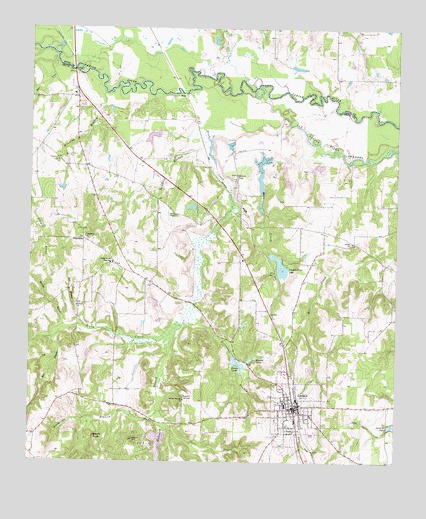
Lindale, TX USGS Topographic Map
Click on map above to begin viewing in our Map Viewer.

This topographic map contains these locations and features:
Feature Name Type Latitude Longitude GNIS ID View Map
Bartley BranchStreamN32.5385°W95.4866°1330107View Map
Bell BranchStreamN32.5357°W95.4922°1330365View Map
Bible Baptist ChurchChurchN32.5018°W95.3900°2023546View Map
Bowdoin BranchStreamN32.5943°W95.4400°1331118View Map
Bragg Morris High SchoolSchoolN32.5574°W95.4713°1331187View Map
Carmel ChurchChurchN32.5449°W95.4838°1332170View Map
Davis BranchStreamN32.5104°W95.4533°1334080View Map
Duck CreekStreamN32.5993°W95.4136°1373490View Map
First United Methodist Church of LindaleChurchN32.5151°W95.4133°2023393View Map
Flewellen CemeteryCemeteryN32.5868°W95.4905°1335952View Map
Flewellen CemeteryCemeteryN32.5879°W95.4869°1335953View Map
Fraser Farm Airport (historical)AirportN32.5662°W95.4683°1387083View Map
FriendshipPopulated PlaceN32.5643°W95.4819°1378332View Map
Friendship ChurchChurchN32.5649°W95.4811°1336234View Map
Friendship ChurchChurchN32.5704°W95.4886°2023409View Map
Hall BranchStreamN32.5393°W95.4811°1337244View Map
Harris ChapelChurchN32.5712°W95.4500°1337385View Map
Harris Chapel LakeReservoirN32.5734°W95.4454°1854820View Map
Harris Chapel Lake DamDamN32.5735°W95.4436°1854819View Map
Hide-A-Way Lake Number TwoReservoirN32.5040°W95.4559°1372158View Map
Hubbard BranchStreamN32.5393°W95.4472°1338202View Map
Hubbard CemeteryCemeteryN32.5065°W95.4641°1338203View Map
Lake-Hide-Away Dam Number 2DamN32.5085°W95.4536°1854813View Map
Lake-Hide-Away Number 2ReservoirN32.5085°W95.4536°1854814View Map
LindalePopulated PlaceN32.5157°W95.4094°1339958View Map
Lindale Club DamDamN32.5601°W95.4186°1854809View Map
Lindale Club LakeReservoirN32.5565°W95.4149°1339959View Map
Lindale DivisionCivilN32.5286°W95.4686°1938923View Map
Lindale Fire Department Station 1BuildingN32.5163°W95.4079°2655158View Map
Lindale High SchoolSchoolN32.5165°W95.3983°2008799View Map
Lindale Intermediate SchoolSchoolN32.5085°W95.4083°2008800View Map
Lindale Middle SchoolSchoolN32.5085°W95.4086°2008801View Map
Lindale Post OfficePost OfficeN32.5107°W95.4102°2731150View Map
Lindale Primary SchoolSchoolN32.5154°W95.4119°2008802View Map
Lorraine LakeReservoirN32.5104°W95.3753°1340559View Map
Luckeible BranchStreamN32.5151°W95.4555°1340723View Map
Macs CreekStreamN32.5896°W95.3994°1340819View Map
Macs Creek DamDamN32.5868°W95.4186°1854817View Map
Macs Creek LakeReservoirN32.5841°W95.4212°1854818View Map
Mount SinaiSummitN32.5071°W95.4775°1347165View Map
Oakhurst FarmLocaleN32.5821°W95.4291°1343012View Map
Rock CreekStreamN32.6164°W95.4918°1375779View Map
Sabine ChurchChurchN32.5635°W95.3902°1345802View Map
Smith LakeReservoirN32.5942°W95.4575°1854822View Map
Smith Lake DamDamN32.5951°W95.4552°1854821View Map
Stevenson BranchStreamN32.5454°W95.4441°1347911View Map
Stewart LakesReservoirN32.5303°W95.4231°1347922View Map
Tomlin LakeReservoirN32.5282°W95.4290°1348635View Map
Tomlin Lake DamDamN32.5301°W95.4302°1854815View Map
Velma Penny Elementary SchoolSchoolN32.5063°W95.4169°2008766View Map
Walnut SpringSpringN32.5186°W95.4478°1349449View Map
Walnut Springs ChurchChurchN32.5182°W95.4469°1349454View Map
Winding BranchStreamN32.6062°W95.4747°1350291View Map

Note: Coordinates in the location and feature list above are referenced to NAD83 datum.


Copyright (C) 2008-2025 Ryan Niemi / Sunset Dynamics ... All Rights Reserved