TopoQuest Logo
Do you find TopoQuest useful?
Help keep TopoQuest running and adding new maps/features by donating!
Bitcoin:  19c7KJd3qBynnjoSw5npx9KScwjBe4ifkT
Litecoin:  LXs6TkuXGGXo1vDsWCkWVdjQX94eUKd6ui
Home View Maps Find Maps Find Places Resources & Links


Cottageville, West Virginia Topographic Map

USGS Map Title: Cottageville, WV
USGS Map MRC: 38081G7
DRG (GeoTIFF) Download: o38081g7.tif


Neighboring USGS Topographic Map Quads:


  New Haven, WV  
38081H8
 

  Ravenswood, WV  
38081H7
 

  Sandyville, WV  
38081H6
 

  Mount Alto, WV  
38081G8
 

  Cottageville, WV  
38081G7
 

  Ripley, WV  
38081G6
 

  Robertsburg, WV  
38081F8
 

  Elmwood, WV  
38081F7
 

  Kenna, WV  
38081F6


Map MRC Location:

N39°
W82°
N39°
W81°
H8 H7 H6 H5 H4 H3 H2 H1
G8 G7 G6 G5 G4 G3 G2 G1
F8 F7 F6 F5 F4 F3 F2 F1
E8 E7 E6 E5 E4 E3 E2 E1
D8 D7 D6 D5 D4 D3 D2 D1
C8 C7 C6 C5 C4 C3 C2 C1
B8 B7 B6 B5 B4 B3 B2 B1
A8 A7 A6 A5 A4 A3 A2 A1
N38°
W82°
N38°
W81°

Cottageville, WV USGS 1:24K Topographic Map Preview:
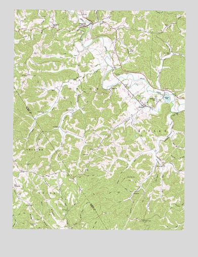
Cottageville, WV USGS Topographic Map
Click on map above to begin viewing in our Map Viewer.

This topographic map contains these locations and features:
Feature Name Type Latitude Longitude GNIS ID View Map
AngeronaPopulated PlaceN38.8306°W81.8043°1553729View Map
Ankrum CemeteryCemeteryN38.8712°W81.8515°1534960View Map
Antioch ChurchChurchN38.8354°W81.8318°1534976View Map
Antioch Church CemeteryCemeteryN38.8358°W81.8321°2726714View Map
Bar RunStreamN38.8540°W81.8226°1535204View Map
Beech Grove School (historical)SchoolN38.8018°W81.8257°1559892View Map
Big Horse LakeReservoirN38.7978°W81.7566°1558922View Map
Big Horse RunStreamN38.8040°W81.7610°1535865View Map
Big Spruce CemeteryCemeteryN38.7610°W81.8340°2727627View Map
Big Spruce CemeteryCemeteryN38.7609°W81.8343°1535974View Map
Big Spruce School (historical)SchoolN38.7623°W81.8354°1560138View Map
Blaine Memorial CemeteryCemeteryN38.8623°W81.8279°1536072View Map
Boyce CemeteryCemeteryN38.8662°W81.7629°1536271View Map
Brown School (historical)SchoolN38.8437°W81.8299°1559895View Map
Bull RunStreamN38.7831°W81.7660°1536703View Map
Bush CemeteryCemeteryN38.8520°W81.7899°1536778View Map
Cherry Grove CemeteryCemeteryN38.8167°W81.8524°1537239View Map
Cossin CemeteryCemeteryN38.8004°W81.8565°1537694View Map
CottagevillePopulated PlaceN38.8656°W81.8235°1554196View Map
Cottageville CemeteryCemeteryN38.8382°W81.7989°2586293View Map
Cottageville ChurchChurchN38.8379°W81.7987°1537696View Map
Cottageville Elementary SchoolSchoolN38.8665°W81.8263°1559913View Map
Cottageville Post OfficePost OfficeN38.8671°W81.8196°1559914View Map
Cow RunStreamN38.8442°W81.8068°1537745View Map
Creston CemeteryCemeteryN38.7865°W81.8649°1678894View Map
Creston ChurchChurchN38.7868°W81.8649°1537817View Map
DanstownPopulated PlaceN38.7709°W81.7868°1554255View Map
EvansPopulated PlaceN38.8204°W81.7796°1554416View Map
Evans Elementary SchoolSchoolN38.8223°W81.7834°1559928View Map
Evans Post OfficePost OfficeN38.8214°W81.7793°1559929View Map
Evergreen HillsPopulated PlaceN38.8651°W81.8468°1538771View Map
Fairview ChurchChurchN38.8376°W81.8651°1538812View Map
Fairview School (historical)SchoolN38.8376°W81.8651°1559932View Map
Falls RunStreamN38.8670°W81.8187°1538884View Map
Flagrock School (historical)SchoolN38.7876°W81.8107°1559937View Map
Foster ChapelChurchN38.7554°W81.7782°1539166View Map
Foster Chapel CemeteryCemeteryN38.7752°W81.7787°2726739View Map
Foster RidgeRidgeN38.7743°W81.7718°1539168View Map
Grass RunStreamN38.8287°W81.8415°1539607View Map
GunvillePopulated PlaceN38.7748°W81.8726°1549720View Map
Gunville RidgeRidgeN38.7654°W81.8643°1539797View Map
Horse Cave RunStreamN38.7593°W81.8351°1540475View Map
Huntsville (historical)Populated PlaceN38.8315°W81.8401°1559955View Map
Hutchinson Farm Pond DamDamN38.8368°W81.7915°1558915View Map
Hutchison LakeReservoirN38.8254°W81.7710°1540642View Map
Isaacs RunStreamN38.8301°W81.7782°1540731View Map
Johns RunStreamN38.7937°W81.7724°1540966View Map
Kapp RidgeRidgeN38.7681°W81.8471°1541077View Map
Kay HollowValleyN38.7745°W81.7810°1541089View Map
King CemeteryCemeteryN38.7726°W81.8274°1541207View Map
Left Fork Cow RunStreamN38.8309°W81.8304°1541646View Map
Left Fork Mud RunStreamN38.8501°W81.7604°1541696View Map
Lieu HollowValleyN38.7879°W81.7707°1541953View Map
Little Horse Cave RunStreamN38.7509°W81.8337°1542116View Map
Little Horse LakeReservoirN38.8034°W81.7549°1558924View Map
Lloyd Casto SpringSpringN38.7751°W81.8743°1560242View Map
Locust Grove RidgeRidgeN38.8673°W81.7607°1542297View Map
Locust Grove School (historical)SchoolN38.8684°W81.7576°1559976View Map
Loglick RunStreamN38.8412°W81.8032°1542319View Map
Lone Oak School (historical)SchoolN38.8620°W81.8460°1559985View Map
Lonepine School (historical)SchoolN38.8623°W81.7999°1559981View Map
Long Bottom Church (historical)ChurchN38.8037°W81.8374°1559982View Map
Longview CemeteryCemeteryN38.7921°W81.8206°2586200View Map
Longview ChurchChurchN38.7926°W81.8204°1542442View Map
Longview School (historical)SchoolN38.7956°W81.8157°1542443View Map
Martin ChapelChurchN38.8506°W81.7612°1542810View Map
McDade CemeteryCemeteryN38.7526°W81.8593°1542983View Map
McKinley School (historical)SchoolN38.7504°W81.7760°1559990View Map
Mount MoriahPopulated PlaceN38.7865°W81.7657°1549837View Map
Mount Moriah Church CemeteryCemeteryN38.7881°W81.7656°2726911View Map
Mount Tabor Church CemeteryCemeteryN38.7652°W81.8667°2728459View Map
Mountain Flower School (historical)SchoolN38.7626°W81.7579°1560002View Map
Mud RunStreamN38.8287°W81.7729°1543912View Map
New Interest School (historical)SchoolN38.8515°W81.7607°1560015View Map
Otterbein CemeteryCemeteryN38.8315°W81.7940°2586150View Map
Otterbein ChurchChurchN38.8318°W81.7935°1544467View Map
Parchment CreekStreamN38.8168°W81.7590°1544570View Map
ProvidencePopulated PlaceN38.8084°W81.8415°1555420View Map
Right Fork Cow RunStreamN38.8309°W81.8304°1545629View Map
Right Fork Mud RunStreamN38.8501°W81.7604°1545682View Map
Rollins LakeReservoirN38.8249°W81.7632°1546052View Map
Rollins Lake Wildlife Management AreaParkN38.8251°W81.7612°2043550View Map
RoundknobSummitN38.7798°W81.7915°1546115View Map
Roundknob RunStreamN38.7901°W81.7718°1546116View Map
Salem CemeteryCemeteryN38.7698°W81.8712°1546281View Map
Sayre CemeteryCemeteryN38.7715°W81.7987°1546470View Map
Silver ValleyStreamN38.8309°W81.8304°1546790View Map
Silver Valley School (historical)SchoolN38.8176°W81.8312°1546791View Map
Staats CemeteryCemeteryN38.8262°W81.7840°1547301View Map
Stewarts HollowValleyN38.7679°W81.7885°1547411View Map
Sugar RunStreamN38.8679°W81.8151°1547657View Map
Taber CemeteryCemeteryN38.7640°W81.8624°1678915View Map
Tabor ChurchChurchN38.7634°W81.8624°1547860View Map
Victory School (historical)SchoolN38.7523°W81.7937°1560082View Map
Walnut Grove School (historical)SchoolN38.8329°W81.7954°1560084View Map
West Virginia Baptist Church Camp DamDamN38.8034°W81.7549°1558923View Map
Western DistrictCivilN38.8192°W81.7618°1928409View Map
Wv Baptist Church Camp DamDamN38.7968°W81.7549°1558921View Map
Zion Church CemeteryCemeteryN38.7649°W81.7903°2726947View Map

Note: Coordinates in the location and feature list above are referenced to NAD83 datum.


Copyright (C) 2008-2024 Ryan Niemi / Sunset Dynamics ... All Rights Reserved