TopoQuest Logo
Do you find TopoQuest useful?
Help keep TopoQuest running and adding new maps/features by donating!
Bitcoin:  19c7KJd3qBynnjoSw5npx9KScwjBe4ifkT
Litecoin:  LXs6TkuXGGXo1vDsWCkWVdjQX94eUKd6ui
Home View Maps Find Maps Find Places Resources & Links


Elmwood, West Virginia Topographic Map

USGS Map Title: Elmwood, WV
USGS Map MRC: 38081F7
DRG (GeoTIFF) Download: o38081f7.tif


Neighboring USGS Topographic Map Quads:


  Mount Alto, WV  
38081G8
 

  Cottageville, WV  
38081G7
 

  Ripley, WV  
38081G6
 

  Robertsburg, WV  
38081F8
 

  Elmwood, WV  
38081F7
 

  Kenna, WV  
38081F6
 

  Winfield, WV  
38081E8
 

  Bancroft, WV  
38081E7
 

  Sissonville, WV  
38081E6


Map MRC Location:

N39°
W82°
N39°
W81°
H8 H7 H6 H5 H4 H3 H2 H1
G8 G7 G6 G5 G4 G3 G2 G1
F8 F7 F6 F5 F4 F3 F2 F1
E8 E7 E6 E5 E4 E3 E2 E1
D8 D7 D6 D5 D4 D3 D2 D1
C8 C7 C6 C5 C4 C3 C2 C1
B8 B7 B6 B5 B4 B3 B2 B1
A8 A7 A6 A5 A4 A3 A2 A1
N38°
W82°
N38°
W81°

Elmwood, WV USGS 1:24K Topographic Map Preview:
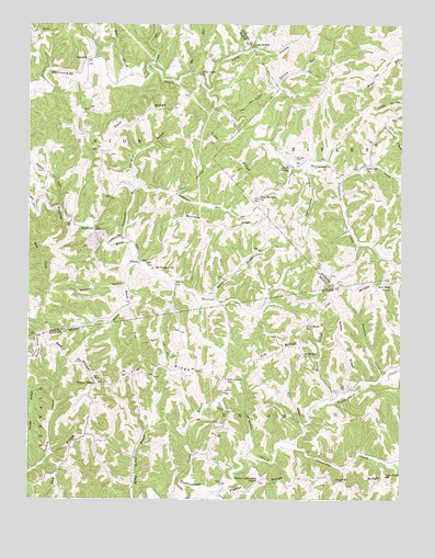
Elmwood, WV USGS Topographic Map
Click on map above to begin viewing in our Map Viewer.

This topographic map contains these locations and features:
Feature Name Type Latitude Longitude GNIS ID View Map
Arthur Barnett SpringSpringN38.6301°W81.7849°1678192View Map
Bailey BranchStreamN38.6770°W81.8135°1535115View Map
Baker BranchStreamN38.7345°W81.8437°1535142View Map
Barnett Community ChapelChurchN38.6298°W81.7974°1535266View Map
Barnette CemeteryCemeteryN38.7151°W81.7860°1535271View Map
Barnette Chapel CemeteryCemeteryN38.6295°W81.7975°2586131View Map
Bee RidgeRidgeN38.6468°W81.8543°1535492View Map
Bee RunStreamN38.7370°W81.8215°1535508View Map
Beech ForkStreamN38.6870°W81.8382°1535523View Map
Bill King BranchStreamN38.7065°W81.8390°1535996View Map
Buckelew HollowValleyN38.6579°W81.7565°1536580View Map
Cain RidgeRidgeN38.7243°W81.8243°1536848View Map
Cherry ForkStreamN38.6265°W81.8165°1537237View Map
Clendenin CreekStreamN38.6387°W81.7851°1537400View Map
Coal HollowValleyN38.7054°W81.8257°1537451View Map
Cobb SpringSpringN38.6404°W81.8549°1678191View Map
DeerlickLocaleN38.7406°W81.8554°1538114View Map
Early Castro SpringSpringN38.6801°W81.7612°1678184View Map
ElmwoodPopulated PlaceN38.6956°W81.8529°1549673View Map
Fisher RidgeRidgeN38.6298°W81.7824°1538995View Map
Harris BranchStreamN38.6501°W81.7743°1540005View Map
Hill BranchStreamN38.6445°W81.7821°1540280View Map
Jim RidgeRidgeN38.6629°W81.7901°1540899View Map
Kenneth Asbury SpringSpringN38.6434°W81.8054°1678189View Map
Kenneth Asbury SpringSpringN38.6423°W81.8132°1678190View Map
Left Fork Clendenin CreekStreamN38.6348°W81.7504°1541644View Map
Little Spruce RunStreamN38.7262°W81.8076°1542227View Map
Lone Grove School (historical)SchoolN38.6304°W81.7546°1542325View Map
Lone Oak ChurchChurchN38.7126°W81.7624°1542327View Map
Long HollowValleyN38.6420°W81.8004°1542377View Map
Long HollowValleyN38.7329°W81.8151°1542382View Map
Long Hollow Baptist Church CemeteryCemeteryN38.7445°W81.7995°2726764View Map
Long Hollow ChurchChurchN38.7445°W81.8001°1542383View Map
Martin CemeteryCemeteryN38.6529°W81.7715°1542807View Map
Morrison RidgeRidgeN38.6968°W81.8126°1543588View Map
Moss Chapel CemeteryCemeteryN38.6815°W81.7531°2586215View Map
Mount Olive CemeteryCemeteryN38.7034°W81.7961°2726912View Map
Mount Prospect CemeteryCemeteryN38.6860°W81.8335°2728458View Map
Mount Prospect ChurchChurchN38.6856°W81.8335°1543752View Map
Mount Zion CemeteryCemeteryN38.6628°W81.7829°2586146View Map
Mount Zion ChurchChurchN38.6631°W81.7826°1543824View Map
New Home School (historical)SchoolN38.6706°W81.7826°1544119View Map
New Jersey School (historical)SchoolN38.6562°W81.8087°1544129View Map
New Moss ChapelChurchN38.6815°W81.7537°1544133View Map
New Mount Olive ChurchChurchN38.7040°W81.7976°1544134View Map
Pennington SpringSpringN38.6273°W81.8112°1678194View Map
Peppermint CreekStreamN38.7090°W81.7707°1544711View Map
Riffee RidgeRidgeN38.6676°W81.7715°1545587View Map
Right Fork Clendenin CreekStreamN38.6348°W81.7504°1545627View Map
Rock CastleLocaleN38.7126°W81.7868°1545897View Map
Rock Castle ChurchChurchN38.7370°W81.8179°1545898View Map
Sapsucker RunStreamN38.6926°W81.8440°1546430View Map
Sayre CemeteryCemeteryN38.7417°W81.8157°1546469View Map
Spruce RunStreamN38.7393°W81.8346°1547274View Map
Sulug BranchStreamN38.6284°W81.8215°1547724View Map
Tightsqueeze HollowValleyN38.7120°W81.7821°1548093View Map
TribblePopulated PlaceN38.6876°W81.8379°1555823View Map
Union DistrictCivilN38.7153°W81.8727°1928387View Map
Walker ChapelChurchN38.6551°W81.8518°1548720View Map
Walker Chapel CemeteryCemeteryN38.6555°W81.8520°2586206View Map
Warner BranchStreamN38.6754°W81.8418°1548802View Map
Warner CemeteryCemeteryN38.6487°W81.8090°1548803View Map
Williams HollowValleyN38.6812°W81.8429°1549175View Map

Note: Coordinates in the location and feature list above are referenced to NAD83 datum.


Copyright (C) 2008-2025 Ryan Niemi / Sunset Dynamics ... All Rights Reserved