TopoQuest Logo
Do you find TopoQuest useful?
Help keep TopoQuest running and adding new maps/features by donating!
Bitcoin:  19c7KJd3qBynnjoSw5npx9KScwjBe4ifkT
Litecoin:  LXs6TkuXGGXo1vDsWCkWVdjQX94eUKd6ui
Home View Maps Find Maps Find Places Resources & Links


Covert, Michigan Topographic Map

USGS Map Title: Covert, MI
USGS Map MRC: 42086C3
DRG (GeoTIFF) Download: o42086c3.tif


Neighboring USGS Topographic Map Quads:


  South Haven, MI  
42086D3
 

  Lacota, MI  
42086D2


  Covert, MI  
42086C3
 

  McDonald, MI  
42086C2
 

  Benton Heights, MI  
42086B4
 

  Coloma, MI  
42086B3
 

  Hartford, MI  
42086B2


Map MRC Location:

N43°
W87°
N43°
W86°
H8 H7 H6 H5 H4 H3 H2 H1
G8 G7 G6 G5 G4 G3 G2 G1
F8 F7 F6 F5 F4 F3 F2 F1
E8 E7 E6 E5 E4 E3 E2 E1
D8 D7 D6 D5 D4 D3 D2 D1
C8 C7 C6 C5 C4 C3 C2 C1
B8 B7 B6 B5 B4 B3 B2 B1
A8 A7 A6 A5 A4 A3 A2 A1
N42°
W87°
N42°
W86°

Covert, MI USGS 1:24K Topographic Map Preview:
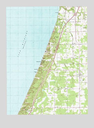
Covert, MI USGS Topographic Map
Click on map above to begin viewing in our Map Viewer.

This topographic map contains these locations and features:
Feature Name Type Latitude Longitude GNIS ID View Map
Blue Star ChurchChurchN42.3556°W86.2878°1618431View Map
Brandywine CreekStreamN42.3145°W86.3200°621894View Map
BraywoodPopulated PlaceN42.2628°W86.3459°1617460View Map
Camp Na Wa KwaLocaleN42.3523°W86.3000°622608View Map
Charter Township of South HavenCivilN42.3655°W86.2576°1627099View Map
Consumers Power Company HeliportAirportN42.3273°W86.3047°1624161View Map
CovertPopulated PlaceN42.2936°W86.2622°623919View Map
Covert Branch LibraryBuildingN42.2950°W86.2622°2574975View Map
Covert CemeteryCemeteryN42.2986°W86.2611°2574964View Map
Covert Community ChurchChurchN42.3089°W86.2622°2574970View Map
Covert High SchoolSchoolN42.2889°W86.2611°2574976View Map
Covert Historical MuseumBuildingN42.2950°W86.2622°2574971View Map
Covert Library Historical MarkerParkN42.2944°W86.2630°2570904View Map
Covert Medical CenterHospitalN42.2944°W86.2628°2574973View Map
Covert Post OfficePost OfficeN42.2956°W86.2622°2574972View Map
Covert Station (historical)LocaleN42.2956°W86.2583°2574965View Map
Covert Township Fire and Emergency Medical ServicesBuildingN42.2943°W86.2629°2636027View Map
Covert Township ParkParkN42.2989°W86.3259°1618433View Map
Covert Township Police DepartmentBuildingN42.2951°W86.2622°2737492View Map
Covert/South Haven KOA CampgroundLocaleN42.2744°W86.2617°2574974View Map
Crystal BeachPopulated PlaceN42.3567°W86.2981°624165View Map
Deerlick CreekStreamN42.3723°W86.2934°624504View Map
Deerlick SchoolSchoolN42.3736°W86.2834°624505View Map
Dune Lake CampgroundLocaleN42.2569°W86.3278°2365071View Map
Dyckman SwampSwampN42.3389°W86.2975°1618435View Map
Emanuel HomeChurchN42.2520°W86.2645°625552View Map
Emmanuel Home CemeteryCemeteryN42.2508°W86.2625°2574955View Map
First Baptist ChurchChurchN42.3028°W86.2619°2574969View Map
First Spiritual Church of GodChurchN42.2939°W86.2650°2574966View Map
Fish CemeteryCemeteryN42.2656°W86.2981°1618439View Map
Fish CornersPopulated PlaceN42.2592°W86.3022°1618438View Map
Fish SchoolSchoolN42.2575°W86.3009°626050View Map
Gospel Tabernacle Baptist ChurchChurchN42.2989°W86.2622°2574967View Map
Interchange 13CrossingN42.3017°W86.3086°2575011View Map
Interchange 18CrossingN42.3653°W86.2683°2575012View Map
Law SchoolSchoolN42.3603°W86.2684°630202View Map
Linden HillsPopulated PlaceN42.3042°W86.3247°630498View Map
Mitchell Brothers Mobile Home ParkPopulated PlaceN42.3594°W86.2806°2574635View Map
Mud LakeLakeN42.2781°W86.3014°1618432View Map
Packard Gospel CenterChurchN42.3314°W86.2703°634281View Map
Packard Post Office (historical)Post OfficeN42.3314°W86.2661°2574427View Map
Palisades ParkPopulated PlaceN42.3125°W86.3211°634305View Map
Pallisades Park Post Office (historical)Post OfficeN42.3125°W86.3211°1926626View Map
Rogers CreekStreamN42.2539°W86.3570°636117View Map
Roosevelt HillsLocaleN42.3334°W86.3097°636154View Map
Seventh-Day Adventist ChurchChurchN42.2981°W86.2622°2574968View Map
South Haven Area Regional AirportAirportN42.3468°W86.2587°1618430View Map
Thunder MountainSummitN42.2559°W86.3484°1614840View Map
Township of CovertCivilN42.2838°W86.2810°1626138View Map
Trinity ChurchChurchN42.3311°W86.2706°1618434View Map
Van Buren CountyCivilN42.2851°W86.3064°1623020View Map
Van Buren State ParkLocaleN42.3478°W86.3009°1615467View Map
WCSY-FM (South Haven)TowerN42.3006°W86.2509°1625501View Map
WildwoodPopulated PlaceN42.3664°W86.2948°1617945View Map

Note: Coordinates in the location and feature list above are referenced to NAD83 datum.


Copyright (C) 2008-2025 Ryan Niemi / Sunset Dynamics ... All Rights Reserved