TopoQuest Logo
Do you find TopoQuest useful?
Help keep TopoQuest running and adding new maps/features by donating!
Bitcoin:  19c7KJd3qBynnjoSw5npx9KScwjBe4ifkT
Litecoin:  LXs6TkuXGGXo1vDsWCkWVdjQX94eUKd6ui
Home View Maps Find Maps Find Places Resources & Links


Lacota, Michigan Topographic Map

USGS Map Title: Lacota, MI
USGS Map MRC: 42086D2
DRG (GeoTIFF) Download: o42086d2.tif


Neighboring USGS Topographic Map Quads:


  Glenn, MI  
42086E2
 

  Fennville, MI  
42086E1
 

  South Haven, MI  
42086D3
 

  Lacota, MI  
42086D2
 

  Pullman, MI  
42086D1
 

  Covert, MI  
42086C3
 

  McDonald, MI  
42086C2
 

  Bangor, MI  
42086C1


Map MRC Location:

N43°
W87°
N43°
W86°
H8 H7 H6 H5 H4 H3 H2 H1
G8 G7 G6 G5 G4 G3 G2 G1
F8 F7 F6 F5 F4 F3 F2 F1
E8 E7 E6 E5 E4 E3 E2 E1
D8 D7 D6 D5 D4 D3 D2 D1
C8 C7 C6 C5 C4 C3 C2 C1
B8 B7 B6 B5 B4 B3 B2 B1
A8 A7 A6 A5 A4 A3 A2 A1
N42°
W87°
N42°
W86°

Lacota, MI USGS 1:24K Topographic Map Preview:
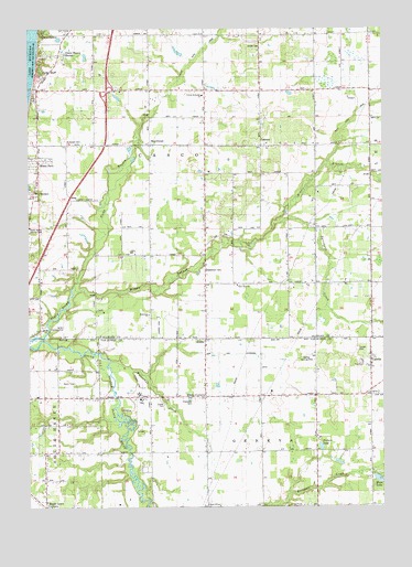
Lacota, MI USGS Topographic Map
Click on map above to begin viewing in our Map Viewer.

This topographic map contains these locations and features:
Feature Name Type Latitude Longitude GNIS ID View Map
Beechdale SchoolSchoolN42.4628°W86.1784°621001View Map
Beeches Golf ClubLocaleN42.3828°W86.1958°2574667View Map
Black River DrainStreamN42.4848°W86.1989°1623095View Map
Butternut CreekStreamN42.4131°W86.2225°622387View Map
Buys SchoolSchoolN42.4914°W86.2275°622400View Map
Casco ChurchChurchN42.4984°W86.1881°1618701View Map
Cedar BluffPopulated PlaceN42.4856°W86.2461°622889View Map
Chambers CemeteryCemeteryN42.4034°W86.1917°1618709View Map
Chambers SchoolSchoolN42.4045°W86.1975°623054View Map
Church of GodChurchN42.3753°W86.1831°1618708View Map
Church of the NazareneChurchN42.4033°W86.2447°2574526View Map
Crow SchoolSchoolN42.4328°W86.1495°624143View Map
Demler Landing Strip (historical)AirportN42.4145°W86.1525°1618712View Map
Eastman CreekStreamN42.3753°W86.1672°1618824View Map
Elm Creek DrainStreamN42.4784°W86.1334°625501View Map
Evergreen Glade SchoolSchoolN42.4411°W86.2156°625709View Map
Farnum SchoolSchoolN42.4303°W86.2486°625843View Map
Fideland Fun ParkLocaleN42.4044°W86.2097°2574687View Map
Geneva Center SchoolSchoolN42.3756°W86.1686°626722View Map
Gingerman RacewayLocaleN42.4053°W86.1478°2574640View Map
Glenn Haven ShoresPopulated PlaceN42.4925°W86.2375°1618702View Map
Glenn StoresPopulated PlaceN42.4984°W86.2356°1617981View Map
Grace Apostolic Tabernacle ChurchChurchN42.4075°W86.1972°2574527View Map
Hadaway SchoolSchoolN42.4917°W86.2067°627580View Map
HawkheadPopulated PlaceN42.4695°W86.2073°1617613View Map
Hawkhead Post Office (historical)Post OfficeN42.4694°W86.2072°2573916View Map
Hawkshead LinksLocaleN42.4611°W86.2272°2573391View Map
HollywoodPopulated PlaceN42.4928°W86.2389°1617624View Map
Iddle SchoolSchoolN42.4825°W86.1545°628922View Map
Interchange 26CrossingN42.4839°W86.2222°2574077View Map
KibbiePopulated PlaceN42.4189°W86.1875°629650View Map
Kibbie ChapelChurchN42.4334°W86.1867°629651View Map
Kibbie Christian Reformed ChurchChurchN42.4172°W86.1875°2572318View Map
Kibbie CornersLocaleN42.4042°W86.1875°623052View Map
Kibbie Post Office (historical)Post OfficeN42.4186°W86.1881°2574432View Map
Kibbie SchoolSchoolN42.4195°W86.1970°629652View Map
Kibbie Station (historical)LocaleN42.4189°W86.1881°2574412View Map
LacotaPopulated PlaceN42.4136°W86.1298°629933View Map
Lacota CemeteryCemeteryN42.4164°W86.1342°1618711View Map
Lacota ChurchChurchN42.4048°W86.1297°1618710View Map
Lacota Post OfficePost OfficeN42.4139°W86.1292°2574498View Map
Lacota Station (historical)LocaleN42.4142°W86.1292°2574413View Map
Lake Michigan College-South Haven CampusSchoolN42.4097°W86.2436°2574651View Map
Lannin SchoolSchoolN42.4028°W86.2398°630139View Map
LeisurePopulated PlaceN42.4695°W86.1684°630291View Map
Leisure Post Office (historical)Post OfficeN42.4694°W86.1683°2573915View Map
Locota SchoolSchoolN42.4050°W86.1303°630866View Map
Macedonia ChurchChurchN42.4253°W86.2078°1618703View Map
Manitt LakeLakeN42.4464°W86.1778°631395View Map
Maple Grove CornersPopulated PlaceN42.3756°W86.2439°1618707View Map
McDowell CemeteryCemeteryN42.4709°W86.2370°1618706View Map
McDowell SchoolSchoolN42.4689°W86.2364°631883View Map
Middle Branch Black RiverStreamN42.4325°W86.2334°632247View Map
Moon LakeLakeN42.3823°W86.1263°632629View Map
Mount PleasantPopulated PlaceN42.4573°W86.2473°632833View Map
North Branch Black RiverStreamN42.4184°W86.2495°633575View Map
Ockford DrainStreamN42.4845°W86.1367°1617402View Map
Open Door ChurchChurchN42.4331°W86.1767°1618713View Map
Picture LakeLakeN42.3906°W86.1472°635051View Map
Resurrection Life ChurchChurchN42.3897°W86.2056°2574524View Map
Riverside SchoolSchoolN42.3753°W86.2067°636012View Map
Sanko Landing Strip (historical)AirportN42.4225°W86.2375°1618704View Map
Scott Creek DrainStreamN42.4648°W86.1442°637463View Map
Sheldon SchoolSchoolN42.3761°W86.1303°637722View Map
South Haven Area Emergency Services Station 1 HeadquartersBuildingN42.4693°W86.2369°2636093View Map
South Haven Area Emergency Services Station 2BuildingN42.4692°W86.1685°2636094View Map
South Haven Area Emergency Services Station 4BuildingN42.4076°W86.1691°2635992View Map
South Haven Country ClubLocaleN42.4478°W86.2498°1618705View Map
South Haven Family CampgroundLocaleN42.4083°W86.1681°2574637View Map
Spicebush CreekStreamN42.4478°W86.1634°638504View Map
Stephenson CemeteryCemeteryN42.4370°W86.1881°1618714View Map
Stuller CemeteryCemeteryN42.4953°W86.1672°1618700View Map
Sulphur SpringsPopulated PlaceN42.4161°W86.2350°1617880View Map
Township of CascoCivilN42.4610°W86.1929°1626038View Map
Township of GenevaCivilN42.3756°W86.1675°1626344View Map
Tripp and Extension DrainStreamN42.4095°W86.2084°635039View Map
Trowbridge Farms Airport (historical)AirportN42.4091°W86.1703°1624162View Map
United Methodist ChurchChurchN42.4825°W86.1881°1618699View Map
Walle FieldAirportN42.4717°W86.1274°1624115View Map
WCSY-AM (South Haven)TowerN42.4381°W86.2492°1625636View Map
West Casco Post Office (historical)Post OfficeN42.4700°W86.2472°2574105View Map
Whispering Pines Estates and Mobile Home ParkPopulated PlaceN42.4017°W86.2031°2574636View Map

Note: Coordinates in the location and feature list above are referenced to NAD83 datum.


Copyright (C) 2008-2024 Ryan Niemi / Sunset Dynamics ... All Rights Reserved