TopoQuest Logo
Do you find TopoQuest useful?
Help keep TopoQuest running and adding new maps/features by donating!
Bitcoin:  19c7KJd3qBynnjoSw5npx9KScwjBe4ifkT
Litecoin:  LXs6TkuXGGXo1vDsWCkWVdjQX94eUKd6ui
Home View Maps Find Maps Find Places Resources & Links


Camptonville, California Topographic Map

USGS Map Title: Camptonville, CA
USGS Map MRC: 39121D1
DRG (GeoTIFF) Download: o39121d1.tif


Neighboring USGS Topographic Map Quads:


  Clipper Mills, CA  
39121E2
 

  Strawberry Valley, CA  
39121E1
 

  Goodyears Bar, CA  
39120E8
 

  Challenge, CA  
39121D2
 

  Camptonville, CA  
39121D1
 

  Pike, CA  
39120D8
 

  French Corral, CA  
39121C2
 

  Nevada City, CA  
39121C1
 

  North Bloomfield, CA  
39120C8


Map MRC Location:

N40°
W122°
N40°
W121°
H8 H7 H6 H5 H4 H3 H2 H1
G8 G7 G6 G5 G4 G3 G2 G1
F8 F7 F6 F5 F4 F3 F2 F1
E8 E7 E6 E5 E4 E3 E2 E1
D8 D7 D6 D5 D4 D3 D2 D1
C8 C7 C6 C5 C4 C3 C2 C1
B8 B7 B6 B5 B4 B3 B2 B1
A8 A7 A6 A5 A4 A3 A2 A1
N39°
W122°
N39°
W121°

Camptonville, CA USGS 1:24K Topographic Map Preview:
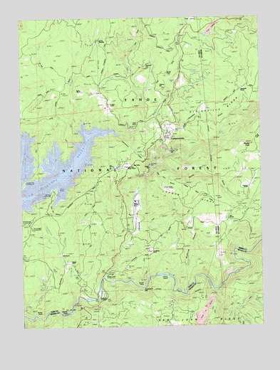
Camptonville, CA USGS Topographic Map
Click on map above to begin viewing in our Map Viewer.

This topographic map contains these locations and features:
Feature Name Type Latitude Longitude GNIS ID View Map
Alaska PeakSummitN39.4485°W121.0055°1662289View Map
Badger Hill (historical)Populated PlaceN39.3835°W121.0255°1703625View Map
Badger Hill DiggingsLocaleN39.3807°W121.0313°256419View Map
Bartsch RanchLocaleN39.4010°W121.0997°256568View Map
Beresford RanchLocaleN39.4007°W121.1211°256840View Map
Brandy CreekStreamN39.4579°W121.0602°257434View Map
Bridger CreekStreamN39.4574°W121.0930°257457View Map
Camp PendolaLocaleN39.4902°W121.0852°1662313View Map
Campbell GulchValleyN39.4610°W121.0536°257912View Map
CamptonvillePopulated PlaceN39.4518°W121.0486°1658208View Map
Camptonville CemeteryCemeteryN39.4509°W121.0480°1703473View Map
Camptonville Census Designated PlaceCensusN39.4521°W121.0487°2628715View Map
Camptonville Elementary SchoolSchoolN39.4531°W121.0484°1703474View Map
Camptonville Post OfficePost OfficeN39.4522°W121.0504°1703475View Map
Camptonville TunnelTunnelN39.4466°W121.0674°2440590View Map
Camptonville Volunteer Fire DepartmentBuildingN39.4545°W121.0465°2621913View Map
Cape HornSummitN39.4582°W121.0672°257955View Map
Celestial ValleyValleyN39.4124°W121.0680°258157View Map
Clear CreekStreamN39.3813°W121.1002°258431View Map
Dads GulchValleyN39.4899°W121.0641°259009View Map
Dark Day Boat RampLocaleN39.4316°W121.1063°275069View Map
Dark Day CanyonValleyN39.4271°W121.1069°259060View Map
Dark Day Picnic AreaLocaleN39.4277°W121.1086°275070View Map
Emory FordCrossingN39.3957°W121.0541°1703485View Map
Emory IslandIslandN39.3954°W121.0494°259920View Map
Fast CreekStreamN39.4016°W121.0397°260057View Map
Freemans Bridge (historical)BridgeN39.3896°W121.0858°1703488View Map
Freemans CrossingCrossingN39.3888°W121.0855°1658577View Map
French CreekStreamN39.4707°W121.0458°260377View Map
Galena HillSummitN39.4718°W121.0525°1658596View Map
Galena Hill (historical)Populated PlaceN39.4735°W121.0555°1703490View Map
Garden Valley (historical)Populated PlaceN39.4346°W121.1052°1703491View Map
Godfrey RanchLocaleN39.4432°W121.0050°260632View Map
Granite PointCliffN39.3810°W121.1038°224416View Map
Grizzly CreekStreamN39.4407°W121.0561°1703492View Map
Grizzly CreekStreamN39.3888°W121.0244°260913View Map
Grizzly GulchValleyN39.4404°W121.0552°260924View Map
High Point RavineValleyN39.4374°W121.0583°261327View Map
Hornswaggle Group CampgroundLocaleN39.4146°W121.1205°275067View Map
Hornswoggle CreekStreamN39.4074°W121.1044°261470View Map
Horse ValleyValleyN39.4613°W121.0541°1703494View Map
Horse Valley CreekStreamN39.4702°W121.0616°261515View Map
Jarrett SpringSpringN39.4504°W121.0194°1662442View Map
Jaybird CreekStreamN39.4752°W121.0677°261912View Map
Joubert DiggingsLocaleN39.4943°W121.0263°262029View Map
Junction House (historical)LocaleN39.4227°W121.0755°1703495View Map
Kelly RanchLocaleN39.4046°W121.1055°262113View Map
Kennedy RanchLocaleN39.4846°W121.1208°262136View Map
Little Willow CreekStreamN39.3935°W121.0991°262749View Map
Log CabinLocaleN39.4402°W121.0677°262769View Map
Log Cabin 1034-003 DamDamN39.4399°W121.0594°1664184View Map
Lohman RanchLocaleN39.4304°W121.0491°262791View Map
Lohman RidgeRidgeN39.4274°W121.0336°262792View Map
Lohman Ridge TunnelTunnelN39.4260°W121.0267°2440591View Map
Moonshine CampgroundLocaleN39.3863°W121.0913°275073View Map
Moonshine CreekStreamN39.3877°W121.0961°263798View Map
Mosquito CreekStreamN39.4138°W121.0688°263858View Map
North Yuba Ranger StationLocaleN39.4396°W121.0708°275071View Map
Oak ValleyPopulated PlaceN39.4985°W121.0380°1659275View Map
Oak Valley Guard StationLocaleN39.4954°W121.0550°264296View Map
Oregon CreekStreamN39.3949°W121.0833°264387View Map
Oregon Creek Picnic AreaLocaleN39.3952°W121.0813°275074View Map
Our HouseLocaleN39.4174°W121.0211°255005View Map
Pendola RanchLocaleN39.4902°W121.0863°1662443View Map
Pike City Volunteer Fire DepartmentBuildingN39.4185°W121.0180°2622335View Map
Porter RanchLocaleN39.4346°W121.0205°264964View Map
Pourier CreekStreamN39.4924°W121.0297°231002View Map
Rocky PointCapeN39.3824°W121.1172°265542View Map
Rothe Ranch (historical)LocaleN39.4343°W121.1038°1670474View Map
San Juan RidgeRidgeN39.3777°W121.0269°265805View Map
Schoolhouse CampgroundLocaleN39.4171°W121.1227°275068View Map
Skyline RanchLocaleN39.4704°W121.0941°266256View Map
Sleighville CreekStreamN39.4779°W121.0422°266285View Map
Sleighville HouseLocaleN39.4710°W121.0102°266286View Map
Sleighville RidgeRidgeN39.4632°W121.0233°266287View Map
Studhorse CanyonValleyN39.3954°W121.0483°267819View Map
United States Forest Service North Yuba Ranger StationBuildingN39.4397°W121.0709°2621915View Map
Wagner CreekStreamN39.4041°W121.1066°268730View Map
Wayman RanchLocaleN39.4310°W121.0072°268825View Map
Weeds PointPopulated PlaceN39.4774°W121.0497°1660140View Map
Williamson CreekStreamN39.4771°W121.0397°269129View Map
Willow CreekStreamN39.4541°W121.0769°269137View Map
Youngs HillSummitN39.4788°W121.0608°1660220View Map
Youngs Hill (historical)Populated PlaceN39.4768°W121.0677°1703523View Map

Note: Coordinates in the location and feature list above are referenced to NAD83 datum.


Copyright (C) 2008-2024 Ryan Niemi / Sunset Dynamics ... All Rights Reserved