TopoQuest Logo
Do you find TopoQuest useful?
Help keep TopoQuest running and adding new maps/features by donating!
Bitcoin:  19c7KJd3qBynnjoSw5npx9KScwjBe4ifkT
Litecoin:  LXs6TkuXGGXo1vDsWCkWVdjQX94eUKd6ui
Home View Maps Find Maps Find Places Resources & Links


Challenge, California Topographic Map

USGS Map Title: Challenge, CA
USGS Map MRC: 39121D2
DRG (GeoTIFF) Download: o39121d2.tif


Neighboring USGS Topographic Map Quads:


  Forbestown, CA  
39121E3
 

  Clipper Mills, CA  
39121E2
 

  Strawberry Valley, CA  
39121E1
 

  Rackerby, CA  
39121D3
 

  Challenge, CA  
39121D2
 

  Camptonville, CA  
39121D1
 

  Oregon House, CA  
39121C3
 

  French Corral, CA  
39121C2
 

  Nevada City, CA  
39121C1


Map MRC Location:

N40°
W122°
N40°
W121°
H8 H7 H6 H5 H4 H3 H2 H1
G8 G7 G6 G5 G4 G3 G2 G1
F8 F7 F6 F5 F4 F3 F2 F1
E8 E7 E6 E5 E4 E3 E2 E1
D8 D7 D6 D5 D4 D3 D2 D1
C8 C7 C6 C5 C4 C3 C2 C1
B8 B7 B6 B5 B4 B3 B2 B1
A8 A7 A6 A5 A4 A3 A2 A1
N39°
W122°
N39°
W121°

Challenge, CA USGS 1:24K Topographic Map Preview:
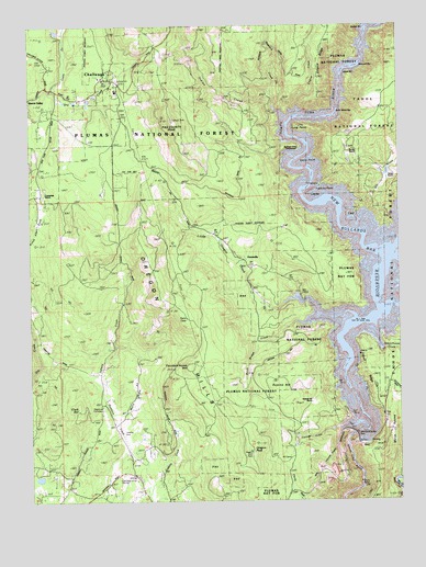
Challenge, CA USGS Topographic Map
Click on map above to begin viewing in our Map Viewer.

This topographic map contains these locations and features:
Feature Name Type Latitude Longitude GNIS ID View Map
Baker RanchLocaleN39.4610°W121.1272°256448View Map
Bullards Bar (historical)Populated PlaceN39.4227°W121.1388°1703472View Map
Bullards Bar Dam (historical)DamN39.4091°W121.1447°1670469View Map
Burnt Bridge CampgroundLocaleN39.4210°W121.1683°276501View Map
Burnt Bridge CreekStreamN39.4221°W121.1577°257721View Map
Burris RanchLocaleN39.4668°W121.1427°257734View Map
ChallengePopulated PlaceN39.4874°W121.2236°1655885View Map
Challenge District Ranger StationLocaleN39.4846°W121.2216°276826View Map
Challenge Post OfficePost OfficeN39.4840°W121.2210°1703476View Map
Clark HillSummitN39.3991°W121.2352°258403View Map
Clayton RanchLocaleN39.4927°W121.2494°1703477View Map
Costa CreekStreamN39.4835°W121.2433°258745View Map
Cottage CreekStreamN39.3941°W121.1461°258749View Map
Cummings RanchLocaleN39.4552°W121.2458°258985View Map
Elbow BarBarN39.4799°W121.1441°276503View Map
Empire CreekStreamN39.4788°W121.1605°259923View Map
Empire RidgeRidgeN39.4921°W121.1519°259927View Map
Foster Bar (historical)Populated PlaceN39.4360°W121.1300°1703487View Map
Fountain House HillSummitN39.4104°W121.1980°1656030View Map
Frenchy PointCapeN39.4557°W121.1561°260410View Map
Frenchy Point CampgroundLocaleN39.4568°W121.1536°276500View Map
Garden Point CampgroundLocaleN39.4324°W121.1252°1662441View Map
Garden ValleyValleyN39.4249°W121.1316°1670470View Map
Girot RanchLocaleN39.4124°W121.1322°260577View Map
Girot RidgeRidgeN39.4082°W121.1355°260578View Map
Gochette RanchLocaleN39.4854°W121.1608°260627View Map
GreenvillePopulated PlaceN39.4366°W121.1775°1656052View Map
Hinton Surnuf MineMineN39.4224°W121.2183°261366View Map
Horseshoe MineMineN39.4879°W121.2113°261534View Map
Indian CreekStreamN39.4777°W121.1672°261732View Map
Indiana CreekStreamN39.4107°W121.2475°261779View Map
Indiana RanchLocaleN39.4002°W121.2277°261780View Map
Keystone CreekStreamN39.4074°W121.2305°262158View Map
Little Oregon CreekStreamN39.4260°W121.1544°262683View Map
Long BarBarN39.4543°W121.1522°1670471View Map
Long PointCapeN39.4732°W121.1602°262865View Map
Madrone Cove CampgroundLocaleN39.4677°W121.1625°276499View Map
Maple Grove CreekStreamN39.3963°W121.2227°263177View Map
Marys RavineValleyN39.3802°W121.1266°263253View Map
Milk RanchLocaleN39.4466°W121.1655°263576View Map
Mill CreekStreamN39.4502°W121.1280°263603View Map
Missouri BarBarN39.4824°W121.1436°1655293View Map
Mother Lode MineMineN39.4099°W121.2313°263881View Map
New Bullards Bar 1034 DamDamN39.3932°W121.1411°1664182View Map
New Bullards Bar DamDamN39.3927°W121.1421°264055View Map
New Bullards Bar ReservoirReservoirN39.4420°W121.1316°267058View Map
Oregon HillsRidgeN39.4293°W121.2072°264391View Map
Oregon PeakSummitN39.3882°W121.1766°264392View Map
Pike County House (historical)LocaleN39.4943°W121.2077°1703506View Map
Pike County PeakSummitN39.4752°W121.2036°264727View Map
Red Cross MineMineN39.3863°W121.2138°265264View Map
Rich GulchValleyN39.4229°W121.1408°1703512View Map
Rock Island BarBarN39.4757°W121.1472°1670473View Map
Schoolhouse CreekStreamN39.4199°W121.1338°265920View Map
Sharon ValleyPopulated PlaceN39.4821°W121.2469°1656287View Map
Slapjack CreekStreamN39.4818°W121.1700°266262View Map
Stony PointCapeN39.4635°W121.1602°267790View Map
Sucker BarBarN39.4954°W121.1383°276502View Map
Summit HillSummitN39.4060°W121.1675°1656342View Map
Summit Hill RanchLocaleN39.4013°W121.1566°267921View Map
Whitehead RanchLocaleN39.4941°W121.1519°269025View Map
Williams RanchLocaleN39.4093°W121.2130°269123View Map
Yellowjacket CreekStreamN39.3824°W121.1266°269356View Map
Yuba County Forestry HeadquarterLocaleN39.3813°W121.2216°238293View Map
Yuba Feather Elementary SchoolSchoolN39.4827°W121.2216°1703525View Map
Yuba Foothills DivisionCivilN39.4493°W121.1797°1935389View Map

Note: Coordinates in the location and feature list above are referenced to NAD83 datum.


Copyright (C) 2008-2025 Ryan Niemi / Sunset Dynamics ... All Rights Reserved