TopoQuest Logo
Do you find TopoQuest useful?
Help keep TopoQuest running and adding new maps/features by donating!
Bitcoin:  19c7KJd3qBynnjoSw5npx9KScwjBe4ifkT
Litecoin:  LXs6TkuXGGXo1vDsWCkWVdjQX94eUKd6ui
Home View Maps Find Maps Find Places Resources & Links


Nevada City, California Topographic Map

USGS Map Title: Nevada City, CA
USGS Map MRC: 39121C1
DRG (GeoTIFF) Download: o39121c1.tif


Neighboring USGS Topographic Map Quads:


  Challenge, CA  
39121D2
 

  Camptonville, CA  
39121D1
 

  Pike, CA  
39120D8
 

  French Corral, CA  
39121C2
 

  Nevada City, CA  
39121C1
 

  North Bloomfield, CA  
39120C8
 

  Rough And Ready, CA  
39121B2
 

  Grass Valley, CA  
39121B1
 

  Chicago Park, CA  
39120B8


Map MRC Location:

N40°
W122°
N40°
W121°
H8 H7 H6 H5 H4 H3 H2 H1
G8 G7 G6 G5 G4 G3 G2 G1
F8 F7 F6 F5 F4 F3 F2 F1
E8 E7 E6 E5 E4 E3 E2 E1
D8 D7 D6 D5 D4 D3 D2 D1
C8 C7 C6 C5 C4 C3 C2 C1
B8 B7 B6 B5 B4 B3 B2 B1
A8 A7 A6 A5 A4 A3 A2 A1
N39°
W122°
N39°
W121°

Nevada City, CA USGS 1:24K Topographic Map Preview:
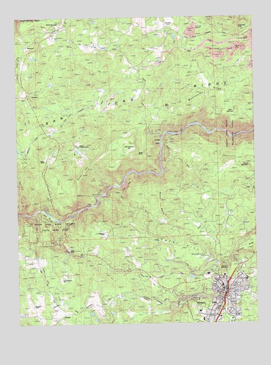
Nevada City, CA USGS Topographic Map
Click on map above to begin viewing in our Map Viewer.

This topographic map contains these locations and features:
Feature Name Type Latitude Longitude GNIS ID View Map
American Victorian MuseumBuildingN39.2621°W121.0202°1682835View Map
B-Four RanchLocaleN39.3174°W121.0325°256393View Map
Bald MountainSummitN39.3343°W121.0133°256462View Map
Bellett 317 DamDamN39.3632°W121.0411°1663826View Map
Bicentennial MuseumBuildingN39.2632°W121.0172°1682844View Map
Blind Shady CreekStreamN39.3488°W121.0611°257202View Map
Brush CreekStreamN39.3007°W121.0244°257524View Map
Bunker HillSummitN39.3104°W121.0916°1658172View Map
Cement HillRidgeN39.2818°W121.0413°258165View Map
Champion (historical)Populated PlaceN39.2596°W121.0377°1703627View Map
Champion MineMineN39.2585°W121.0380°258191View Map
CherokeePopulated PlaceN39.3702°W121.0430°1658264View Map
Cherokee DiggingsLocaleN39.3688°W121.0347°258237View Map
City of Nevada CityCivilN39.2607°W121.0231°2411225View Map
Daisy Blue MineMineN39.2863°W121.0405°259016View Map
Deer Creek DitchCanalN39.2599°W121.0552°259221View Map
Deer Creek Elementary SchoolSchoolN39.2510°W121.0293°1682871View Map
Devils SlideSlopeN39.3071°W121.0679°259331View Map
Eagle RavineValleyN39.2674°W121.0033°259674View Map
Empress MineMineN39.2535°W121.1044°259929View Map
Excelsior DitchCanalN39.2968°W121.0852°260006View Map
Firehouse Number 1 MuseumBuildingN39.2632°W121.0177°1682885View Map
Firehouse Number 2BuildingN39.2632°W121.0205°1682886View Map
First Baptist ChurchChurchN39.2638°W121.0177°1703658View Map
First Methodist ChurchChurchN39.2629°W121.0208°1703659View Map
Four-T RanchLocaleN39.3713°W121.0466°260302View Map
Gold RunStreamN39.2607°W121.0186°266758View Map
Hilliard RanchLocaleN39.2799°W121.0994°261353View Map
Hoyt CrossingCrossingN39.3043°W121.0786°1658794View Map
Indian FlatFlatN39.2679°W121.0563°261743View Map
Jones BarBarN39.2941°W121.1097°261995View Map
Jones Bar (historical)Populated PlaceN39.2938°W121.1097°1703630View Map
Jones RavineValleyN39.2949°W121.1169°262007View Map
KJFA-FM (Grass Valley)TowerN39.2746°W121.0108°1662888View Map
Lake VeraReservoirN39.3013°W121.0270°268682View Map
Lake Vera 303 DamDamN39.3020°W121.0282°1663821View Map
Little Deer CreekStreamN39.2621°W121.0155°262583View Map
Marshall RanchLocaleN39.2691°W121.1022°263230View Map
Meyers RavineValleyN39.3104°W121.0505°263481View Map
Milhous Ranch AirportAirportN39.3216°W121.0763°1653766View Map
Miller RanchLocaleN39.3377°W121.0472°263638View Map
Montezuma HillSummitN39.3238°W121.0647°1659163View Map
Montezuma RidgeRidgeN39.3457°W121.0222°263766View Map
Morris ReservoirReservoirN39.3585°W121.1173°263842View Map
Murphy RanchLocaleN39.3196°W121.0616°263979View Map
Nevada CityPopulated PlaceN39.2616°W121.0161°1659211View Map
Nevada City City HallBuildingN39.2624°W121.0197°1703660View Map
Nevada City Downtown Historic DistrictParkN39.2632°W121.0186°1682923View Map
Nevada City Police DepartmentBuildingN39.2627°W121.0196°2751063View Map
Nevada City Post OfficePost OfficeN39.2635°W121.0168°1682924View Map
Nevada City Rancheria (historical)CivilN39.2743°W121.0411°1670458View Map
Nevada City SchoolSchoolN39.2654°W121.0191°1682925View Map
Nevada County Consolidated Fire District Station 84BuildingN39.2691°W121.0164°2622181View Map
Nevada County CourthouseBuildingN39.2638°W121.0180°1682928View Map
Nevada County Law LibraryBuildingN39.2638°W121.0183°1682926View Map
Nevada County Sheriff's OfficeBuildingN39.2701°W121.0260°2751060View Map
Nevada County Wade Brown Correctional FacilityBuildingN39.2687°W121.0279°2770089View Map
Nevada TheatreBuildingN39.2629°W121.0205°1682930View Map
NewtownPopulated PlaceN39.2527°W121.1033°264077View Map
North San JuanPopulated PlaceN39.3693°W121.1038°1659251View Map
North San Juan Census Designated PlaceCensusN39.3718°W121.1061°2628766View Map
North San Juan Fire Protection District Station 1BuildingN39.3694°W121.1032°2622166View Map
North San Juan Fire Protection District Station 3BuildingN39.3530°W121.0655°2622175View Map
North San Juan Post OfficePost OfficeN39.3705°W121.1023°1682933View Map
Oak Tree Elementary SchoolSchoolN39.3663°W121.0963°1682935View Map
Personeni RanchLocaleN39.2574°W121.1175°264660View Map
Pioneer CemeteryCemeteryN39.2656°W121.0237°1682943View Map
Pioneer ParkParkN39.2596°W121.0116°1682944View Map
Providence (historical)Populated PlaceN39.2588°W121.0374°1703632View Map
Purdon CreekStreamN39.3271°W121.0477°265068View Map
Purdon CrossingCrossingN39.3274°W121.0463°1659440View Map
Rays RanchLocaleN39.3393°W121.0830°1703633View Map
Reader RanchLocaleN39.3166°W121.1108°265243View Map
Red CastleBuildingN39.2607°W121.0158°1682952View Map
Robinson RanchLocaleN39.2868°W121.0786°265467View Map
Rock CreekStreamN39.3118°W121.0486°265487View Map
Round MountainSummitN39.3146°W121.0024°1659791View Map
Rush CreekStreamN39.2918°W121.1047°265679View Map
San Juan RidgeRidgeN39.3410°W121.0663°267211View Map
Searls Historical LibraryBuildingN39.2632°W121.0186°1682963View Map
SebastopolPopulated PlaceN39.3627°W121.1211°1659620View Map
Selby FlatFlatN39.2910°W121.0291°265988View Map
Seven Hills Intermediate SchoolSchoolN39.2547°W121.0309°1682964View Map
Shady CreekStreamN39.2954°W121.1230°266024View Map
Shady Creek Fire CampLocaleN39.3277°W121.1113°266025View Map
Shelby Flat (historical)Populated PlaceN39.2888°W121.0286°1703634View Map
Stewart MansionBuildingN39.2591°W121.0233°1682976View Map
Sugarloaf MountainSummitN39.2735°W121.0180°1659906View Map
Sugarloaf PeakSummitN39.3704°W121.0094°1659909View Map
SweetlandPopulated PlaceN39.3429°W121.1202°1659936View Map
Tahoe National Forest Supervisor OfficeLocaleN39.2699°W121.0183°275148View Map
Trinity Episcopal ChurchChurchN39.2635°W121.0158°1682978View Map
White SpotPopulated PlaceN39.2813°W121.0108°1660168View Map
Williams RanchLocaleN39.2746°W121.1158°269122View Map
Wokodot (historical)Populated PlaceN39.2638°W121.0177°1682999View Map

Note: Coordinates in the location and feature list above are referenced to NAD83 datum.


Copyright (C) 2008-2024 Ryan Niemi / Sunset Dynamics ... All Rights Reserved