TopoQuest Logo
Do you find TopoQuest useful?
Help keep TopoQuest running and adding new maps/features by donating!
Bitcoin:  19c7KJd3qBynnjoSw5npx9KScwjBe4ifkT
Litecoin:  LXs6TkuXGGXo1vDsWCkWVdjQX94eUKd6ui
Home View Maps Find Maps Find Places Resources & Links


Dutch Gap, Virginia Topographic Map

USGS Map Title: Dutch Gap, VA
USGS Map MRC: 37077D3
DRG (GeoTIFF) Download: o37077d3.tif


Neighboring USGS Topographic Map Quads:


  Richmond, VA  
37077E4
 

  Seven Pines, VA  
37077E3
 

  Quinton, VA  
37077E2
 

  Drewrys Bluff, VA  
37077D4
 

  Dutch Gap, VA  
37077D3
 

  Roxbury, VA  
37077D2
 

  Chester, VA  
37077C4
 

  Hopewell, VA  
37077C3
 

  Westover, VA  
37077C2


Map MRC Location:

N38°
W78°
N38°
W77°
H8 H7 H6 H5 H4 H3 H2 H1
G8 G7 G6 G5 G4 G3 G2 G1
F8 F7 F6 F5 F4 F3 F2 F1
E8 E7 E6 E5 E4 E3 E2 E1
D8 D7 D6 D5 D4 D3 D2 D1
C8 C7 C6 C5 C4 C3 C2 C1
B8 B7 B6 B5 B4 B3 B2 B1
A8 A7 A6 A5 A4 A3 A2 A1
N37°
W78°
N37°
W77°

Dutch Gap, VA USGS 1:24K Topographic Map Preview:
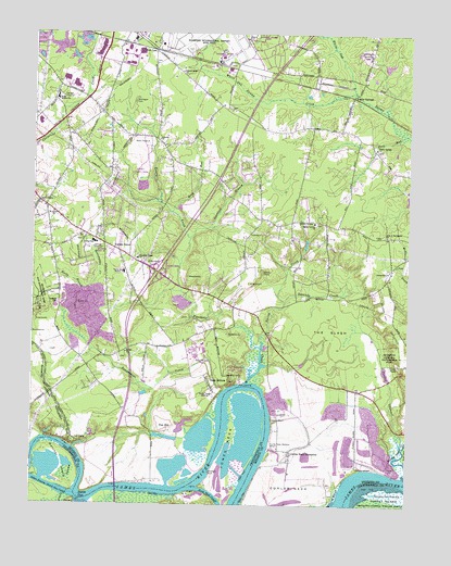
Dutch Gap, VA USGS Topographic Map
Click on map above to begin viewing in our Map Viewer.

This topographic map contains these locations and features:
Feature Name Type Latitude Longitude GNIS ID View Map
Aiken HouseBuildingN37.3813°W77.3344°1760360View Map
Aiken SwampSwampN37.3831°W77.3630°1477902View Map
Aiken Swamp-Dutch Gap CutoffChannelN37.3796°W77.3689°1462378View Map
Bailey CreekStreamN37.4076°W77.3036°1462682View Map
Baker Elementary SchoolSchoolN37.4765°W77.3730°1760363View Map
Bennets Store (historical)LocaleN37.4393°W77.3386°1760364View Map
Bethel CemeteryCemeteryN37.4143°W77.3433°1760365View Map
Bethel ChurchChurchN37.4151°W77.3436°1463180View Map
Bethel School (historical)SchoolN37.4154°W77.3439°1760366View Map
Beulah CemeteryCemeteryN37.4804°W77.3097°1760367View Map
Beulah ChurchChurchN37.4801°W77.3094°1760368View Map
Camp HollyLocaleN37.4371°W77.2980°1464331View Map
Camp Holly SpringsSpringN37.4365°W77.2989°1760369View Map
Central School (historical)SchoolN37.4488°W77.2925°1760370View Map
Church of GodChurchN37.4796°W77.2700°1760372View Map
Cotman (historical)Populated PlaceN37.4260°W77.3014°1760375View Map
Crewes ChannelStreamN37.3899°W77.2514°1465428View Map
Crewes HouseBuildingN37.4124°W77.2533°1465429View Map
Curles Neck Mansion WharfLocaleN37.3904°W77.2961°1465535View Map
Curles Neck PlantationLocaleN37.3890°W77.2889°1477965View Map
Darbytown EstatesPopulated PlaceN37.4607°W77.3094°1760376View Map
Darbytown Road LandfillLocaleN37.4996°W77.3746°2518624View Map
Deep BottomPopulated PlaceN37.4068°W77.3094°1492850View Map
Deep Bottom LandingLocaleN37.4074°W77.3055°1760377View Map
Deep Bottom ParkParkN37.4107°W77.3086°1760378View Map
Deep RunStreamN37.4735°W77.2519°1465710View Map
Deerlick BranchStreamN37.4457°W77.3228°1465722View Map
Dorey ParkParkN37.4629°W77.3389°1760380View Map
Dutch GapGapN37.3771°W77.3572°1466059View Map
East End Christian AcademySchoolN37.4718°W77.3292°2465383View Map
Eastgate Industrial CenterLocaleN37.4943°W77.3436°1760382View Map
Fair HillPopulated PlaceN37.3954°W77.3297°1492919View Map
Fort Brady (historical)MilitaryN37.3914°W77.3619°1492959View Map
Fort Harrison (historical)MilitaryN37.4278°W77.3733°1492965View Map
Fort Harrison National CemeteryCemeteryN37.4285°W77.3665°1471332View Map
Fort LeePopulated PlaceN37.4957°W77.3353°1492967View Map
Four Mile Creek CemeteryCemeteryN37.4412°W77.3401°1760396View Map
Four Mile Creek ParkParkN37.4438°W77.3233°1760395View Map
Fourmile CreekStreamN37.4076°W77.3036°1466810View Map
Fourmile Creek ChurchChurchN37.4404°W77.3403°1466812View Map
George F Baker Elementary SchoolSchoolN37.4825°W77.3675°1462702View Map
Good Neighbor Village Assisted Living FacilityBuildingN37.4239°W77.3330°2519999View Map
Gravel Hill ChurchChurchN37.4371°W77.2561°1467385View Map
Gravel Hill School (historical)SchoolN37.4368°W77.2555°1760397View Map
Griggs DamDamN37.4229°W77.3094°1490084View Map
Griggs PondReservoirN37.4235°W77.3095°1502031View Map
Hardy Central CemeteryCemeteryN37.4497°W77.2810°1760399View Map
Hardy Central ChurchChurchN37.4501°W77.2816°1467740View Map
Hatcher IslandIslandN37.3857°W77.3647°1467822View Map
Henrico Central SchoolSchoolN37.4368°W77.3447°1467925View Map
Henrico CountyCivilN37.4577°W77.2966°1480133View Map
Henrico County Fire Station 2BuildingN37.4843°W77.3594°2086230View Map
Henrico County Firehouse 18BuildingN37.4508°W77.2899°2086207View Map
Henrico County Firehouse 4BuildingN37.4418°W77.3516°2086232View Map
Henricopolis (historical)Populated PlaceN37.3843°W77.3539°1760401View Map
Henricus ParkParkN37.3793°W77.3705°1760075View Map
James CemeteryCemeteryN37.4224°W77.3197°1760411View Map
James CemeteryCemeteryN37.4188°W77.3453°1760412View Map
John Rolfe Middle SchoolSchoolN37.4768°W77.3729°1760413View Map
Jones NeckCapeN37.3910°W77.3094°1468851View Map
Jones Neck CutoffBendN37.3768°W77.3141°1468852View Map
Jonesboro School (historical)SchoolN37.4801°W77.3097°1760414View Map
Kingdom Preparatory AcademySchoolN37.4772°W77.3634°2464989View Map
Malvern Hill BattlefieldLocaleN37.4229°W77.2555°1470036View Map
Mehfoud Elementary SchoolSchoolN37.4368°W77.3448°2465327View Map
Montague CemeteryCemeteryN37.4818°W77.3414°1470685View Map
Picketts WharfLocaleN37.3843°W77.2650°1472270View Map
Pioneer ChurchChurchN37.4718°W77.3336°1472427View Map
Point BremoCapeN37.3768°W77.2728°1472563View Map
Poplar SpringsLocaleN37.4835°W77.2683°1472664View Map
Poplar Springs CemeteryCemeteryN37.4695°W77.2613°1760422View Map
Poplar Springs ChurchChurchN37.4699°W77.2611°1472666View Map
Reedy BranchStreamN37.4318°W77.3586°1473105View Map
Richmond DragwayLocaleN37.4868°W77.2755°1491236View Map
Richmond Yacht BasinBayN37.3907°W77.3628°1478068View Map
Ross RunStreamN37.4526°W77.3289°1473562View Map
Roundabout CreekStreamN37.4060°W77.3103°1473594View Map
Saint James ChurchChurchN37.4526°W77.3686°1473733View Map
Saint James School (historical)SchoolN37.4499°W77.3741°1760424View Map
Second Bethel ChurchChurchN37.4896°W77.3258°1474137View Map
Star of Bethlehem ChurchChurchN37.4463°W77.2575°1475073View Map
Sweeney CreekStreamN37.4290°W77.2911°1475379View Map
The SlashFlatN37.4213°W77.2766°1475614View Map
Tilmans WharfLocaleN37.3974°W77.2950°1475715View Map
Turner WoodsPopulated PlaceN37.4640°W77.3039°1760437View Map
Union Grove Chapel (historical)ChurchN37.4288°W77.2894°1760438View Map
Valley Mill PondReservoirN37.4444°W77.2840°1760439View Map
VarinaPopulated PlaceN37.4496°W77.3450°1852919View Map
Varina - Enon BridgeBridgeN37.3793°W77.3461°1922783View Map
Varina Baptist ChurchChurchN37.4446°W77.3544°1760440View Map
Varina Branch Henrico County Public LibraryBuildingN37.4718°W77.3725°1760441View Map
Varina DistrictCivilN37.4661°W77.3073°1927547View Map
Varina Elementary SchoolSchoolN37.4446°W77.3545°1476154View Map
Varina Episcopal ChurchChurchN37.4460°W77.3591°1760442View Map
Varina FarmPopulated PlaceN37.3818°W77.3361°1478069View Map
Varina GardensPopulated PlaceN37.4396°W77.3594°1760443View Map
Varina GrovePopulated PlaceN37.4432°W77.3486°1493857View Map
Varina MeadowsPopulated PlaceN37.4526°W77.3489°1760444View Map
Varina PlacePopulated PlaceN37.4474°W77.3525°1760445View Map
Ward Elementary SchoolSchoolN37.4675°W77.3247°2465103View Map
Washington Memorial Park and MausoleumsCemeteryN37.4954°W77.2647°1476359View Map
White Oak Swamp CreekStreamN37.4849°W77.2686°1476625View Map
Whitlock EstatesPopulated PlaceN37.4632°W77.3305°1760449View Map
Williamson FarmsPopulated PlaceN37.4738°W77.3522°1760450View Map
Woodson RockCapeN37.3840°W77.3158°1476978View Map
WRVA-AM (Richmond)TowerN37.4038°W77.3161°1502543View Map
WRVQ-FM (Richmond)TowerN37.4038°W77.3161°1502700View Map
Yahley Mills EstatesPopulated PlaceN37.4560°W77.2858°1760448View Map

Note: Coordinates in the location and feature list above are referenced to NAD83 datum.


Copyright (C) 2008-2024 Ryan Niemi / Sunset Dynamics ... All Rights Reserved