TopoQuest Logo
Do you find TopoQuest useful?
Help keep TopoQuest running and adding new maps/features by donating!
Bitcoin:  19c7KJd3qBynnjoSw5npx9KScwjBe4ifkT
Litecoin:  LXs6TkuXGGXo1vDsWCkWVdjQX94eUKd6ui
Home View Maps Find Maps Find Places Resources & Links


Roxbury, Virginia Topographic Map

USGS Map Title: Roxbury, VA
USGS Map MRC: 37077D2
DRG (GeoTIFF) Download: o37077d2.tif


Neighboring USGS Topographic Map Quads:


  Seven Pines, VA  
37077E3
 

  Quinton, VA  
37077E2
 

  Tunstall, VA  
37077E1
 

  Dutch Gap, VA  
37077D3
 

  Roxbury, VA  
37077D2
 

  Providence Forge, VA  
37077D1
 

  Hopewell, VA  
37077C3
 

  Westover, VA  
37077C2
 

  Charles City, VA  
37077C1


Map MRC Location:

N38°
W78°
N38°
W77°
H8 H7 H6 H5 H4 H3 H2 H1
G8 G7 G6 G5 G4 G3 G2 G1
F8 F7 F6 F5 F4 F3 F2 F1
E8 E7 E6 E5 E4 E3 E2 E1
D8 D7 D6 D5 D4 D3 D2 D1
C8 C7 C6 C5 C4 C3 C2 C1
B8 B7 B6 B5 B4 B3 B2 B1
A8 A7 A6 A5 A4 A3 A2 A1
N37°
W78°
N37°
W77°

Roxbury, VA USGS 1:24K Topographic Map Preview:
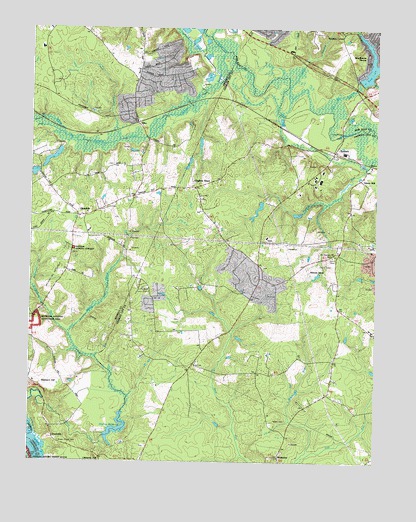
Roxbury, VA USGS Topographic Map
Click on map above to begin viewing in our Map Viewer.

This topographic map contains these locations and features:
Feature Name Type Latitude Longitude GNIS ID View Map
Canal SwampStreamN37.4674°W77.2178°1464393View Map
Charles City Volunteer Fire Department Station 2BuildingN37.4575°W77.1473°2086330View Map
Chickahominy AcademySchoolN37.4413°W77.2289°1760371View Map
Chickahominy State Designated Tribal Statistical AreaCensusN37.3990°W77.1268°2418815View Map
Chickahominy Tribal CenterBuildingN37.4120°W77.1253°2772023View Map
Crumps SwampStreamN37.4776°W77.1500°1465497View Map
District 1CivilN37.3831°W77.1938°1986427View Map
Ednas MillPopulated PlaceN37.4571°W77.1300°1499379View Map
ElkoPopulated PlaceN37.4729°W77.2114°1477299View Map
GlendalePopulated PlaceN37.4457°W77.2330°1477354View Map
Glendale National CemeteryCemeteryN37.4360°W77.2344°1467162View Map
Grace Chapel CemeteryCemeteryN37.3804°W77.2389°1478675View Map
GranvillePopulated PlaceN37.3821°W77.2414°1499485View Map
Harrison Magisterial DistrictCivilN37.3890°W77.1811°1927336View Map
Hughes StoreLocaleN37.4538°W77.1903°1478797View Map
James City County Sheriff's OfficeBuildingN37.4550°W77.1783°2086183View Map
Kent DamDamN37.4851°W77.1314°1490445View Map
Kent DamReservoirN37.4851°W77.1314°1490446View Map
Long BridgeBridgeN37.4701°W77.1380°1478984View Map
Malvern HillSummitN37.3969°W77.2394°1499703View Map
McDowell CreekStreamN37.4263°W77.2500°1470251View Map
MontpelierPopulated PlaceN37.3765°W77.1594°1479118View Map
Mount Pleasant CemeteryCemeteryN37.4351°W77.1411°1479153View Map
NancePopulated PlaceN37.4613°W77.1275°1499786View Map
Nances ShopLocaleN37.4318°W77.1508°1479182View Map
RoxburyPopulated PlaceN37.4649°W77.1408°1479471View Map
Saint Johns ChurchChurchN37.3793°W77.2072°1479501View Map
Salem CemeteryCemeteryN37.3874°W77.1569°1479533View Map
Salem RunStreamN37.3765°W77.1522°1479535View Map
Samaria High SchoolSchoolN37.4135°W77.1275°1479539View Map
Sand BranchStreamN37.4049°W77.2261°1739774View Map
Shirley Mill DamDamN37.3829°W77.2228°1490076View Map
Shirley MillpondReservoirN37.3845°W77.2163°1479617View Map
Toe Ink SwampStreamN37.4765°W77.1416°1475753View Map
Toe Ink WaysideParkN37.4874°W77.1428°1475754View Map
Turkey Island CreekStreamN37.3821°W77.2491°1479770View Map
Ukrop DamDamN37.4651°W77.2364°1490082View Map
Ukrop PondReservoirN37.4651°W77.2364°1490083View Map
Union ChurchChurchN37.4760°W77.2122°1476051View Map
Union ChurchChurchN37.4304°W77.1664°1479781View Map
Western RunStreamN37.4107°W77.2355°1476519View Map
White Oak SwampStreamN37.4932°W77.1803°1476624View Map
Willis ChurchChurchN37.4346°W77.2358°1476777View Map
Woodhaven ShoresPopulated PlaceN37.4918°W77.1286°1500345View Map
Wrights CornerPopulated PlaceN37.4993°W77.1380°1477735View Map

Note: Coordinates in the location and feature list above are referenced to NAD83 datum.


Copyright (C) 2008-2025 Ryan Niemi / Sunset Dynamics ... All Rights Reserved